Josephine Falls
British Columbia • 25 m
By Armen Suny · Last verified Jun 2026
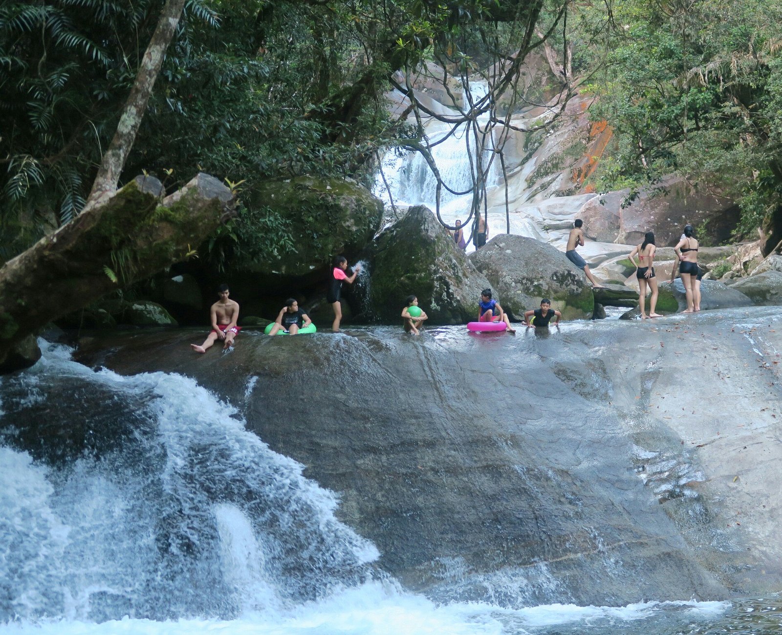
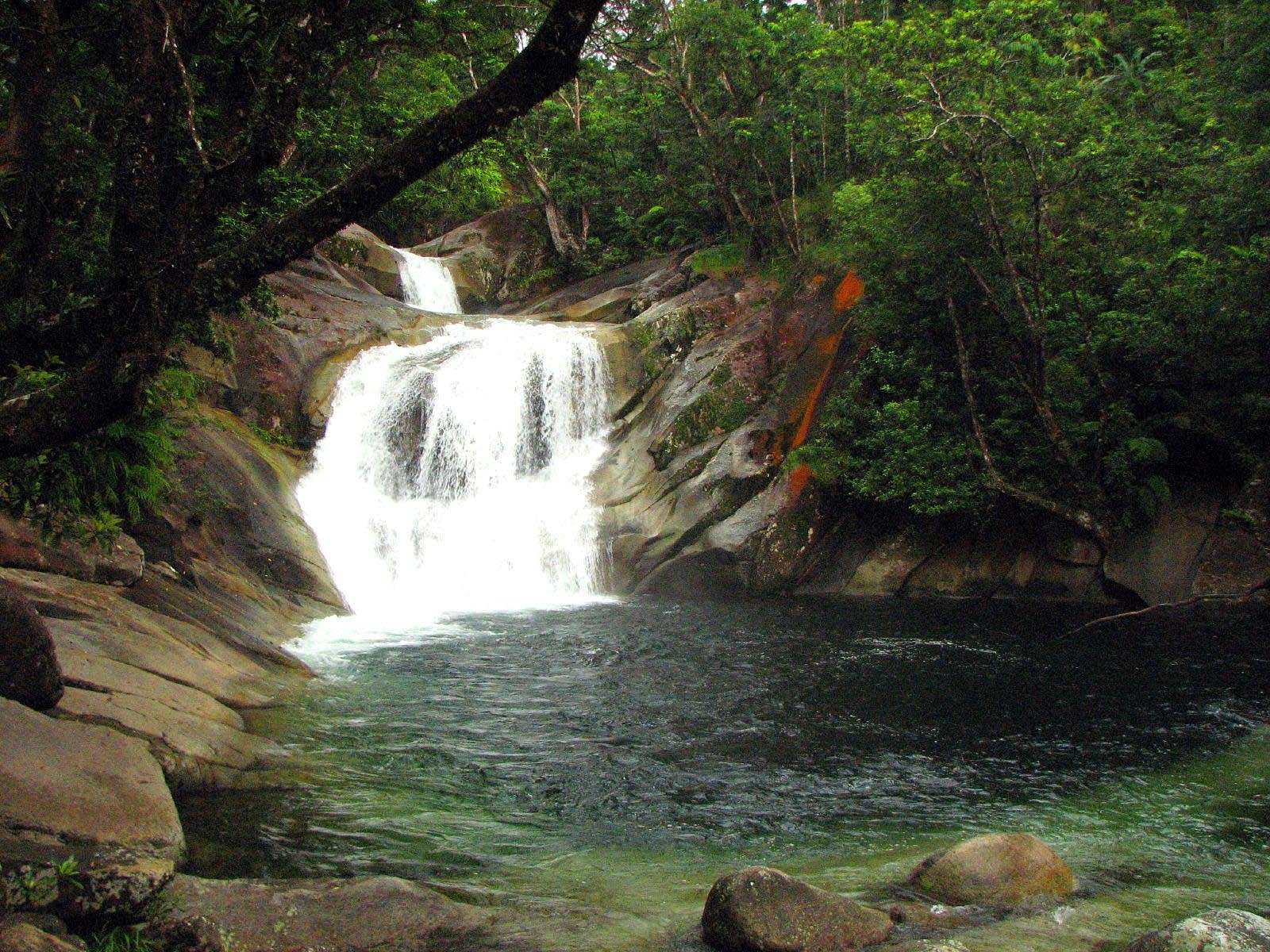
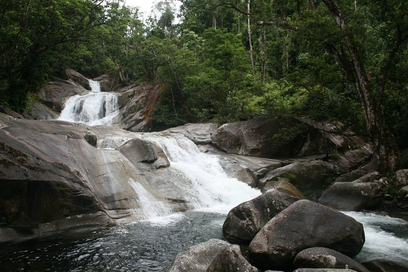
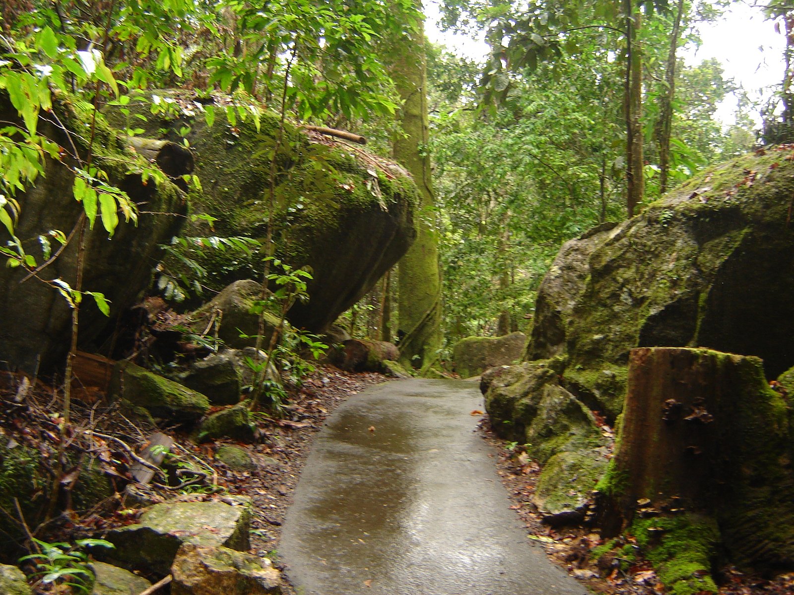
Photo Credits (5)
Difficulty
Moderate
Trail Length
5.8 km
Trail Type
Loop
Elevation Gain
151 m
About Josephine Falls
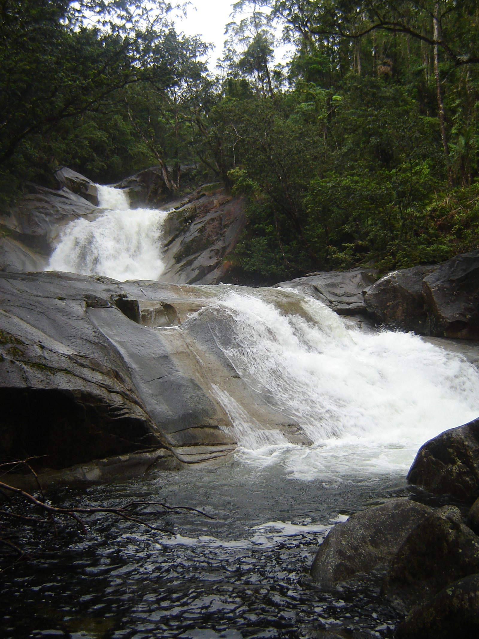
Josephine Falls (near Cranbrook, BC) is a lesser-documented cascade located in the East Kootenay region of southeastern British Columbia. It appears as a scenic, likely multi-step cascade set in forested terrain. Official trail and infrastructure information is limited; reports suggest access may require travel on secondary or forest roads and a short walk. Visitors should treat route descriptions as approximate and verify current local conditions before travel.
The Setting
Josephine Falls sits at 1,492 metres within Privately Protected Area (NCC 1001320), in the mountains of British Columbia. The falls drop 25 metres.
Why This Waterfall Exists
Josephine Falls flows over hard intrusive rock laid down about 359-419 million years ago. These resistant rocks form a durable ledge that water cannot easily wear away, creating a 82-foot drop where softer material downstream has already eroded.
Trail & Hike Details
The Approach
The moderate 5.8-km loop trail gains 151 metres of elevation on the way to the falls.
Trail Description
There is no widely published, maintained trail description from official sources for this waterfall. Based on typical small Kootenay-area falls, expect a short unmarked or semi-marked path through forest with uneven footing, roots and rocky sections. The final approach may require scrambling over rocks near the stream; trails (if present) may be muddy and become slippery when wet. Because formal signage and maintenance are not confirmed, navigation may rely on GPS coordinates, local knowledge, or recent visitor reports.
What to Expect
The falls cascade 25 metres over hard intrusive rock.
Accessibility
The trail is not wheelchair accessible. Uneven terrain and elevation changes require steady footing.
Frequently Asked Questions
🐶 Are Dogs Allowed at Josephine Falls?
❌ Dogs are not allowed
Are There Any Fees or Permits Required?
🆖 No fees required
🏊 Is There Swimming at Josephine Falls?
❌ Swimming is not allowed
When to Visit
Late spring to early summer for highest water flow and vibrant vegetation; fall for lower visitor numbers and autumn colours. Avoid visiting after heavy storms if roads are unpaved, and be cautious in winter when access may be limited by snow and ice.
Seasonal Access
The best time to visit is Spring, Summer, and Fall. Winter access may be limited. Check with the managing park or local authority for current conditions.
Safety Information
Hazards may include: slippery and mossy rocks near the falls; unstable or steep banks; fast or cold water; limited or no cell service; unmarked trails; variable road conditions on secondary/forest roads; potential wildlife encounters. Use caution near edges, do not climb wet rocks, and avoid entering water if you are unsure of depth/current. Check local conditions and closures before travel.
Current Water Conditions
9.3 m³/s
Current discharge — how much water is flowing
About average for this time of year
Based on 55 years of record
2.01 m
Water depth at gauge
7-Day Discharge Trend
What does this mean for your visit?
Flow is about average for this time of year.
About This Gauge
This gauge is on a nearby waterway and may not reflect exact conditions at the falls.
7-Day Flow Outlook
Based on the WSC gauge FORDING RIVER AT THE MOUTH (14 km away).
Today
Moderate
9.3 m³/s
8/10Tomorrow
Moderate
9.1 m³/s
8/10Thu
Moderate
9.7 m³/s
6/10Fri
Moderate
10 m³/s
6/10Sat
Moderate
8.9 m³/s
9/10Sun
Moderate
8.2 m³/s
9/10Mon
Moderate
8.1 m³/s
8/10Best window: Sat — moderate flow, sunny (trip score 9/10).
Best time of year: this gauge typically runs highest from late April to late July, peaking in June.
How we calculate this
This is a transparent outlook, not a precise forecast. We take the waterfall's current flow strength (how it ranks against its historical normal for today, from the nearest WSC stream gauge), carry that ranking forward along the gauge's seasonal curve, and nudge it for forecast rain. Confidence is highest for the next day or two and falls further out. Always check official conditions and your own judgment before visiting — high flows can be dangerous.
Know when to go.
Get a free email alert when waterfalls near Cranbrook hit peak flow. We only send when conditions are worth the trip — no weekly newsletters, no spam.
Weather Forecast
Location & Access
Getting There
The waterfall is located approximately 62.4 miles (about 100 km) from Cranbrook, BC (coordinates provided: 50.0226, -114.8766). Access likely involves driving on paved highways followed by secondary/forest roads. Exact turn-offs and road conditions are not well documented; some sections may be unpaved and could require a high-clearance or 4x4 vehicle. Cell coverage may be limited in places, carry a map or GPS and confirm local road conditions with regional authorities before departure.
Get Directions on Google MapsParking
Parking information is not well documented. Expect limited or informal roadside pullouts or a small unmarked parking area if a trailhead exists. Do not block gates or private driveways. If parking on a shoulder, use caution and avoid soft shoulders.
Elevation
1,492 metres above sea level
Coordinates
50.022607° N, -114.876615° W
Land Management
Managed by Nature Conservancy of Canada
Visitor Tips & Gear
1) Verify current road and trail conditions with local ranger districts or visitor centres before you go. 2) Use a good map or GPS and download offline maps, cell signal may be unreliable. 3) Wear sturdy, grippy footwear; expect slippery rocks and uneven ground. 4) Respect private property and posted signs; do not trespass. 5) Pack out all trash and leave no trace. 6) If travelling on logging/forestry roads, check for seasonal closures and gates.
As an Amazon Associate, we earn from qualifying purchases.
With 5.8 km and 151 m of elevation gain, sturdy boots and trekking poles will help on this moderate trail. Sun exposure on the trail makes good sun protection a must in summer.

Polarized Sunglasses (Knockaround)
Cuts glare off the water so you actually see the falls — and your photos turn out better too.

Columbia Watertight II Rain Jacket
Packs into its own pocket, seam-sealed, and keeps you dry from spray and surprise rain.

Earth Pak Waterproof Dry Bag
Keeps your phone and gear dry when waterfall mist soaks everything else.

Waterproof Phone Pouch (AiRunTech)
Cheap insurance — take photos right next to the falls without killing your phone.

Timberland Euro Sprint Mid Waterproof
Trusted waterproof boot with premium leather and grippy rubber sole — reliable on rocky, wet trails.

TrailBuddy Trekking Poles
Lightweight aluminum, cork grips, and flip-locks that actually hold — a best-seller for good reason.
Where to Stay
Browse vacation cabins and private rentals nearby
Unique outdoor stays — tents, yurts, and treehouses
Rent a campervan or RV for your waterfall road trip
Some links are affiliate links. We may earn a commission at no extra cost to you.
Nearby Campground
Elkford Municipal Campground
2.9 km away
Additional Information
Nearby Attractions
Cranbrook amenities and visitor services (museum, shops); Fort Steele Heritage Town (regional historic attraction) and other East Kootenay outdoor recreation opportunities such as hiking and fishing. Exact distances vary, verify routing from Cranbrook or local visitor centres.
Wildlife
Typical southeastern BC wildlife, deer, elk, black bear, cougars, small mammals, and a variety of birds. Be aware of ticks in warmer months. Carry bear spray in bear country and know how to use it.
Cities near Josephine Falls
Writing about Josephine Falls? Embed this waterfall on your site for free.