Photo Credits (5)
Difficulty
Easy
Trail Length
3.9 km
Trail Type
Out And Back
Elevation Gain
66 m
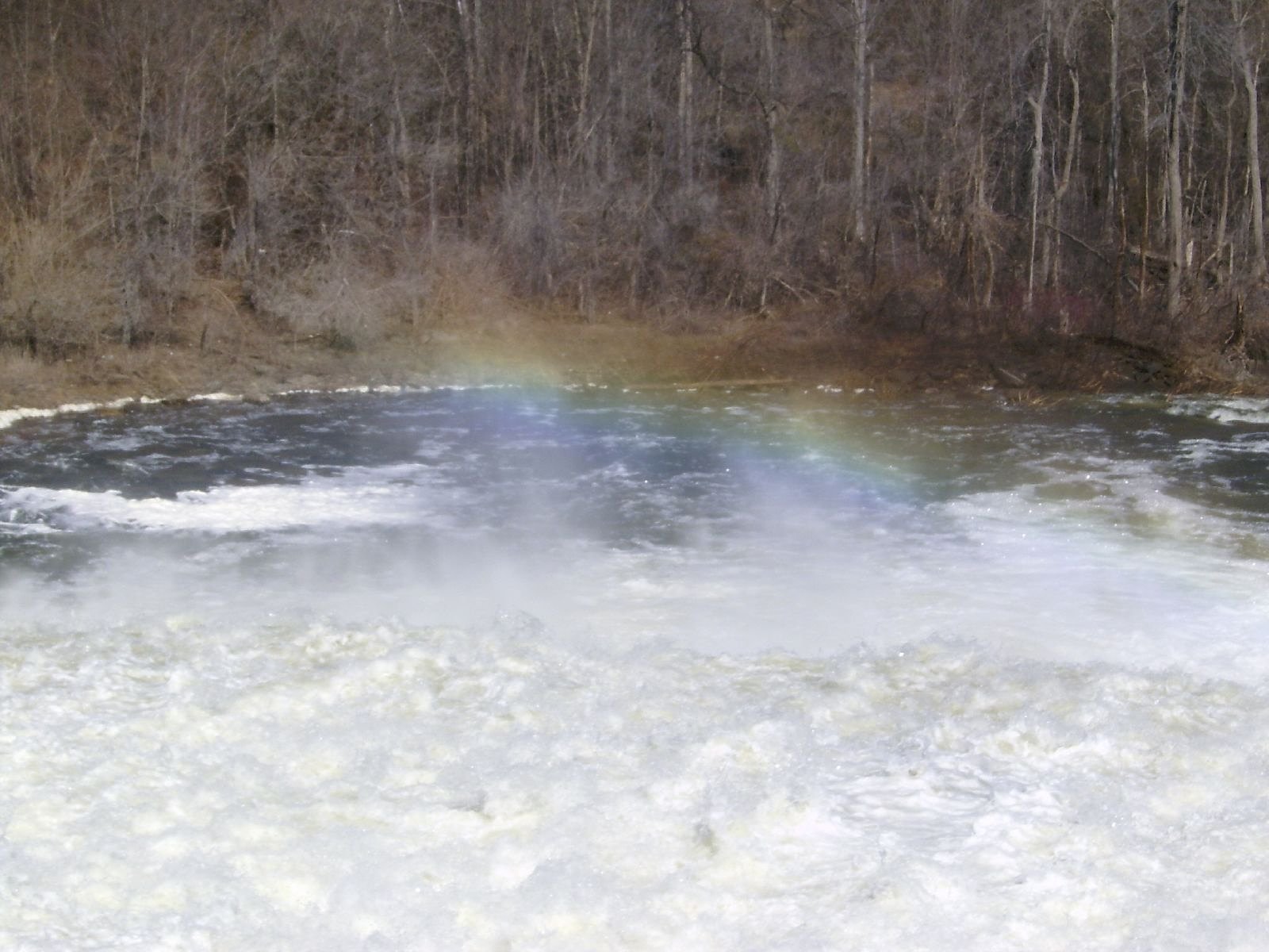
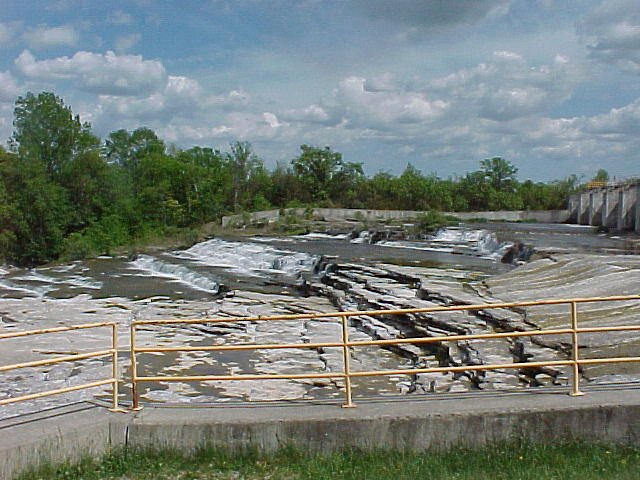
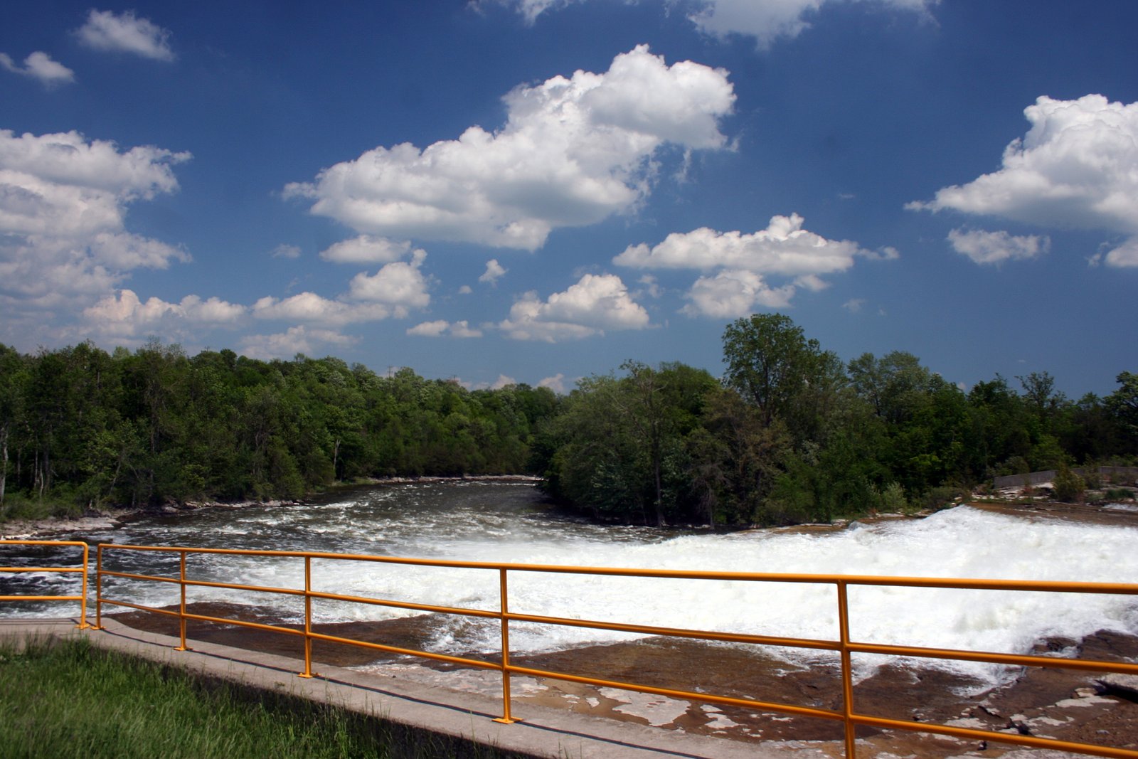
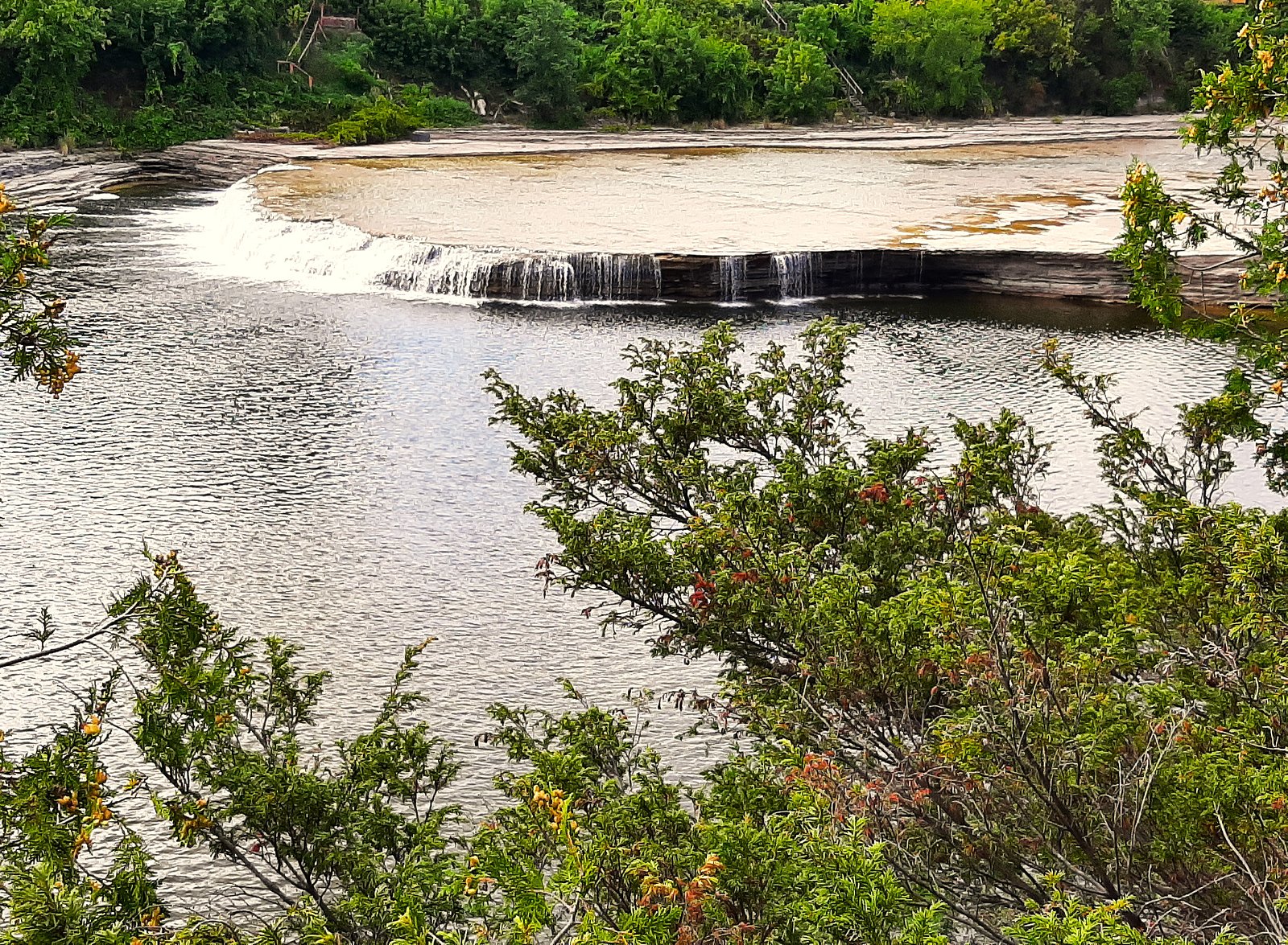
About Healey Falls
Healey Falls is a small riverside cascade in southeastern Ontario, located roughly between Peterborough and Belleville (coordinates 44.3769, -77.7858). The falls are a local scenic spot on a river channel with a relatively short approach from a roadside parking or small conservation-area lot. Flow and appearance vary with season and recent weather, spring melt typically brings the strongest flows. Specific published measurements for the drop are not readily available and documentation about formal infrastructure at the site is limited.
Why This Waterfall Exists
Healey Falls flows over layered sedimentary rock laid down about 458-470 million years ago. Over time, the stream has worn through these layers at different rates, creating the step that forms the waterfall.
Trail & Hike Details
The Approach
The easy 3.9-km out-and-back trail gains 66 metres of elevation on the way to the falls.
Trail Description
Approach is typically short from the parking/pullout to a riverside viewing area. Surfaces may be paved, packed earth, or a short set of steps; some sections can be uneven, muddy, or slippery when wet. There may be informal social trails along the river; these can be narrow and exposed. Expect minimal formal infrastructure unless the falls are part of a named conservation area.
What to Expect
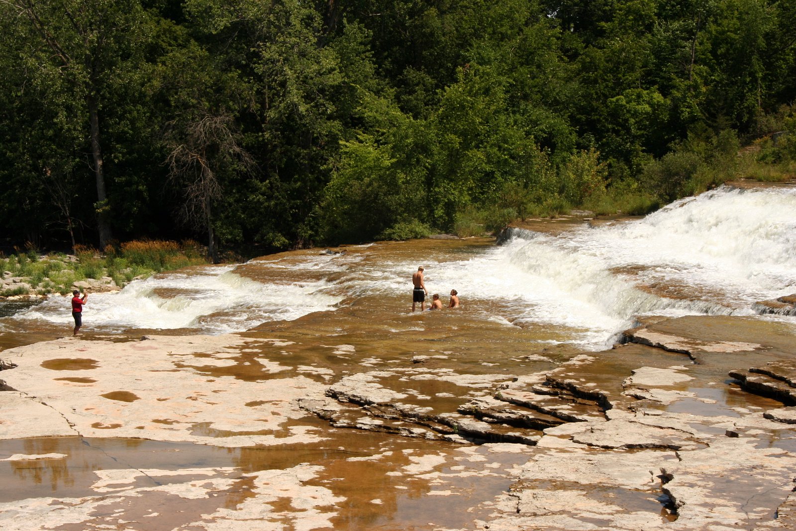
A modest cascade or set of rapids rather than a single large vertical drop. Flow varies seasonally, highest in late winter/early spring and after heavy rain. Facilities (toilets, picnic shelters) are likely limited or absent. The site is scenic for photography and short visits; swimming is not documented and may be unsafe. Cell coverage can be variable depending on your provider.
Accessibility
The trail is not wheelchair accessible. Uneven terrain and elevation changes require steady footing.
Frequently Asked Questions
🐶 Are Dogs Allowed at Healey Falls?
❌ Dogs are not allowed
Are There Any Fees or Permits Required?
🆖 No fees required
🏊 Is There Swimming at Healey Falls?
❌ Swimming is not allowed
When to Visit
Late spring typically offers the best water flow and dramatic appearance. Fall provides attractive foliage colors. Summer is good for comfortable weather but flows may be lower. Winter can offer attractive ice formations but access may be icy and hazardous.
Seasonal Access
The best time to visit is Spring, Summer, Fall, and Winter. Check with the managing park or local authority for current conditions.
Safety Information
Hazards include slippery rocks, steep or unstable banks, strong currents (particularly during spring runoff or after heavy rain), cold water temperature, and limited or no lifeguards. Cell phone reception may be unreliable. Wear appropriate footwear, keep a safe distance from the water edge, supervise children closely, and obey any posted warnings or barriers. In winter, ice near flowing water is dangerous, do not assume ice is safe.
Current Water Conditions
0.1 m³/s
Current discharge — how much water is flowing
About average for this time of year
Based on 19 years of record
2.06 m
Water depth at gauge
7-Day Discharge Trend
What does this mean for your visit?
Flow is about average for this time of year.
About This Gauge
This gauge is on a nearby waterway and may not reflect exact conditions at the falls.
7-Day Flow Outlook
Based on the WSC gauge TROUT CREEK NEAR CAMPBELLFORD (9 km away).
Today
Moderate
0.1 m³/s
8/10Tomorrow
Moderate
0.1 m³/s
8/10Tue
Strong
0.2 m³/s
7/10Wed
Strong
0.1 m³/s
8/10Thu
Moderate
0.1 m³/s
8/10Fri
Moderate
0.1 m³/s
6/10Sat
Moderate
0.1 m³/s
8/10Best window: Today — moderate flow, cloudy (trip score 8/10).
Best time of year: this gauge typically runs highest from early March to mid May, peaking in April.
How we calculate this
This is a transparent outlook, not a precise forecast. We take the waterfall's current flow strength (how it ranks against its historical normal for today, from the nearest WSC stream gauge), carry that ranking forward along the gauge's seasonal curve, and nudge it for forecast rain. Confidence is highest for the next day or two and falls further out. Always check official conditions and your own judgment before visiting — high flows can be dangerous.
Know when to go.
Get a free email alert when waterfalls near Peterborough hit peak flow. We only send when conditions are worth the trip — no weekly newsletters, no spam.
Weather Forecast
Location & Access
Getting There
Use the provided coordinates (44.3769, -77.7858) in a GPS or mapping app to locate the falls. The site is about 26–27 miles from both Peterborough and Belleville. Access is typically from local roads; follow signage or pull off at the nearest small parking/pullout. Consult local conservation authority or municipal websites for the most current access notes before you go.
Get Directions on Google MapsParking
Parking is likely limited to a small roadside pullout or a small lot associated with a conservation area. Expect few spaces and no paid lot infrastructure in many seasons. Park legally and avoid blocking driveways or shoulders.
Elevation
171 metres above sea level
Coordinates
44.376927° N, -77.785799° W
Visitor Tips & Gear
• Check recent trip reports or local conservation authority pages for current access and conditions before you go. • Wear sturdy, non-slip footwear; rocks near the water will be slippery. • Parking is limited, arrive early on busy days. • Respect private property and posted signage; stay on marked trails and viewing areas. • Expect bugs in warm months; bring repellant. Watch for ticks in spring–fall. • Do not attempt to climb on wet rock faces or swim near the falls when flow is high.
As an Amazon Associate, we earn from qualifying purchases.
This easy 3.9 km hike is straightforward — comfortable trail shoes and plenty of water should do. Icy conditions are common in winter — traction cleats are a smart addition.

Columbia Watertight II Rain Jacket
Packs into its own pocket, seam-sealed, and keeps you dry from spray and surprise rain.

Polarized Sunglasses (Knockaround)
Cuts glare off the water so you actually see the falls — and your photos turn out better too.

Earth Pak Waterproof Dry Bag
Keeps your phone and gear dry when waterfall mist soaks everything else.

Waterproof Phone Pouch (AiRunTech)
Cheap insurance — take photos right next to the falls without killing your phone.

Kahtoola MICROspikes
Cult-favorite traction cleats that grip ice and wet rock — essential for winter waterfall hikes.

JOBY GorillaPod Starter Kit
Wraps around railings and rocks for long-exposure waterfall shots — no flat surface needed.
Where to Stay
Browse vacation cabins and private rentals nearby
Unique outdoor stays — tents, yurts, and treehouses
Rent a campervan or RV for your waterfall road trip
Some links are affiliate links. We may earn a commission at no extra cost to you.
Nearby Campground
Ferris Park Campground
10.1 km away
Additional Information
Nearby Attractions
Nearest population centers are Peterborough and Belleville. The general region includes a number of rivers, lakes and conservation areas typical of central/eastern Ontario; consult local tourism or conservation authority pages for things to do nearby.
Wildlife
Expect common southern Ontario wildlife near waterways: waterfowl, songbirds, turtles, beaver, and white-tailed deer. Take normal precautions for ticks and mosquitoes in warmer months.
Cities near Healey Falls
Nearby Waterfalls
Writing about Healey Falls? Embed this waterfall on your site for free.