
Photo Credits (4)
Difficulty
Moderate
Trail Length
1.1 km
Trail Type
Out And Back
Elevation Gain
52 m
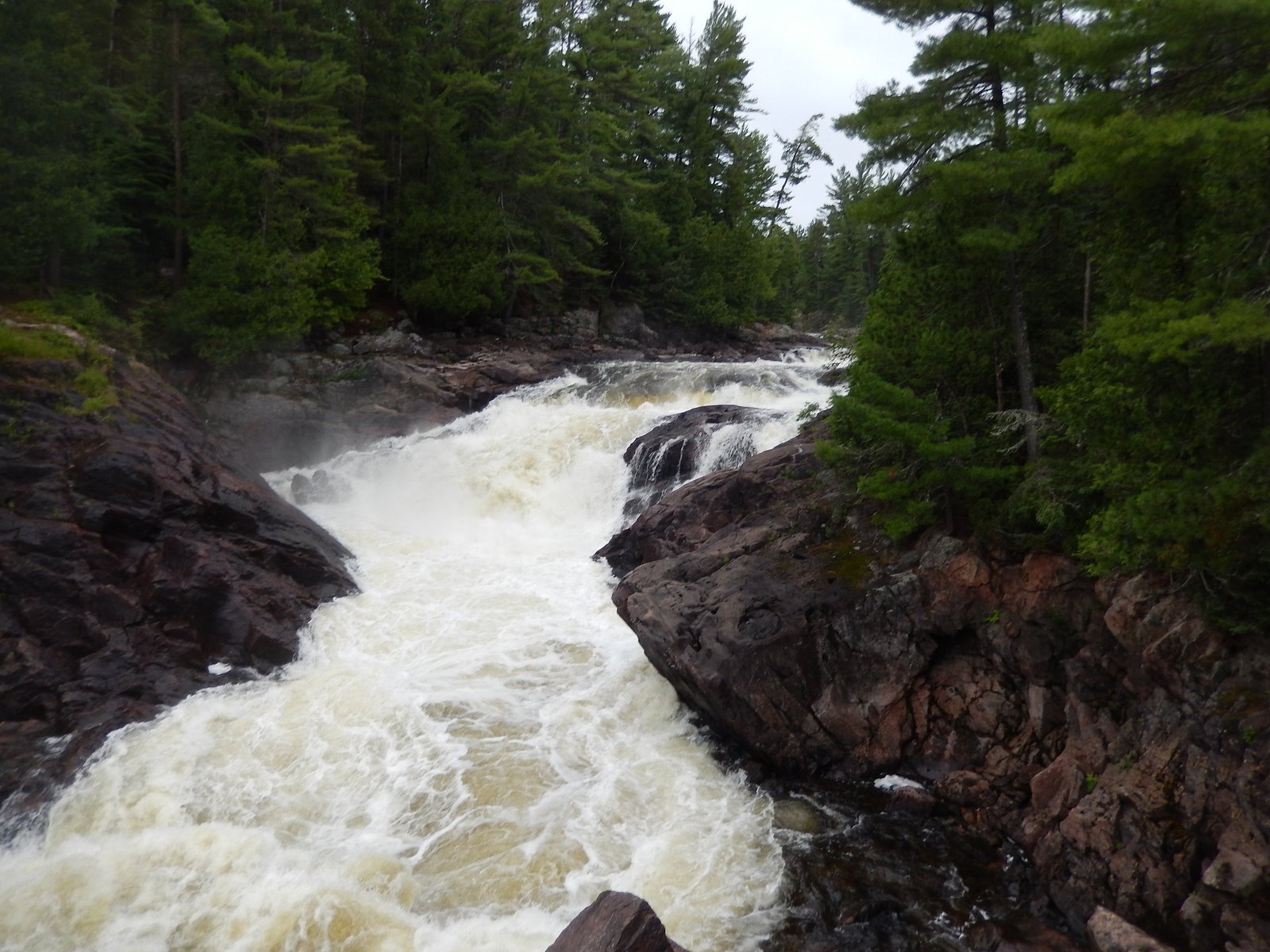
About Grande Chute
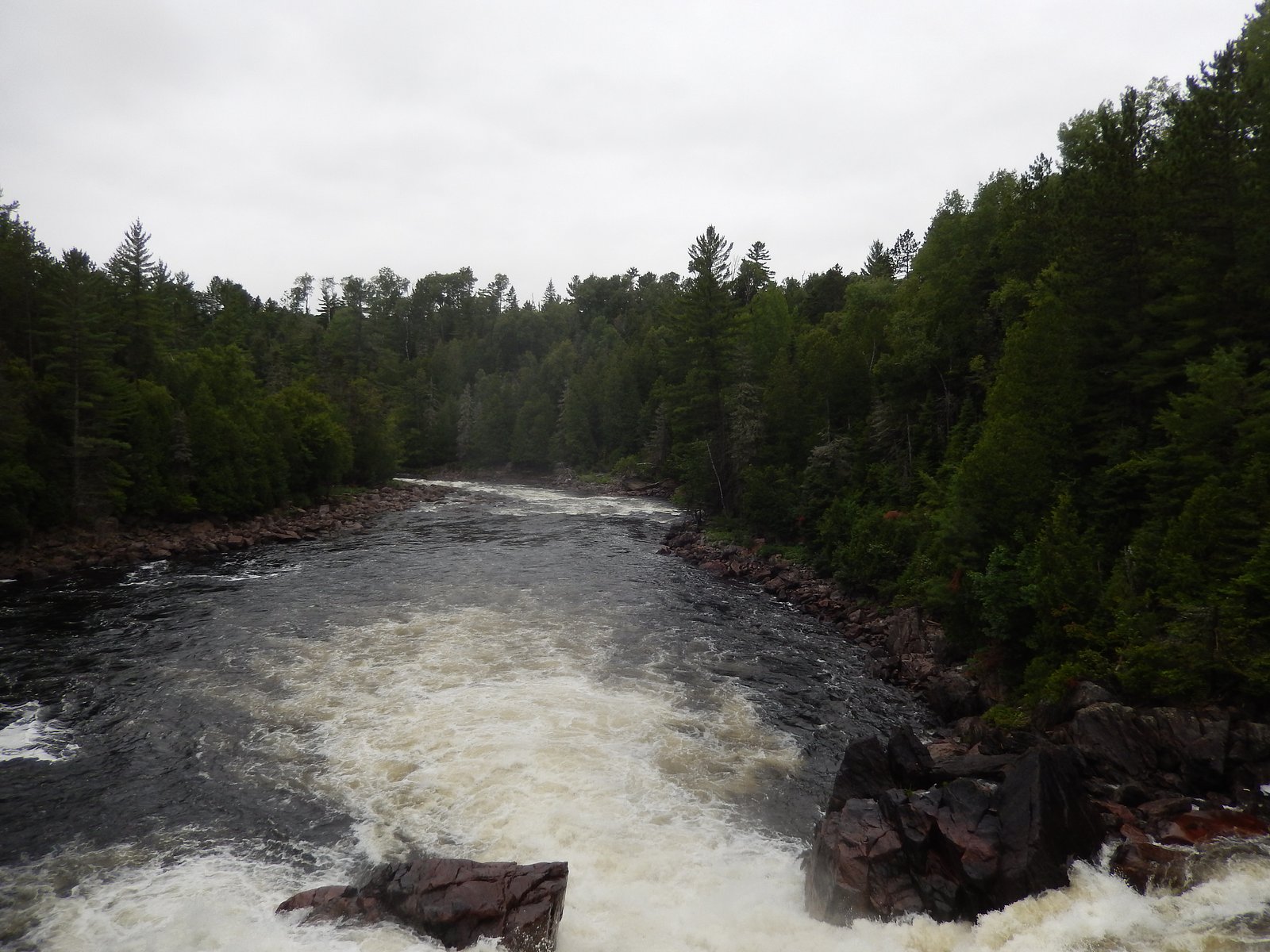
Grande Chute ("large fall") is a waterfall listed near coordinates 47.058, -79.3695 in the Temiskaming / Cobalt / New Liskeard region of northeastern Ontario/near the Ontario–Quebec border. Sources and local reports vary on exact provincial attribution; visitors should verify with local maps and signage. The falls appear in a generally remote, forested landscape typical of the Temiskaming area and may be most impressive during spring snowmelt and after heavy rain. Detailed, authoritative measurements and official infrastructure information (viewing platforms, maintained trails) are not confidently available for this feature.
The Setting
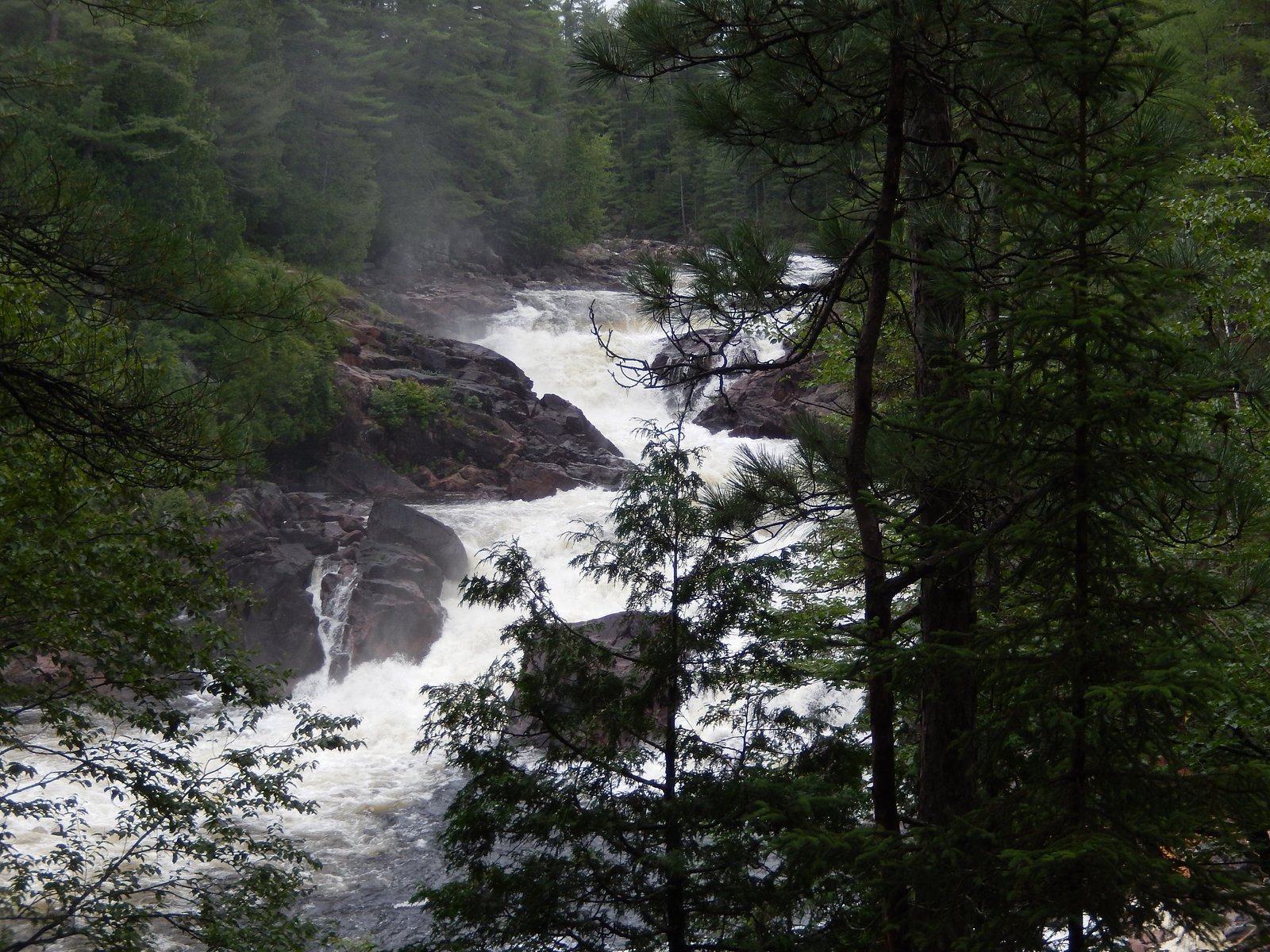
Grande Chute sits at 243 metres within Opémican National Park, in the foothills of Quebec. The falls drop 27 metres.
Why This Waterfall Exists
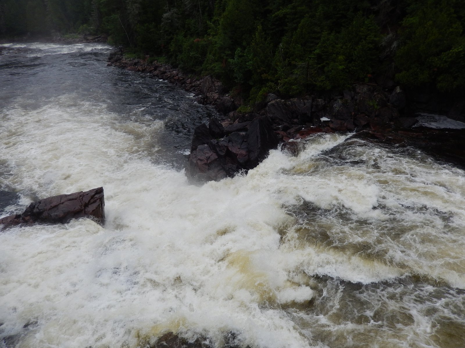
Grande Chute flows over hard crystalline rock laid down over 2.5-2.8 billion years ago. These resistant rocks form a durable ledge that water cannot easily wear away, creating a 90-foot drop where softer material downstream has already eroded.
Trail & Hike Details
The Approach
The moderate 1.1-km out-and-back trail gains 52 metres of elevation on the way to the falls.
Trail Description
There is no widely published, maintained trail description available for Grande Chute at the provided coordinates. Based on regional examples, access may be via a short unmarked path or roadside approach through mixed forest to a viewpoint; alternatively the falls could be viewable from a road or small parking area. Expect uneven ground, natural vegetation, and potentially wet/muddy conditions near the stream. If planning a hike from a nearby trailhead, research local trail maps or contact local rangers/visitor centers first.
What to Expect
The falls cascade 27 metres over hard crystalline rock.
Accessibility
The trail is not wheelchair accessible. Uneven terrain and elevation changes require steady footing.
Frequently Asked Questions
🐶 Are Dogs Allowed at Grande Chute?
❌ Dogs are not allowed
Are There Any Fees or Permits Required?
🆖 No fees required
🏊 Is There Swimming at Grande Chute?
❌ Swimming is not allowed
When to Visit
Late spring (snowmelt) and early summer for the highest water flow. Fall offers color but may have lower flows; winter may present a frozen cascade and icy approach conditions. Check recent weather and local reports for road and trail conditions.
Seasonal Access
The best time to visit is Spring, Summer, Fall, and Winter. Check with Opémican National Park for current conditions.
Safety Information
Potential hazards: slippery and unstable rocks near the water, steep or unguarded edges, fast-flowing currents, sudden water-level changes (especially during spring thaw or after rain), cold water temperatures, ticks and biting insects (summer), and winter ice hazards. The area may be remote with limited cell service, travel with companions if possible, tell someone your plan, and carry emergency supplies. If uncertain about conditions, err on the side of caution and do not approach cliff edges or wet rock surfaces.
7-Day Flow Outlook
Based on the WSC gauge KIPAWA (RIVIERE) A 0.2 KM EN AVAL DU BARRAGE LANIEL (8 km away).
Best time of year: this gauge typically runs highest from mid January to late February, peaking in May.
How we calculate this
This is a transparent outlook, not a precise forecast. We take the waterfall's current flow strength (how it ranks against its historical normal for today, from the nearest WSC stream gauge), carry that ranking forward along the gauge's seasonal curve, and nudge it for forecast rain. Confidence is highest for the next day or two and falls further out. Always check official conditions and your own judgment before visiting — high flows can be dangerous.
Know when to go.
Get a free email alert when waterfalls near Cobalt hit peak flow. We only send when conditions are worth the trip — no weekly newsletters, no spam.
Weather Forecast
Location & Access
Getting There
Approximate location: 47.058 N, -79.3695 W, roughly 29–34 miles from the towns of Cobalt and New Liskeard respectively. Expect gravel and secondary roads in the area; final approach may be via a local access road or roadside turnout. Use detailed local maps, a GPS device with the above coordinates, or contact local visitor information in Cobalt/Temiskaming Shores for the most current access directions.
Get Directions on Google MapsParking
Parking information is not confirmed. There may be limited roadside parking or an informal turnout near the falls. Do not block private driveways or the roadway; park clear of the travel lane. If you require paved or designated parking, verify locally before visiting.
Elevation
243 metres above sea level
Coordinates
47.057961° N, -79.369494° W
Land Management
Managed by Ministère de l'Environnement, de la Lutte contre les changements climatiques, de la Faune et des Parcs, Direction des parcs
Visitor Tips & Gear
• Verify exact location and access with local authorities or visitor centers in Cobalt / Temiskaming Shores before you go. • Bring a printed map and download offline maps; GPS coordinates are approximate. • Wear sturdy waterproof footwear; expect slippery rocks near the water. • Treat the area as remote: carry food, water, a first-aid kit, and layers. • Follow Leave No Trace: pack out waste, avoid trampling vegetation, and respect private property. • If you bring dogs, keep them on leash and under control; local leash rules may apply.
As an Amazon Associate, we earn from qualifying purchases.
With 1.1 km and 52 m of elevation gain, sturdy boots and trekking poles will help on this moderate trail. Icy conditions are common in winter — traction cleats are a smart addition.

Columbia Watertight II Rain Jacket
Packs into its own pocket, seam-sealed, and keeps you dry from spray and surprise rain.

Polarized Sunglasses (Knockaround)
Cuts glare off the water so you actually see the falls — and your photos turn out better too.

Earth Pak Waterproof Dry Bag
Keeps your phone and gear dry when waterfall mist soaks everything else.

Waterproof Phone Pouch (AiRunTech)
Cheap insurance — take photos right next to the falls without killing your phone.

Timberland Euro Sprint Mid Waterproof
Trusted waterproof boot with premium leather and grippy rubber sole — reliable on rocky, wet trails.

TrailBuddy Trekking Poles
Lightweight aluminum, cork grips, and flip-locks that actually hold — a best-seller for good reason.
Where to Stay
Browse vacation cabins and private rentals nearby
Unique outdoor stays — tents, yurts, and treehouses
Rent a campervan or RV for your waterfall road trip
Some links are affiliate links. We may earn a commission at no extra cost to you.
Nearby Campground
Secteur Rivière-Kipawa (Prêt-à-Camper)
2 km away
Additional Information
Nearby Attractions
Towns: Cobalt and New Liskeard (Temiskaming Shores) are the nearest towns with visitor services. Regional attractions may include other rivers, lakes, and provincial recreation areas, verify specifics with local tourism offices.
Wildlife
Typical regional wildlife may include white-tailed deer, moose, black bear, fox, beaver, and a variety of birds. Take standard precautions for a boreal/forest environment: store food securely, make noise while hiking, and understand bear safety protocols.
Cities near Grande Chute
Nearby Waterfalls
Writing about Grande Chute? Embed this waterfall on your site for free.