Grand Sault
New Brunswick • 23 m
By Armen Suny · Last verified Jun 2026
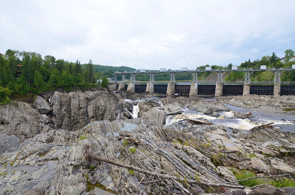
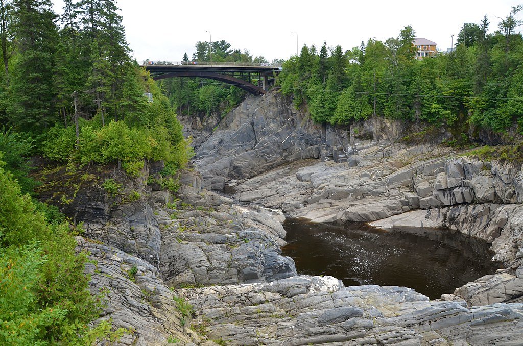
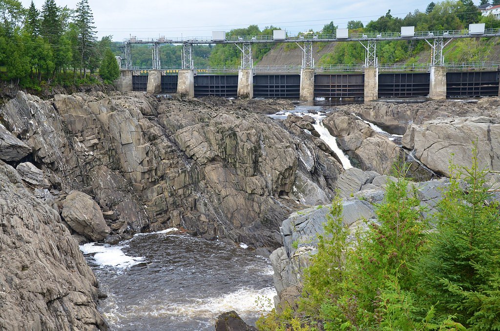
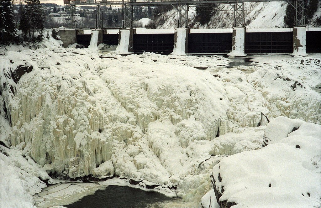

Photo Credits (5)
Difficulty
Drive Up
Trail Length
0.2 km
Elevation Gain
3 m
About Grand Sault
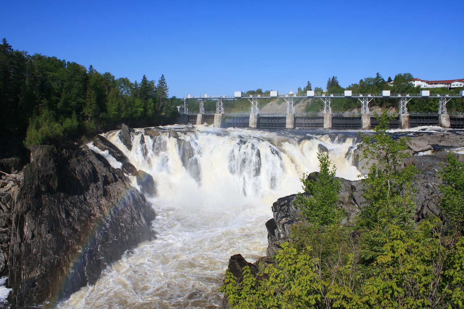
Grand Sault (Grand Falls) on the Saint John River is the dramatic waterfall and gorge adjacent to the town of Grand Falls, New Brunswick. The site features a wide, powerful drop where the river cuts through a steep gorge; flow is typically highest in spring during snowmelt and during periods of high rainfall. The falls are a prominent local landmark with municipal viewpoints and park space overlooking the river and gorge. Exact waterfall dimensions vary by source; the drop is commonly described in local material as being on the order of tens of metres (roughly 60–80 ft), but that figure is not confirmed here.
The Setting
Grand Sault sits at 121 metres in the coastal lowlands of New Brunswick. The falls drop 23 metres.
Why This Waterfall Exists
Grand Sault flows over layered sedimentary rock laid down about 252-539 million years ago. Over time, the stream has worn through these layers at different rates, creating a 75-foot drop that forms the waterfall.
Trail & Hike Details
The Approach
No hiking required. Grand Sault is accessible by vehicle with a roadside viewing area.
Trail Description
Most visitors view the falls from paved or gravel municipal viewpoints and a riverside park that require only a very short walk from parking. There are paved overlooks and stairs to lower vantage points in some spots; access to the river level or deeper into the gorge requires using maintained stairways or trails and may be steep and uneven.
What to Expect
The falls drop 23 metres over layered sedimentary rock.
Accessibility
This waterfall is viewable from a vehicle-accessible area. No hiking is required.
Frequently Asked Questions
🐶 Are Dogs Allowed at Grand Sault?
❌ Dogs are not allowed
Are There Any Fees or Permits Required?
🆖 No fees required
🏊 Is There Swimming at Grand Sault?
❌ Swimming is not allowed
When to Visit
Late spring (ice-out and high water) for peak flow; summer for easy access and warmer weather; early fall for fall foliage and still-reliable river flow. Weekdays and early mornings are less crowded.
Seasonal Access
The best time to visit is Spring, Summer, and Fall. Winter access may be limited. Check with the managing park or local authority for current conditions.
Safety Information
Hazards include steep cliff edges, slippery rocks and walkways (especially when wet or icy), strong currents and dangerous undertows in the river, changing water releases if near dam infrastructure, and rapidly changing weather. Keep children and pets under control, stay behind fences and rails, and obey all posted warnings. In winter expect icy surfaces and shortened daylight, use appropriate footwear and caution.
Current Water Conditions
155.0 m³/s
Current discharge — how much water is flowing
About average for this time of year
Based on 94 years of record
89.68 m
Water depth at gauge
7-Day Discharge Trend
What does this mean for your visit?
Flow is about average for this time of year.
About This Gauge
7-Day Flow Outlook
Based on the WSC gauge SAINT JOHN RIVER AT GRAND FALLS (1 km away).
Today
Moderate
167 m³/s
5/10Tomorrow
Moderate
155 m³/s
6/10Tue
Moderate
147 m³/s
6/10Wed
Moderate
157 m³/s
5/10Thu
Moderate
165 m³/s
5/10Fri
Moderate
163 m³/s
5/10Sat
Moderate
166 m³/s
5/10Best window: Tomorrow — moderate flow, cloudy (trip score 6/10).
Best time of year: this gauge typically runs highest from early April to late June, peaking in May.
How we calculate this
This is a transparent outlook, not a precise forecast. We take the waterfall's current flow strength (how it ranks against its historical normal for today, from the nearest WSC stream gauge), carry that ranking forward along the gauge's seasonal curve, and nudge it for forecast rain. Confidence is highest for the next day or two and falls further out. Always check official conditions and your own judgment before visiting — high flows can be dangerous.
Know when to go.
Get a free email alert when waterfalls near Edmundston hit peak flow. We only send when conditions are worth the trip — no weekly newsletters, no spam.
Weather Forecast
Location & Access
Getting There
The falls are adjacent to the town of Grand Falls, NB, just off Route 2 (Trans-Canada Highway). From the nearby U.S. towns listed (Caribou, Presque Isle, Grand Isle) follow Route 1/US-1 north to connect with the Trans-Canada / NB-2 corridor and follow signage to Grand Falls. Use the provided coordinates (47.0512, -67.739) for precise navigation.
Get Directions on Google MapsParking
There is municipal parking near the main viewing areas and parks in Grand Falls; parking is typically free and located within short walking distance of overlooks. Expect limited spaces during peak tourist times and special events.
Elevation
121 metres above sea level
Coordinates
47.051239° N, -67.739007° W
Visitor Tips & Gear
• Stay behind safety rails and observe posted signage, edges are steep and slippery. • Spring brings the highest flows and the most dramatic views; wear waterproof outer layers if you plan to get close to overlooks. • Winter can be icy, use caution on viewpoints and stairs; some areas may be closed. • Parking can fill during peak times; arrive early or visit weekdays for fewer crowds. • Respect local rules about pets, and keep dogs on leash around overlooks for safety.
As an Amazon Associate, we earn from qualifying purchases.
For this easy 0.2 km trail, lightweight trail shoes and a water bottle are usually sufficient. Sun exposure on the trail makes good sun protection a must in summer.

Polarized Sunglasses (Knockaround)
Cuts glare off the water so you actually see the falls — and your photos turn out better too.

Columbia Watertight II Rain Jacket
Packs into its own pocket, seam-sealed, and keeps you dry from spray and surprise rain.

Earth Pak Waterproof Dry Bag
Keeps your phone and gear dry when waterfall mist soaks everything else.

Waterproof Phone Pouch (AiRunTech)
Cheap insurance — take photos right next to the falls without killing your phone.

JOBY GorillaPod Starter Kit
Wraps around railings and rocks for long-exposure waterfall shots — no flat surface needed.

OR Sombriolet Sun Hat
UPF 50+ sun protection with vents so your head doesn't cook on exposed trail sections.
Where to Stay
Browse vacation cabins and private rentals nearby
Unique outdoor stays — tents, yurts, and treehouses
Rent a campervan or RV for your waterfall road trip
Some links are affiliate links. We may earn a commission at no extra cost to you.
Nearby Campground
Falls and Gorge Campground
0.8 km away
Additional Information
Nearby Attractions
Town of Grand Falls (shops, restaurants, visitor services), riverside parks and viewpoints, and local trails along the gorge. The town typically has visitor information and interpretive material about the falls and hydro history.
Wildlife
Expect common riverine and forest species: waterfowl, ducks, beavers, and typical New Brunswick mammals such as deer and small mammals; moose are present in the broader region. Observe wildlife from a distance.
Cities near Grand Sault
Writing about Grand Sault? Embed this waterfall on your site for free.