Photo Credits (5)
Difficulty
Easy
Trail Length
1.0 km
Trail Type
Out And Back
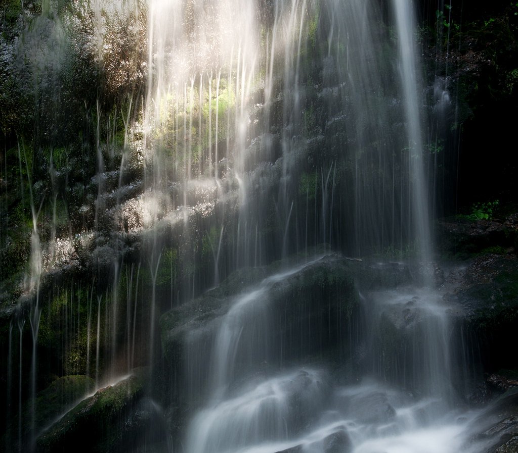
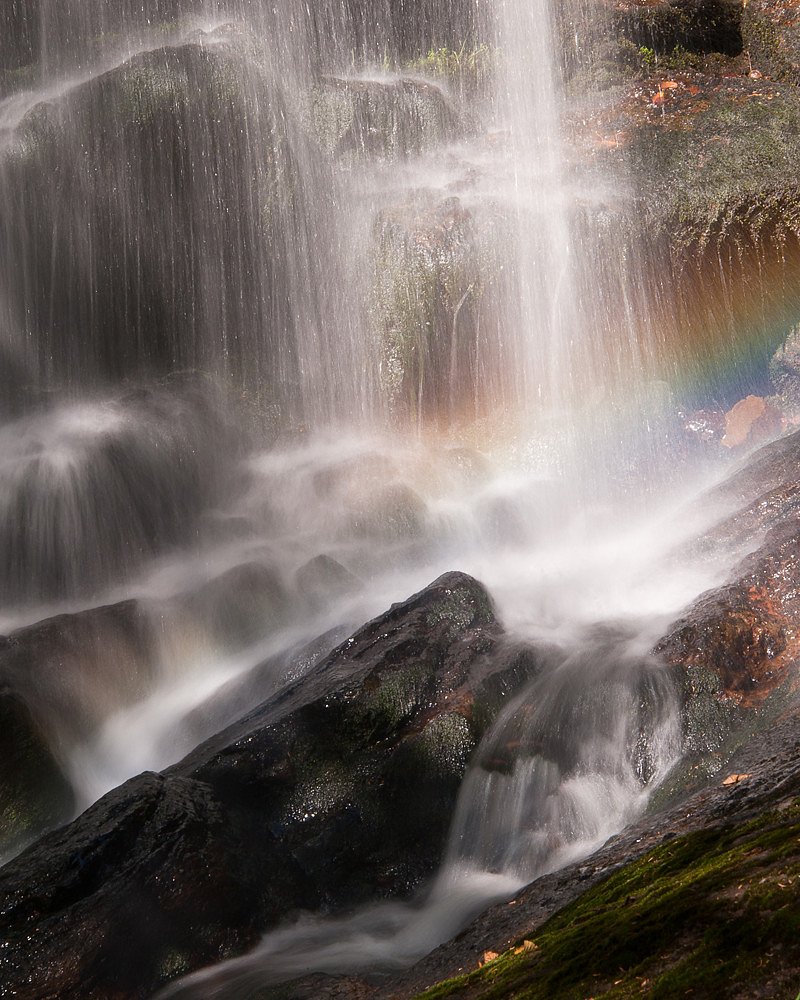
About Fuller Falls
Fuller Falls is a small, forested waterfall in southeastern New Brunswick (coordinates 45.3987, -65.4528). It sits in a wooded, rural setting and is typically visited as a short day trip from Saint John (about 35.4 miles) or Moncton (about 61.8 miles). The falls are described by visitors as a scenic cascade with a rocky gorge and a small plunge/pool; precise published measurements are not readily available, and visitor reports vary with season and water levels.
Why This Waterfall Exists
Fuller Falls flows over volcanic rock laid down about 485 million to 1.0 billion years ago. These resistant rocks form a durable ledge that water cannot easily wear away, creating the falls where softer material downstream has already eroded.
Trail & Hike Details
Trail Description
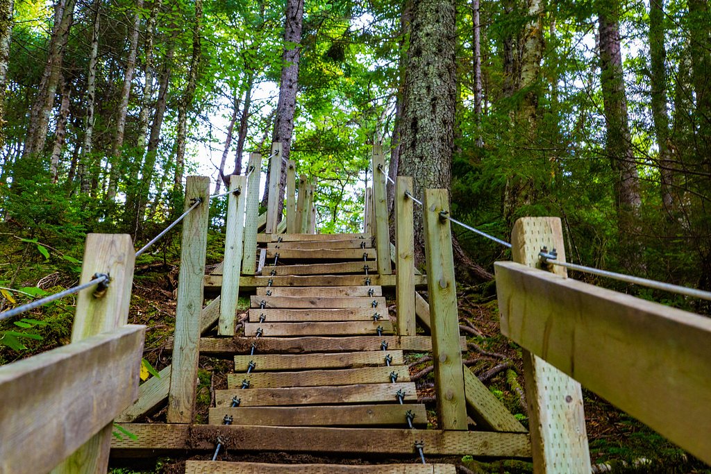
A short out-and-back footpath through mixed forest leads from the parking/pullout to viewpoints of the falls. The tread is typically narrow, with roots and rocks; there may be short steeper sections and informal scramble paths to lower viewpoints. Some visitors report unmaintained or natural sections rather than constructed boardwalks or formal stairs. Trail length is short (under 1 mile round trip) but uneven in places.
What to Expect
Expect a woodland setting with a modest cascade dropping into a rocky pool or gorge. Flow and appearance vary by season, highest flows in spring (snowmelt and after heavy rain), lower in late summer. There are limited or no infrastructure features (no visitor center, few if any interpretive signs). Views vary depending on vantage point; scrambling for lower views may be necessary and can be slippery.
Accessibility
The trail is short and relatively flat, but the surface may be uneven. Contact the managing agency for accessibility details.
Frequently Asked Questions
🐶 Are Dogs Allowed at Fuller Falls?
❌ Dogs are not allowed
Are There Any Fees or Permits Required?
🆖 No fees required
🏊 Is There Swimming at Fuller Falls?
❌ Swimming is not allowed
When to Visit
Spring (high water and fuller flows) is best for dramatic water; fall offers foliage colors and pleasant temperatures; summer provides warmer weather but lower flows and more bugs. Visit early in the day to avoid any other visitors and to get better light for photos.
Seasonal Access
The best time to visit is Spring, Summer, and Fall. Winter access may be limited. Check with the managing park or local authority for current conditions.
Safety Information
Primary hazards: slippery and unstable rock near the edge and at the base of the falls, fast or cold water, quick rises in flow after rain, limited or no cell service, and limited parking space. Do not climb on wet rocks, stay a safe distance from the edge, supervise children closely, and avoid entering the water unless you are confident of conditions. In winter the trail and rocks can be icy and conditions may be more dangerous or impassable.
Current Water Conditions
Based on a Water Survey of Canada gauge 32.6 km away
0.2 m³/s
Current discharge — how much water is flowing
About average for this time of year
Based on 37 years of record
1.15 m
Water depth at gauge
7-Day Discharge Trend
What does this mean for your visit?
Flow is about average for this time of year.
About This Gauge
This gauge is on a regional waterway. Conditions at the falls may differ, especially after local rain.
7-Day Flow Outlook
Based on the WSC gauge BLACK RIVER AT GARNET SETTLEMENT (33 km away).
Today
Low
0.1 m³/s
4/10Tomorrow
Low
0.1 m³/s
5/10Tue
Low
0.1 m³/s
5/10Wed
Low
0.1 m³/s
4/10Thu
Low
0.1 m³/s
4/10Fri
Low
0.1 m³/s
5/10Sat
Low
0.1 m³/s
4/10Best window: Tomorrow — low flow, cloudy (trip score 5/10).
Best time of year: this gauge typically runs highest from late March to mid May, peaking in April.
How we calculate this
This is a transparent outlook, not a precise forecast. We take the waterfall's current flow strength (how it ranks against its historical normal for today, from the nearest WSC stream gauge), carry that ranking forward along the gauge's seasonal curve, and nudge it for forecast rain. Confidence is highest for the next day or two and falls further out. Always check official conditions and your own judgment before visiting — high flows can be dangerous.
Know when to go.
Get a free email alert when waterfalls near Saint John hit peak flow. We only send when conditions are worth the trip — no weekly newsletters, no spam.
Weather Forecast
Location & Access
Getting There
The waterfall is reached from local rural roads; use the coordinates 45.3987, -65.4528 in a GPS device. From Saint John the drive is approximately 35.4 miles; from Moncton about 61.8 miles. Expect narrow country roads and limited signage near the site. Cell service may be intermittent in some spots, download directions ahead of time.
Get Directions on Google MapsParking
There is typically a small roadside parking area or pullout near the trailhead; parking is limited and informal. Facilities (toilets, trash service) are generally not available.
Elevation
56 metres above sea level
Coordinates
45.398652° N, -65.452777° W
Visitor Tips & Gear
Wear sturdy, closed-toe shoes with good traction. Expect muddy, uneven, or rocky sections; avoid getting too close to the edge of wet rock. Leave no trace: pack out what you bring. Cell service may be weak; let someone know your plans if going alone. Parking is limited, park well off the road and do not block access. Check recent trip reports or local sources for current access conditions before visiting.
Where to Stay
Browse vacation cabins and private rentals nearby
Unique outdoor stays — tents, yurts, and treehouses
Rent a campervan or RV for your waterfall road trip
Some links are affiliate links. We may earn a commission at no extra cost to you.
Nearby Campground
Fundy Trail Provincial Park Campground
4.2 km away
Additional Information
Nearby Attractions
Regional attractions include Saint John and the broader Bay of Fundy coastline. Other Fundy-area sights (Fundy Trail, coastal parks) are accessed elsewhere in the region; check local tourism resources for places to combine with a Fuller Falls visit.
Wildlife
Typical New Brunswick wildlife may be present: songbirds, small mammals (squirrels, rabbits), white-tailed deer, beaver in waterways, and insects (mosquitoes, black flies). Ticks can be present in brushy areas, take precautions.
Cities near Fuller Falls
Nearby Waterfalls
Writing about Fuller Falls? Embed this waterfall on your site for free.