Drywood Falls
Alberta • 3 m
By Armen Suny · Last verified Jun 2026
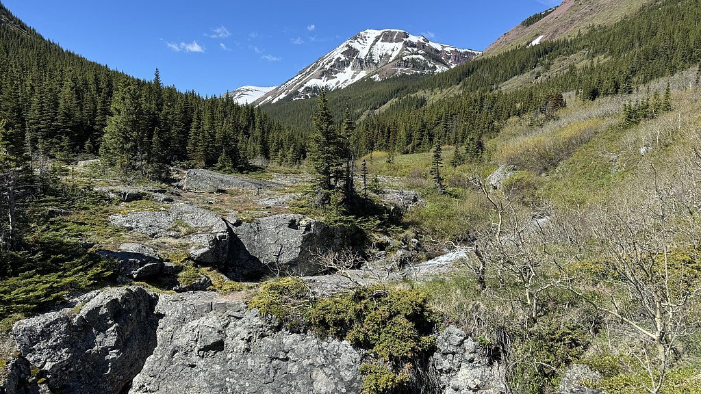
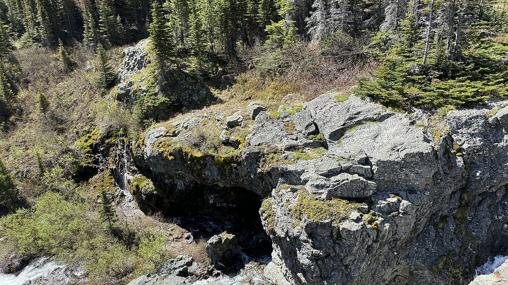
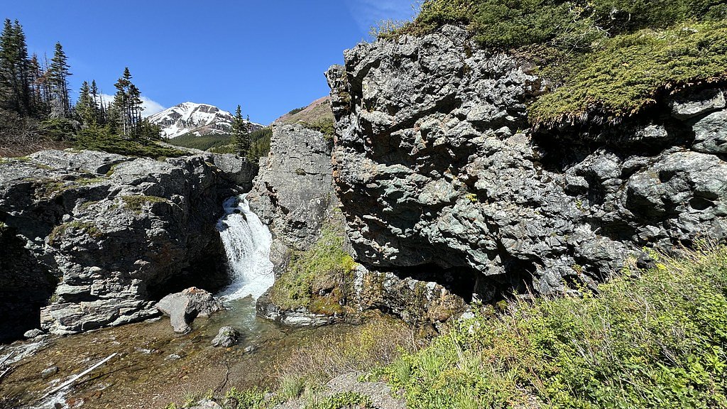
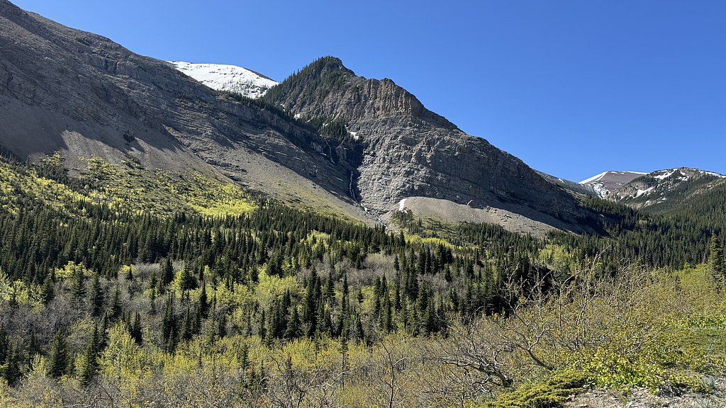
Photo Credits (5)
Trail Type
Out And Back
About Drywood Falls
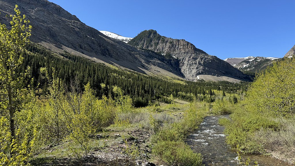
Drywood Falls is a small-to-moderate cascade located in southwestern Alberta near the Canada–U.S. border (coordinates 49.2656, -114.1052). It sits in a remote, mountainous/foothill setting and is best known for seasonal flow changes (higher in spring/early summer and lower in late summer). Exact management jurisdiction is unclear from the coordinates alone, the site is in the general region of Waterton Lakes National Park and near cross-border Glacier National Park (MT); confirm whether the falls lie inside a park or on crown/private land before visiting.
The Setting
Drywood Falls sits at 1,707 metres within Castle Wildland Provincial Park, in the high mountains of Alberta. The falls drop 3 metres.
Why This Waterfall Exists
Drywood Falls flows over Purcell Group, a hard volcanic rock layer deposited over 1.0-1.6 billion years ago. The softer shale and siltstone erodes faster than the resistant volcanic rocks and mafic, creating a 10-foot drop where water plunges over the remaining ledge.
Trail & Hike Details
Trail Description
There is no well-documented, maintained trail description available from established trail resources for this specific site. Expect a backcountry approach: travel on unpaved/forestry roads followed by a possibly unmarked, rough footpath or off-trail bushwhack to reach the stream and falls. Terrain may include steep, rocky sections and creek crossings. Because documented trail information is lacking, plan conservatively: navigation skills, map/GPS, and route-finding experience are recommended.
What to Expect
The falls drop a gentle 3 metres over hard volcanic rock.
Accessibility
Likely not wheelchair accessible. Access appears to be remote with unmaintained trails or informal routes; expect uneven terrain, creek crossings, and steep sections.
Frequently Asked Questions
🐶 Are Dogs Allowed at Drywood Falls?
❌ Dogs are not allowed
Are There Any Fees or Permits Required?
🆖 No fees required
🏊 Is There Swimming at Drywood Falls?
❌ Swimming is not allowed
When to Visit
Late spring to early summer for strongest flows (snowmelt). Early fall can offer good light and color with lower water levels. Winter access may be difficult or hazardous (ice, deep snow) and is recommended only for experienced winter backcountry travelers with proper equipment.
Seasonal Access
The best time to visit is Spring, Summer, Fall, and Winter. Check with the managing park or local authority for current conditions.
Safety Information
Hazards may include: steep and slippery rock near the falls, fast or cold water (especially during snowmelt), unstable banks, unmarked or faint trails, limited cell coverage, rapidly changing weather, and wildlife encounters (including bears). In winter expect ice, avalanche risk in some terrain, and deep snow. Always check local conditions, carry appropriate safety equipment, and do not approach the edge of waterfalls or attempt technical climbs without proper training and gear.
Current Water Conditions
0.3 m³/s
Current discharge — how much water is flowing
About average for this time of year
Based on 20 years of record
7.82 m
Water depth at gauge
7-Day Discharge Trend
What does this mean for your visit?
Flow is about average for this time of year.
About This Gauge
7-Day Flow Outlook
Based on the WSC gauge PINCHER CREEK AT FRONT RANGE ROAD (5 km away).
Today
Moderate
0.3 m³/s
9/10Tomorrow
Moderate
0.4 m³/s
6/10Tue
Moderate
0.4 m³/s
8/10Wed
Moderate
0.3 m³/s
8/10Thu
Moderate
0.3 m³/s
8/10Fri
Moderate
0.3 m³/s
8/10Sat
Moderate
0.3 m³/s
9/10Best window: Today — moderate flow, sunny (trip score 9/10).
Best time of year: this gauge typically runs highest from early May to early July, peaking in June.
How we calculate this
This is a transparent outlook, not a precise forecast. We take the waterfall's current flow strength (how it ranks against its historical normal for today, from the nearest WSC stream gauge), carry that ranking forward along the gauge's seasonal curve, and nudge it for forecast rain. Confidence is highest for the next day or two and falls further out. Always check official conditions and your own judgment before visiting — high flows can be dangerous.
Weather Forecast
Location & Access
Getting There
Located at 49.2656, -114.1052 in southwestern Alberta near the Canada–U.S. border. The falls are roughly 32.1 miles from Polebridge (MT), 47.1 miles from Babb (MT), and 54.2 miles from Saint Mary (MT) as reference points. Access typically requires travel on secondary/forest service or unpaved roads and then a hike; exact access routes and legal access points are not confidently documented here. Use a topographic map or GPS and verify access/road status with Alberta Parks or the local land manager before travel.
Get Directions on Google MapsParking
Parking information is not well documented and may be limited to roadside pullouts or an informal parking area. There may be no developed parking lot or services; park off the road only where legal and safe. Confirm with local authorities or land manager.
Elevation
1,707 metres above sea level
Coordinates
49.265631° N, -114.105157° W
Land Management
Managed by Parks Division, Alberta Forestry and Parks
Visitor Tips & Gear
1) Verify land ownership and access rules before visiting, the falls may be on park, crown, or private land. 2) Tell someone your route and expected return time; the area is remote. 3) Bring navigation tools (map, compass, GPS) and be prepared for unmarked trails. 4) Wear sturdy, waterproof footwear and be cautious on wet/slick rocks near the waterfall. 5) Carry bear spray and know how to use it; this region can have both black and grizzly bears. 6) Check road and weather conditions before travel; unpaved roads can become impassable. 7) Leave no trace and avoid disturbing sensitive habitat.
This trail sits at 5,600 ft above sea level
Elevated TrailUV radiation is roughly 22% stronger at this elevation than at sea level, and the dry air accelerates dehydration. Extra sun protection and fluids go a long way.
As an Amazon Associate, we earn from qualifying purchases.

Coppertone Sport SPF 50 Sunscreen
UV intensity jumps ~4% per 1,000 ft — at this elevation you can burn in half the time.

Sun Bum SPF 30 Lip Balm (3-Pack)
Lips have almost no natural UV protection and burn fast in thin, dry mountain air.

Liquid I.V. Electrolyte Packets
You lose moisture ~2x faster at elevation — electrolytes help you absorb water efficiently.

ROCKNIGHT Polarized UV400 Sunglasses
High-altitude glare off rock and water is intense — UV400 lenses block 99%+ of UVA/UVB.
Where to Stay
Browse vacation cabins and private rentals nearby
Unique outdoor stays — tents, yurts, and treehouses
Rent a campervan or RV for your waterfall road trip
Some links are affiliate links. We may earn a commission at no extra cost to you.
Nearby Campground
Twin Lakes Camp
15 km away
Additional Information
Nearby Attractions
Waterton Lakes National Park (regional), Glacier National Park (MT) across the border, scenic drives and backcountry hiking in the Waterton-Glacier region. Use local visitor centres for up-to-date suggestions and road/trail conditions.
Wildlife
Potential for black bears and grizzly bears, elk, deer, bighorn sheep, mountain goats, coyotes and other typical Rocky Mountain/foothill species. Maintain safe distances and follow wildlife safety guidance.
Writing about Drywood Falls? Embed this waterfall on your site for free.