Photo Credits (2)
Difficulty
Moderate
Trail Length
3.9 km
Trail Type
Out And Back
Elevation Gain
95 m
About Coca Cola Falls
Coca Cola Falls (coordinates: 50.3242, -95.7828) appears to be a small, locally-named cascade in the Interlake/central Manitoba region, approximately 55.1 miles from Selkirk. This site is not widely documented in major guidebooks and may be a seasonal or low-profile waterfall on a small tributary or stream. Access details and facilities are not well recorded; visitors should verify current conditions and access (including private land issues) before travel.
Why This Waterfall Exists
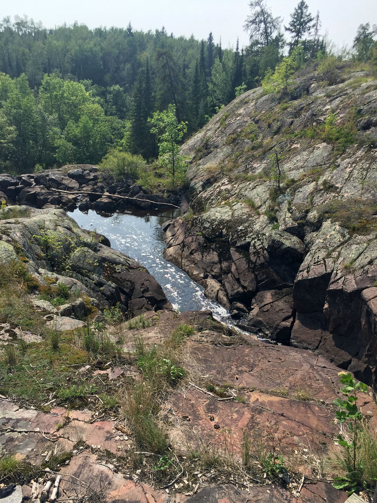
Coca Cola Falls flows over hard intrusive rock laid down over 2.5-2.8 billion years ago. These resistant rocks form a durable ledge that water cannot easily wear away, creating the falls where softer material downstream has already eroded.
Trail & Hike Details
The Approach
The moderate 3.9-km out-and-back trail gains 95 metres of elevation on the way to the falls.
Trail Description
Specific trail descriptions are not available from major trail resources. Access may require a short scramble from a roadside pullout or a short walk along an informal path to the stream. Expect uneven, possibly muddy or rocky terrain and limited or no trail infrastructure (no boardwalks, railings, or signs).
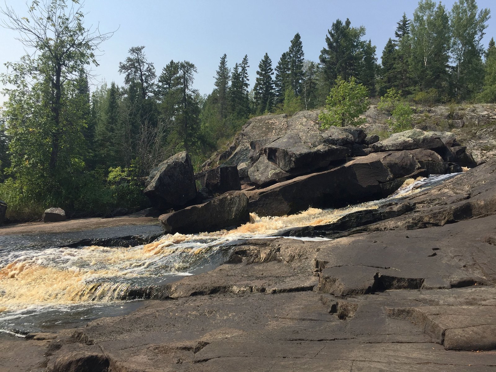
What to Expect
A small cascade or set of rapids rather than a large, single-drop waterfall. Flow is likely seasonal, higher in spring snowmelt and after heavy rains, lower in late summer. Little to no visitor infrastructure: no bathrooms, picnic shelters, or maintained viewpoints are expected. Natural hazards such as slippery rocks, steep or eroded banks, and dense vegetation are likely. Insect activity (black flies, mosquitoes) can be significant in spring and summer. Wildlife in the area may include waterfowl, shorebirds, beavers, and typical Manitoba woodland species; ticks may be present.
Accessibility
The trail is not wheelchair accessible. Uneven terrain and elevation changes require steady footing.
Frequently Asked Questions
🐶 Are Dogs Allowed at Coca Cola Falls?
❌ Dogs are not allowed
Are There Any Fees or Permits Required?
🆖 No fees required
🏊 Is There Swimming at Coca Cola Falls?
❌ Swimming is not allowed
When to Visit
Spring (snowmelt and higher flows) provides the most dramatic water levels. Summer offers easier access but lower flows might make the falls less impressive. Early fall can offer good colors and cooler weather. Winter conditions may render the site icy, and access roads or trails may be closed or unsafe.
Seasonal Access
The best time to visit is Spring, Summer, and Fall. Winter access may be limited. Check with the managing park or local authority for current conditions.
Safety Information
Potential hazards include slippery and unstable rock, steep or eroded banks, cold and fast-moving water, seasonal high flows, and limited or no cell service. Roads to the site may be gravel or poorly maintained; check road conditions before traveling. If the site is on private land, respect posted signs and obtain permission. In winter, ice near falls can be thin and unstable, avoid walking on ice near flowing water. Always tell someone your plan and expected return time when visiting remote or poorly documented sites.
Current Water Conditions
Based on a Water Survey of Canada gauge 30.3 km away
7.4 m³/s
Current discharge — how much water is flowing
About average for this time of year
Based on 38 years of record
1.26 m
Water depth at gauge
7-Day Discharge Trend
What does this mean for your visit?
Flow is about average for this time of year.
About This Gauge
This gauge is on a regional waterway. Conditions at the falls may differ, especially after local rain.
7-Day Flow Outlook
Based on the WSC gauge BIRD RIVER AT OUTLET OF BIRD LAKE (30 km away).
Today
Moderate
7.4 m³/s
8/10Tomorrow
Moderate
7.2 m³/s
8/10Tue
Moderate
7.0 m³/s
8/10Wed
Moderate
6.8 m³/s
8/10Thu
Moderate
7.2 m³/s
6/10Fri
Moderate
7.2 m³/s
6/10Sat
Moderate
7.1 m³/s
6/10Best window: Today — moderate flow, cloudy (trip score 8/10).
Best time of year: this gauge typically runs highest from late April to late July, peaking in June.
How we calculate this
This is a transparent outlook, not a precise forecast. We take the waterfall's current flow strength (how it ranks against its historical normal for today, from the nearest WSC stream gauge), carry that ranking forward along the gauge's seasonal curve, and nudge it for forecast rain. Confidence is highest for the next day or two and falls further out. Always check official conditions and your own judgment before visiting — high flows can be dangerous.
Know when to go.
Get a free email alert when waterfalls near Selkirk hit peak flow. We only send when conditions are worth the trip — no weekly newsletters, no spam.
Weather Forecast
Location & Access
Getting There
The falls are located at the provided coordinates (50.3242, -95.7828), roughly 55 miles from Selkirk. Expect to reach the general area by paved roads followed by local or unpaved roads; some last-mile access may be on a gravel or logging road. Use a reliable map or GPS and confirm road conditions before travel. Cell coverage may be limited in places.
Get Directions on Google MapsParking
There does not appear to be a developed parking lot. Parking may be roadside or on an informal pullout. If the site is on or adjacent to private land, parking and access may be restricted, confirm permission before parking.
Elevation
262 metres above sea level
Coordinates
50.324159° N, -95.782768° W
Visitor Tips & Gear
Confirm access and land ownership before visiting; the falls may be on or adjacent to private land. Wear sturdy, waterproof footwear and expect slippery, uneven surfaces. Bring insect repellent and dress in layers. Carry a printed map or offline GPS track, cell service may be unreliable. Do not rely on finding facilities (toilets, trash cans), pack out all waste. Exercise extra caution near the water and on wet rocks; never turn your back on fast-moving water. If conditions are unclear, ask local residents or park/municipal offices for up-to-date guidance.
As an Amazon Associate, we earn from qualifying purchases.
With 3.9 km and 95 m of elevation gain, sturdy boots and trekking poles will help on this moderate trail. Sun exposure on the trail makes good sun protection a must in summer.

Polarized Sunglasses (Knockaround)
Cuts glare off the water so you actually see the falls — and your photos turn out better too.

Columbia Watertight II Rain Jacket
Packs into its own pocket, seam-sealed, and keeps you dry from spray and surprise rain.

Earth Pak Waterproof Dry Bag
Keeps your phone and gear dry when waterfall mist soaks everything else.

Waterproof Phone Pouch (AiRunTech)
Cheap insurance — take photos right next to the falls without killing your phone.

Timberland Euro Sprint Mid Waterproof
Trusted waterproof boot with premium leather and grippy rubber sole — reliable on rocky, wet trails.

TrailBuddy Trekking Poles
Lightweight aluminum, cork grips, and flip-locks that actually hold — a best-seller for good reason.
Where to Stay
Browse vacation cabins and private rentals nearby
Unique outdoor stays — tents, yurts, and treehouses
Rent a campervan or RV for your waterfall road trip
Some links are affiliate links. We may earn a commission at no extra cost to you.
Nearby Campground
Trail End Camp and Outfitters
15.9 km away
Additional Information
Nearby Attractions
General regional attractions may include Lake Winnipeg shoreline access and local communities such as Selkirk. Exact nearby parks or named attractions relative to this specific coordinate are not well-documented, confirm with local tourism/municipal resources.
Wildlife
Expect typical Interlake/central Manitoba wildlife: waterfowl, shorebirds, beavers, songbirds, and small mammals. Ticks and biting insects (black flies, mosquitoes) can be abundant in warmer months. Larger mammals (deer, moose) occur regionally; bear encounters are less common in this part of Manitoba but can occur in broader regions, stay alert.
Cities near Coca Cola Falls
Writing about Coca Cola Falls? Embed this waterfall on your site for free.