Photo Credits (5)
Difficulty
Easy
Trail Length
1.6 km
Trail Type
Out And Back
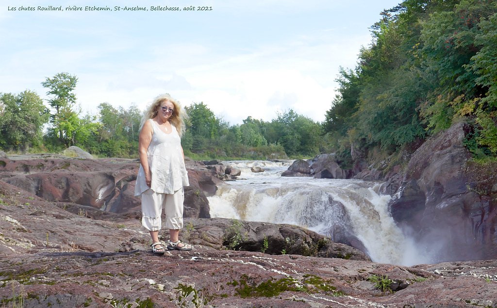
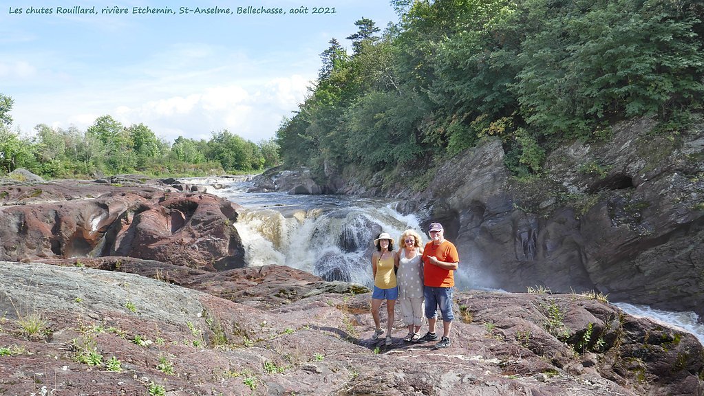
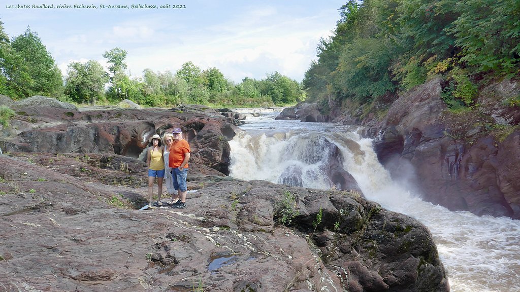
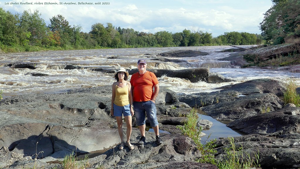
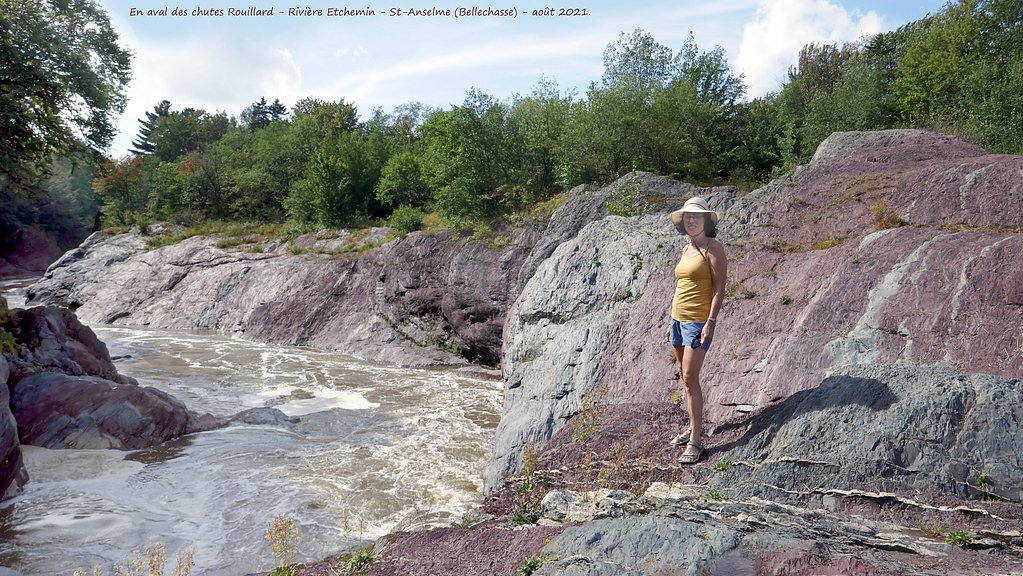
About Chutes Rouillard
Chutes Rouillard (coordinates: 46.6188, -70.9437) is a Quebec waterfall located east of Québec City (≈21.8 miles), and within driving distance of Saint-Georges and Victoriaville. Local reports indicate it is a natural cascade set in a forested landscape. Specific published trail guides and an official height measurement are not readily verifiable from available information; the following description is cautious and summarizes typical conditions for small regional falls in this area.
Why This Waterfall Exists
Chutes Rouillard flows over layered sedimentary rock laid down about 252-539 million years ago. Over time, the stream has worn through these layers at different rates, creating the step that forms the waterfall.
Trail & Hike Details
Trail Description
Detailed, authoritative trail descriptions for Chutes Rouillard are not widely published. Expect a short walk from parking to the falls across forested, possibly uneven ground. Trails in the area may be narrow, with roots and rocks; there may be informal viewpoints rather than constructed platforms. If there is a maintained path it is likely short (under a few miles round-trip), but official trail distance and elevation gain are not confirmed here.
What to Expect
Wooded, natural setting with a cascade over bedrock. Seasonal flow will vary, highest in spring during spring melt and after heavy rains, lower in late summer. Expect muddy or slick sections after rain or during spring runoff. Limited facilities (no restrooms, no potable water) are likely. Cell reception may be spotty depending on provider.
Accessibility
The trail is not wheelchair accessible. Uneven terrain and elevation changes require steady footing.
Frequently Asked Questions
🐶 Are Dogs Allowed at Chutes Rouillard?
❌ Dogs are not allowed
Are There Any Fees or Permits Required?
🆖 No fees required
🏊 Is There Swimming at Chutes Rouillard?
❌ Swimming is not allowed
When to Visit
Spring (snowmelt) for strongest flows and fall for foliage color. Summer is fine for accessible conditions but flows may be reduced. Winter offers icy scenery but access can be hazardous without proper gear.
Seasonal Access
The best time to visit is Spring, Summer, Fall, and Winter. Check with the managing park or local authority for current conditions.
Safety Information
Hazards include slippery rocks and riverbanks, sudden high water during spring melt or storms, cold water temperatures, and unstable ledges. There may be no barriers or signage. Avoid getting too close to the brink, supervise children closely, and do not climb on wet rocks. In winter, ice and snow increase risk of slips and falls, use appropriate traction devices and caution. If access crosses private land, respect property and posted restrictions. In case of emergency, cell service may be unreliable; tell someone your plans and expected return time.
7-Day Flow Outlook
Based on the WSC gauge BOYER SUD (RIVIERE) AU PONT-ROUTE DU RANG GRANDE GRILLADE (10 km away).
Best time of year: this gauge typically runs highest from late March to mid May, peaking in April.
How we calculate this
This is a transparent outlook, not a precise forecast. We take the waterfall's current flow strength (how it ranks against its historical normal for today, from the nearest WSC stream gauge), carry that ranking forward along the gauge's seasonal curve, and nudge it for forecast rain. Confidence is highest for the next day or two and falls further out. Always check official conditions and your own judgment before visiting — high flows can be dangerous.
Know when to go.
Get a free email alert when waterfalls near Québec hit peak flow. We only send when conditions are worth the trip — no weekly newsletters, no spam.
Weather Forecast
Location & Access
Getting There
Located by GPS at 46.6188, -70.9437. The site is reached by car via local/secondary roads from the nearest regional highways; expect a short drive on unpaved or narrow roads in places. Use a recent map or GPS and check for private property signs. Nearest major city is Québec (≈22 miles).
Get Directions on Google MapsParking
Parking is likely limited, may be a small unpaved lot or roadside parking near the trailhead. Parking may be unmarked; use caution and avoid blocking driveways or gates. Confirm parking rules locally.
Elevation
158 metres above sea level
Coordinates
46.618817° N, -70.943658° W
Visitor Tips & Gear
• Wear sturdy, traction-capable footwear; rocks and riverbanks are slippery. • Bring insect repellent in summer and layered clothing in shoulder seasons. • Stay back from the edge, rock near waterfalls can be unstable. • Respect private property signs; some access routes to smaller falls cross private land. • If parking is roadside, avoid blocking traffic and use hazard lights as needed. • Check local park/municipal websites or contact local tourism offices for any updated access info before visiting.
Where to Stay
Browse vacation cabins and private rentals nearby
Unique outdoor stays — tents, yurts, and treehouses
Rent a campervan or RV for your waterfall road trip
Some links are affiliate links. We may earn a commission at no extra cost to you.
Nearby Campground
Camping Parc de la Chaudière
16.4 km away
Additional Information
Nearby Attractions
Regionally, Québec City and its attractions are the nearest major draw. There are also multiple regional parks, rivers and other small waterfalls in the broader area; confirm exact nearby sites with local tourism resources.
Wildlife
Typical southern Quebec wildlife may be present: songbirds, small mammals (squirrels, raccoons), white-tailed deer, and occasionally larger mammals such as moose or black bear in more remote areas. Be cautious with food and pets.
Cities near Chutes Rouillard
Writing about Chutes Rouillard? Embed this waterfall on your site for free.