
Photo Credits (3)
Difficulty
Drive Up
Trail Length
0.2 km
Elevation Gain
3 m
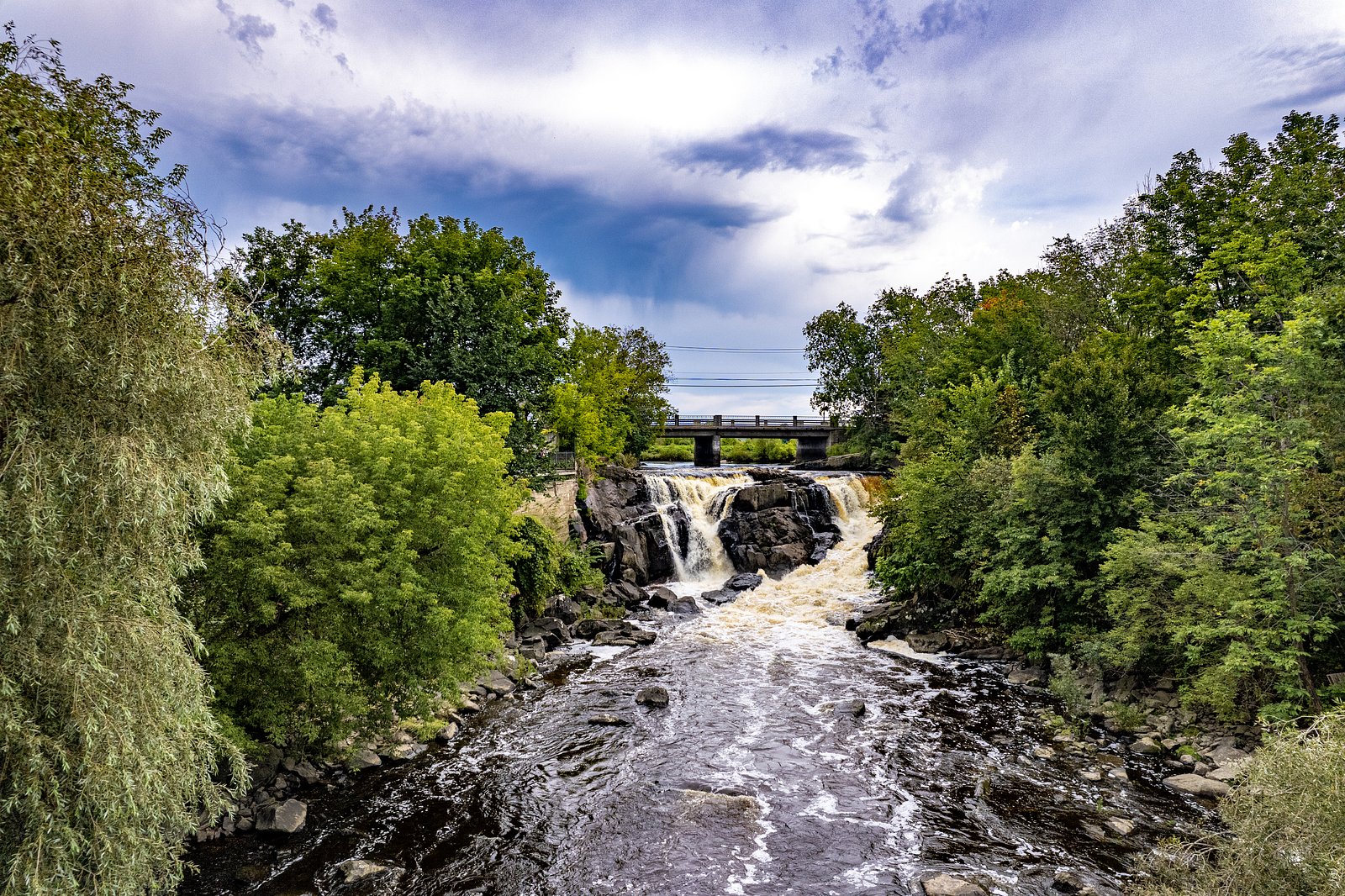
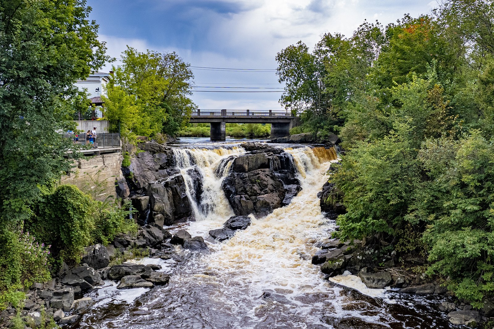
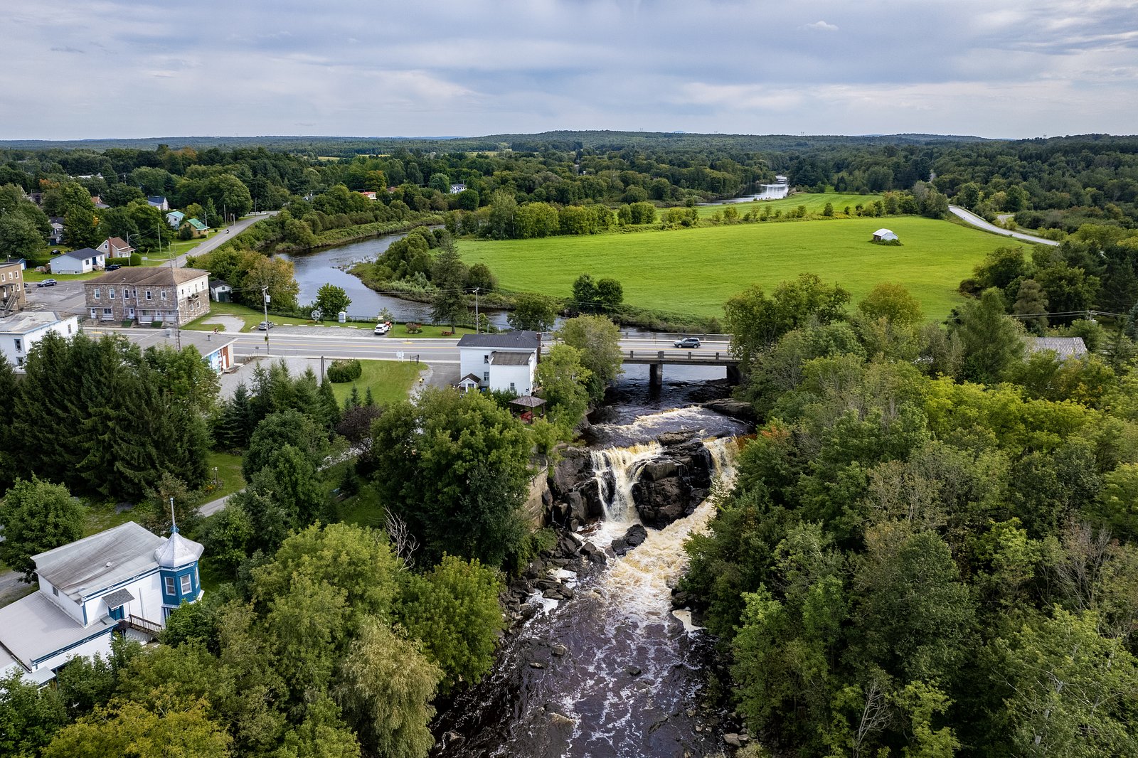
About Chutes de Roxton Falls
Chutes de Roxton Falls (Roxton Falls) is a scenic waterfall and small hydroelectric dam feature located in the village of Roxton Falls, Quebec (coordinates approx. 45.5715, -72.5253). The site offers close-up views of the falls from municipal viewpoints and a small park area. Flow and appearance vary seasonally (high flow during spring melt; reduced flow in late summer). The falls are within driving distance of Drummondville (approx. 17.0 miles), North Troy (approx. 33.2 miles) and Sherbrooke (approx. 34.8 miles).
Why This Waterfall Exists
Chutes de Roxton Falls flows over layered sedimentary rock laid down about 252-539 million years ago. Over time, the stream has worn through these layers at different rates, creating the step that forms the waterfall.
Trail & Hike Details
The Approach
No hiking required. Chutes de Roxton Falls is accessible by vehicle with a roadside viewing area.
Trail Description
Access to viewpoints at Roxton Falls is typically a very short walk from nearby parking or a road-side turnout. Trails and paths to lookouts are generally short and may be paved or compacted; some vantage points include stairs or short drops. There is not typically a long hiking trail to the falls, the experience is primarily viewpoint-based rather than a multi-kilometre hike.
What to Expect
Expect a compact scenic site with clear views of the falls and associated dam/hydropower structures. Seasonal flow changes are notable: strong flow during spring melt and after heavy rain, lower flow in late summer. There may be interpretive signs, railings, and fenced viewing platforms; in some spots railings or barriers may be limited. Nearby village amenities (cafés, shops) may be a short drive away. In winter, ice formations can be attractive but surfaces are often slippery and some viewpoints may be closed or unsafe.
Accessibility
This waterfall is viewable from a vehicle-accessible area. No hiking is required.
Frequently Asked Questions
🐶 Are Dogs Allowed at Chutes de Roxton Falls?
❌ Dogs are not allowed
Are There Any Fees or Permits Required?
🆖 No fees required
🏊 Is There Swimming at Chutes de Roxton Falls?
❌ Swimming is not allowed
When to Visit
Spring (high flows and dramatic runoff) and fall (autumn foliage) are often best for dramatic views. Summer provides easier, warmer access. Winter offers frozen/icy scenery but can be hazardous; only visit if prepared for icy conditions and limited maintenance.
Seasonal Access
The best time to visit is Spring, Summer, Fall, and Winter. Check with the managing park or local authority for current conditions.
Safety Information
Primary hazards include slippery rocks and paths, strong currents and undertows near the dam and plunge pool, seasonal ice and snow, and limited railings in some spots. Stay on marked trails and behind barriers, supervise children and pets closely, and obey all posted signage. Do not attempt to climb on rocks immediately adjacent to the waterfall or dam. In winter, expect icy conditions and potential closures of unsafe viewpoints.
7-Day Flow Outlook
Based on the WSC gauge RUNNELS (RUISSEAU) A SAINT-VALERIEN-DE-MILTON (9 km away).
Best time of year: this gauge typically runs highest from early March to early May, peaking in March.
How we calculate this
This is a transparent outlook, not a precise forecast. We take the waterfall's current flow strength (how it ranks against its historical normal for today, from the nearest WSC stream gauge), carry that ranking forward along the gauge's seasonal curve, and nudge it for forecast rain. Confidence is highest for the next day or two and falls further out. Always check official conditions and your own judgment before visiting — high flows can be dangerous.
Know when to go.
Get a free email alert when waterfalls near Drummondville hit peak flow. We only send when conditions are worth the trip — no weekly newsletters, no spam.
Weather Forecast
Location & Access
Getting There
Located in the village of Roxton Falls in the Montérégie/Estrie region of Quebec. Access is by local municipal roads from surrounding towns (rough driving time ~20–40 minutes from Drummondville or Sherbrooke). Look for municipal signage and parking near the falls and lookout areas. Exact driving directions are best obtained from a map app or local tourism office.
Get Directions on Google MapsParking
There is typically roadside or small municipal parking near the falls/viewpoints. Parking may be limited during weekends and peak season. Expect unpaved or compacted surfaces in places and limited formal lot capacity.
Elevation
100 metres above sea level
Coordinates
45.571472° N, -72.525326° W
Visitor Tips & Gear
• Stay behind barriers and obey signage, the area near the dam and plunge pool can have strong currents and hidden hazards. • Parking is limited; arrive early on weekends or holidays. • Winter conditions can make walkways icy; wear suitable footwear and traction devices if visiting in cold months. • Drones and commercial photography may be restricted, check municipal rules before flying. • Respect private property lines; some vantage points are adjacent to private land.
As an Amazon Associate, we earn from qualifying purchases.
For this easy 0.2 km trail, lightweight trail shoes and a water bottle are usually sufficient. Icy conditions are common in winter — traction cleats are a smart addition.

Columbia Watertight II Rain Jacket
Packs into its own pocket, seam-sealed, and keeps you dry from spray and surprise rain.

Polarized Sunglasses (Knockaround)
Cuts glare off the water so you actually see the falls — and your photos turn out better too.

Earth Pak Waterproof Dry Bag
Keeps your phone and gear dry when waterfall mist soaks everything else.

Waterproof Phone Pouch (AiRunTech)
Cheap insurance — take photos right next to the falls without killing your phone.

Kahtoola MICROspikes
Cult-favorite traction cleats that grip ice and wet rock — essential for winter waterfall hikes.

JOBY GorillaPod Starter Kit
Wraps around railings and rocks for long-exposure waterfall shots — no flat surface needed.
Where to Stay
Browse vacation cabins and private rentals nearby
Unique outdoor stays — tents, yurts, and treehouses
Rent a campervan or RV for your waterfall road trip
Some links are affiliate links. We may earn a commission at no extra cost to you.
Nearby Campground
Camping de l'Ile
1.6 km away
Additional Information
Nearby Attractions
Drummondville (Village Québécois d'Antan and museums), regional parks and small towns of the Eastern Townships near Sherbrooke, and countryside drives. Local hiking and picnic areas may be available within a short drive.
Wildlife
Typical southern Quebec wildlife, songbirds, waterfowl, small mammals (squirrels, raccoons), and occasional deer. Take standard precautions to avoid feeding wildlife and secure food.
Cities near Chutes de Roxton Falls
Writing about Chutes de Roxton Falls? Embed this waterfall on your site for free.