
Photo Credits (5)
Difficulty
Easy
Trail Length
0.6 km
Trail Type
Out And Back
Elevation Gain
12 m
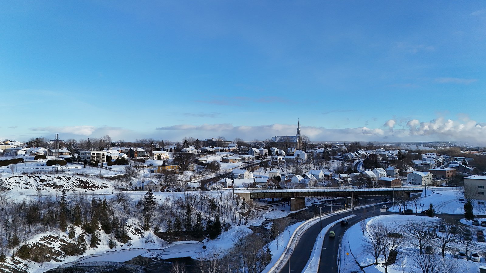
About Chutes de Rivière-du-Loup
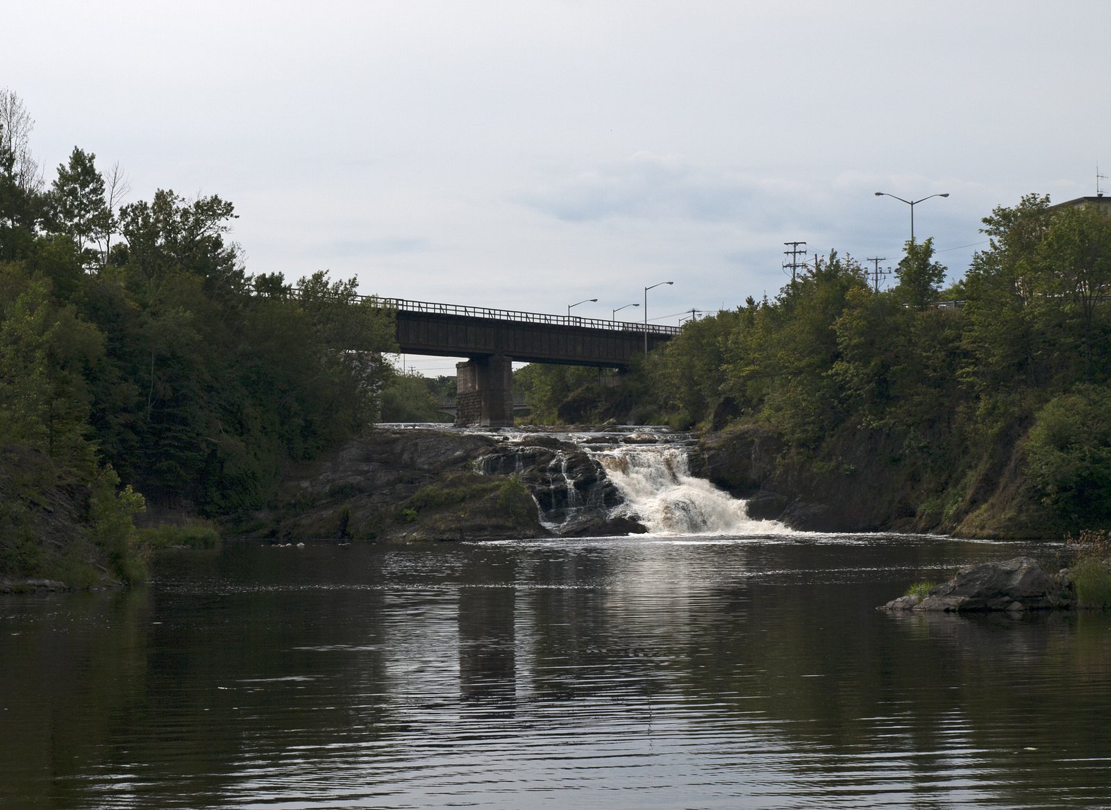
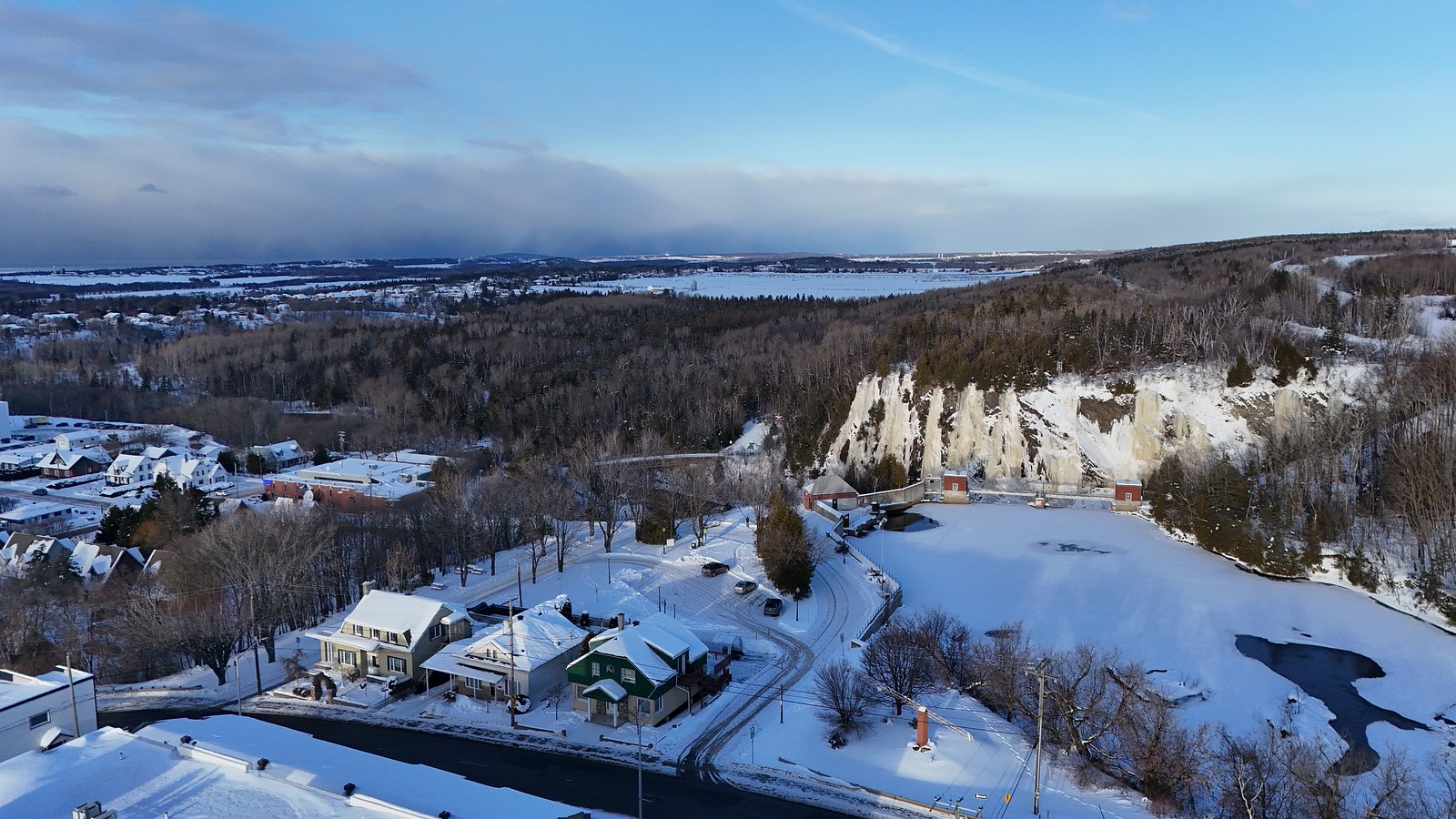
Chutes de Rivière‑du‑Loup is a municipal/riverine waterfall located just outside the town of Rivière‑du‑Loup in Bas‑Saint‑Laurent, Quebec. The site is typically visited from a nearby park or viewpoint and is known for seasonal variation in flow (high in spring runoff, lower in late summer). The waterfall is within a short distance of the town center and is commonly reached by a short walk from parking areas. Specific structural details (exact measured height, official name variation) vary between sources and are not confirmed here.
Why This Waterfall Exists
Chutes de Rivière-du-Loup flows over layered sedimentary rock laid down about 444-539 million years ago. Over time, the stream has worn through these layers at different rates, creating the step that forms the waterfall.
Trail & Hike Details
The Approach
The easy 0.6-km out-and-back trail gains 12 metres of elevation on the way to the falls.
Trail Description
A short, generally well‑maintained path leads from the parking area to one or more viewpoints overlooking the falls. Trails may be paved or compacted gravel for the first section with some steps or steeper sections nearer to the viewpoints. Expect short distances between parking, lookouts, and picnic areas; the main vantage is designed for viewing rather than scrambling down to the base of the falls. Surfaces can be wet and slippery, especially after rain or during freeze/thaw conditions.
What to Expect
Scenic river and forest surroundings with a relatively short walk from parking to viewpoints. Water flow is highest in spring (snowmelt) and after heavy rain; summer flows can be reduced. Visitor infrastructure may include viewing platforms, railings, interpretive signs, and picnic areas. In winter the falls may be partially or fully frozen creating ice formations but access paths and stairs may be icy or closed.
Accessibility
The trail is short and relatively flat, but the surface may be uneven. Contact the managing agency for accessibility details.
Frequently Asked Questions
🐶 Are Dogs Allowed at Chutes de Rivière-du-Loup?
❌ Dogs are not allowed
Are There Any Fees or Permits Required?
🆖 No fees required
🏊 Is There Swimming at Chutes de Rivière-du-Loup?
❌ Swimming is not allowed
When to Visit
Spring (late March–May) for highest flows and dramatic water volume; fall for foliage color combined with reliable access; summer for mild weather and easy access; winter for icy/frozen views if you have appropriate gear. Weekday mornings tend to be less crowded.
Seasonal Access
The best time to visit is Spring, Summer, Fall, and Winter. Check with the managing park or local authority for current conditions.
Safety Information
Hazards include slippery surfaces, steep drop‑offs, cold and fast water, changing weather, and icy conditions in winter. Stay on marked trails and behind railings, supervise children closely, avoid attempting to climb wet rocks near the edge, and do not enter the water. In winter, expect icy stairs and paths, use traction devices and caution. Emergency services response times may vary; cell coverage can be limited in some areas.
7-Day Flow Outlook
Based on the WSC gauge LOUP (RIVIERE DU) A 0,6 KM EN AMONT DU PONT-ROUTE 185 (1 km away).
Best time of year: this gauge typically runs highest from late March to mid June, peaking in April.
How we calculate this
This is a transparent outlook, not a precise forecast. We take the waterfall's current flow strength (how it ranks against its historical normal for today, from the nearest WSC stream gauge), carry that ranking forward along the gauge's seasonal curve, and nudge it for forecast rain. Confidence is highest for the next day or two and falls further out. Always check official conditions and your own judgment before visiting — high flows can be dangerous.
Know when to go.
Get a free email alert when waterfalls near Rivière-du-Loup hit peak flow. We only send when conditions are worth the trip — no weekly newsletters, no spam.
Weather Forecast
Location & Access
Getting There
The falls lie very near downtown Rivière‑du‑Loup (approximately 0.4 miles from the town center). The general approach is by car via the local road network off Route 132 or municipal streets; park in the public parking area associated with the park or viewpoint then follow the marked trail or paved path to the viewing area. Public transit access and exact driving directions should be confirmed locally.
Get Directions on Google MapsParking
Public parking is typically available at the nearby park or trailhead. Parking may be limited at peak times and in winter, and some parking areas may be unpaved. Expect a short walk from the lot to the viewpoints.
Elevation
86 metres above sea level
Coordinates
47.828241° N, -69.528776° W
Visitor Tips & Gear
• Wear sturdy shoes with good traction; rocks and boardwalks can be slippery. • Check local weather and recent visitor reports for trail/parking conditions. • Bring insect repellent in spring/summer. • Exercise caution near edges and respect barriers. • Keep dogs leashed and pack out waste (local rules may apply). • If visiting in winter, use traction devices (microspikes) and be prepared for snow/ice. • Arrive early on weekends/holidays to secure parking.
As an Amazon Associate, we earn from qualifying purchases.
For this easy 0.6 km trail, lightweight trail shoes and a water bottle are usually sufficient. Icy conditions are common in winter — traction cleats are a smart addition.

Columbia Watertight II Rain Jacket
Packs into its own pocket, seam-sealed, and keeps you dry from spray and surprise rain.

Polarized Sunglasses (Knockaround)
Cuts glare off the water so you actually see the falls — and your photos turn out better too.

Earth Pak Waterproof Dry Bag
Keeps your phone and gear dry when waterfall mist soaks everything else.

Waterproof Phone Pouch (AiRunTech)
Cheap insurance — take photos right next to the falls without killing your phone.

Kahtoola MICROspikes
Cult-favorite traction cleats that grip ice and wet rock — essential for winter waterfall hikes.

JOBY GorillaPod Starter Kit
Wraps around railings and rocks for long-exposure waterfall shots — no flat surface needed.
Where to Stay
Browse vacation cabins and private rentals nearby
Unique outdoor stays — tents, yurts, and treehouses
Rent a campervan or RV for your waterfall road trip
Some links are affiliate links. We may earn a commission at no extra cost to you.
Nearby Campground
Camping municipal de la Pointe
3.8 km away
Additional Information
Nearby Attractions
Downtown Rivière‑du‑Loup (riverfront promenade, restaurants, viewpoints), regional parks and viewpoints along Route 132, and coastal access points to the St. Lawrence River. Rimouski and Bic National Park are regionally nearby (Rimouski approx. 72 miles away) for extended travel plans.
Wildlife
Typical Bas‑Saint‑Laurent species: songbirds, waterfowl, beaver and small mammals; larger mammals such as white‑tailed deer and occasionally black bear occur regionally. Take usual precautions: store food, keep dogs supervised, and do not approach wildlife.
Cities near Chutes de Rivière-du-Loup
Writing about Chutes de Rivière-du-Loup? Embed this waterfall on your site for free.