Photo Credits (4)
Difficulty
Easy
Trail Length
1.0 km
Trail Type
Loop
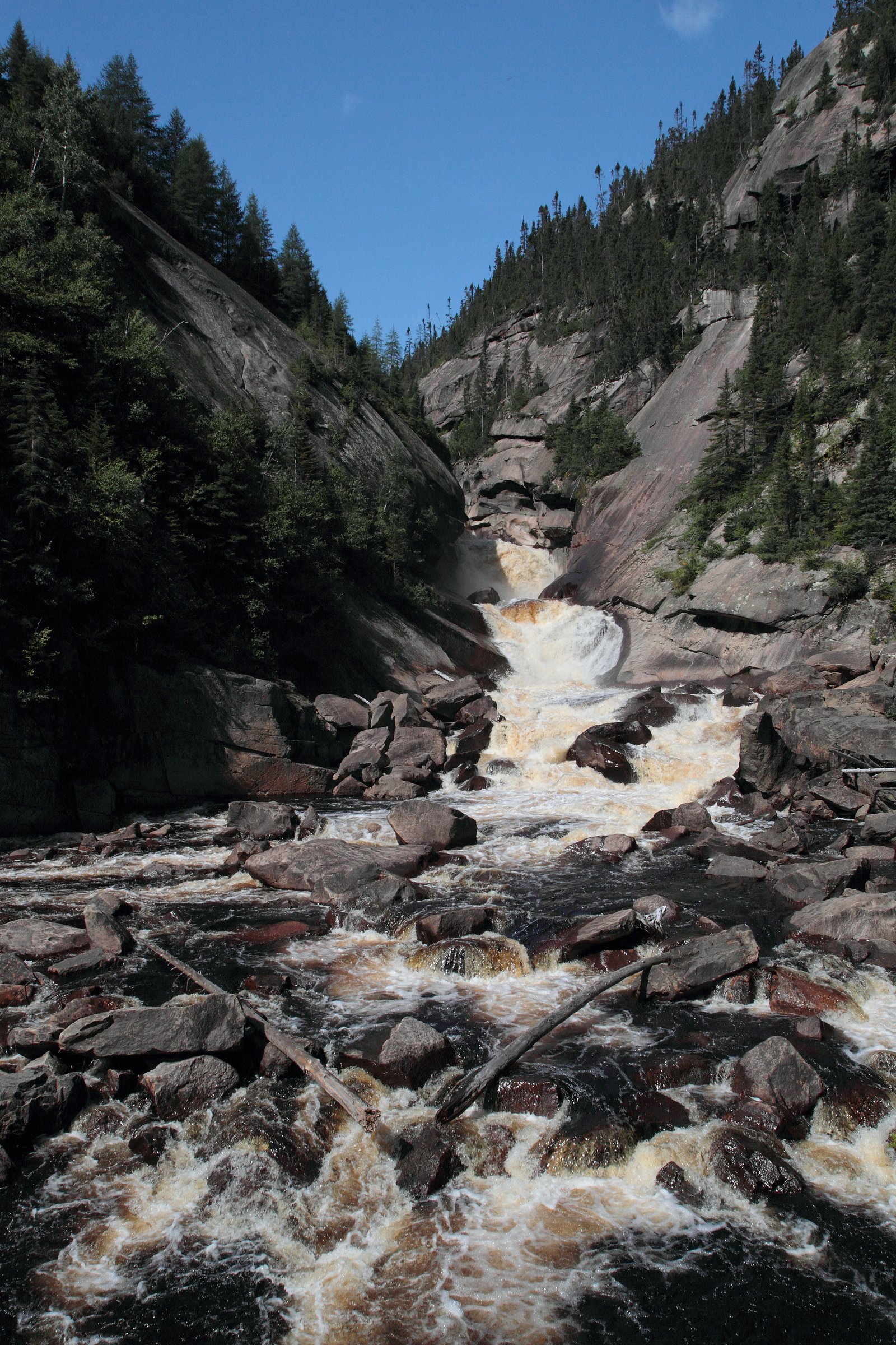
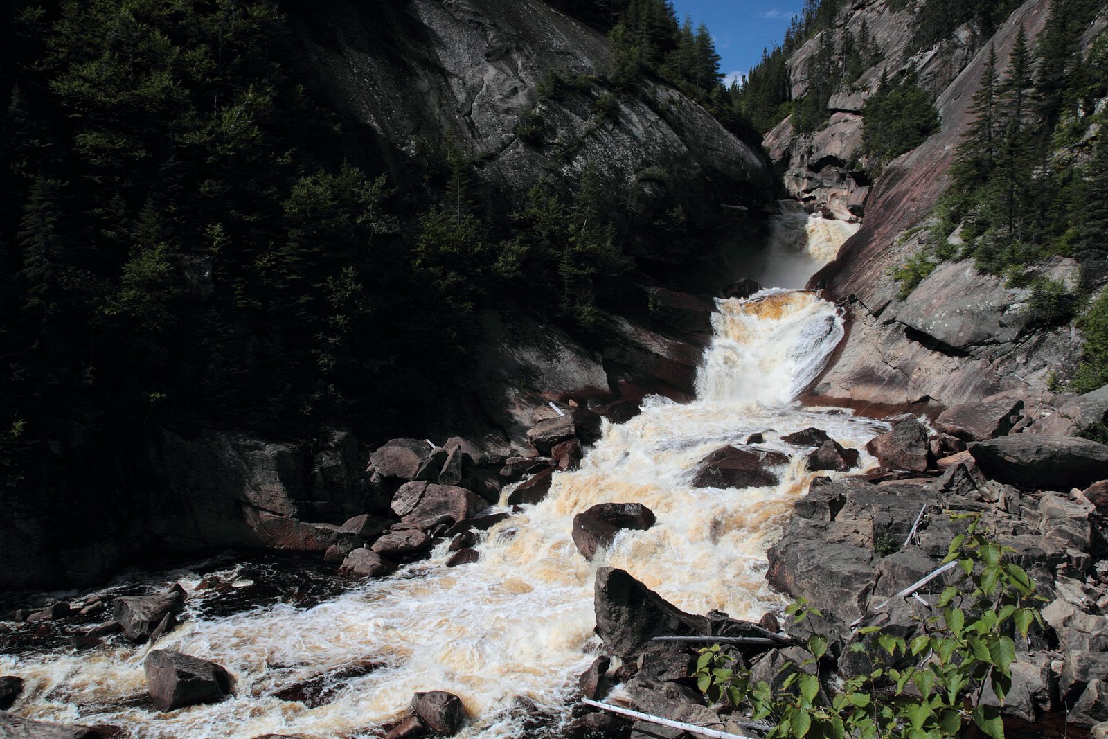
About Chute MacDonald
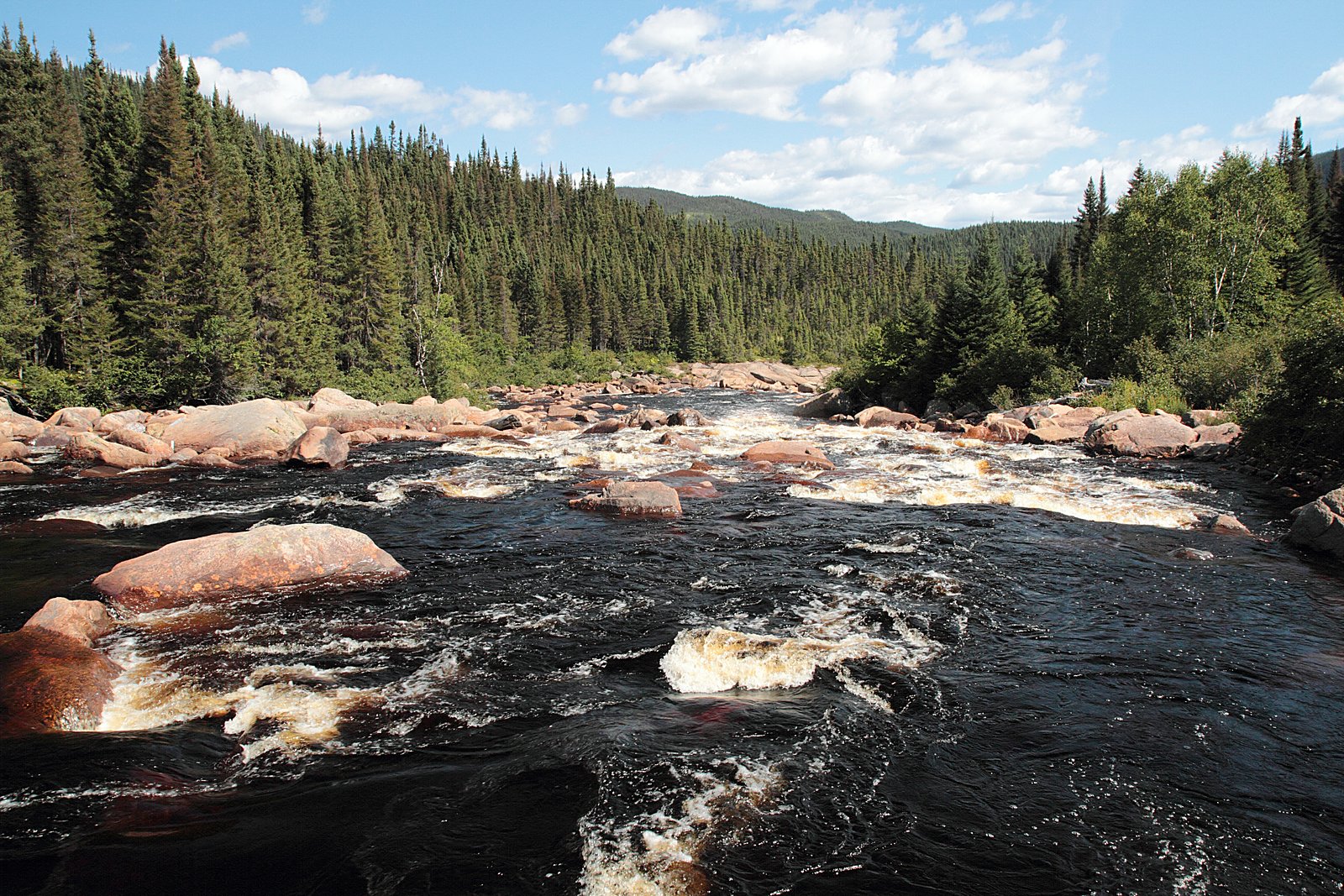
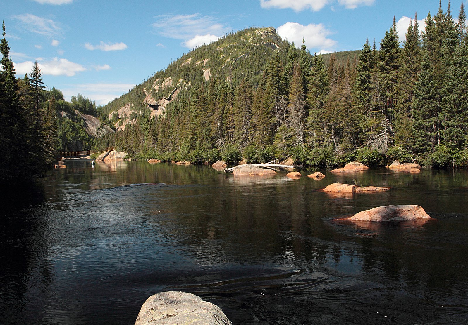
Chute MacDonald is a remote waterfall on the Côte‑Nord (north shore) of Quebec, located inland from Sept‑Îles. The waterfall is in boreal forest terrain and is best described as a scenic, natural cascade in a largely undeveloped area. Exact formal infrastructure (boardwalks, railings, visitor centre) appears to be minimal or absent; access is likely by forest/secondary roads and short, informal trails. Flow varies seasonally and is typically highest in spring during snowmelt and after heavy rains. Details such as official trailhead coordinates, maintained trails, and interpretive facilities are not well documented and may be limited.
Why This Waterfall Exists
Chute MacDonald flows over hard crystalline rock, primarily gneiss, laid down over 1.0-1.6 billion years ago. These resistant rocks form a durable ledge that water cannot easily wear away, creating the falls where softer material downstream has already eroded.
Trail & Hike Details
Trail Description
Documented, maintained trails to Chute MacDonald are not widely published. Visitors generally report short, informal footpaths from a roadside pullout or small clearing down to riverbanks and viewpoints. Trails may be uneven, with roots, rocks, and muddy sections; some scrambling on steep or loose ground near the falls may be required. Because official trailhead signage and wayfinding appear limited, navigation with GPS coordinates or a local map is recommended.
What to Expect
Expect a remote, natural setting in boreal forest. There are likely no facilities (no toilets, no visitor centre, no trash service). The waterfall's flow is seasonal and strongest in spring; summer and early fall often provide the easiest hiking conditions. Mosquitoes and black flies can be abundant in late spring and early summer. Rocks around the falls are slippery; water is cold year‑round. Wildlife in the area may include moose, black bear, beaver, and a variety of birds.
Accessibility
The trail is short and relatively flat, but the surface may be uneven. Contact the managing agency for accessibility details.
Frequently Asked Questions
🐶 Are Dogs Allowed at Chute MacDonald?
❌ Dogs are not allowed
Are There Any Fees or Permits Required?
🆖 No fees required
🏊 Is There Swimming at Chute MacDonald?
❌ Swimming is not allowed
When to Visit
Late spring (May–June) for highest flows from snowmelt; summer (July–August) for easier access and warmer weather; early fall (September–October) for fall colors. Winter can offer frozen scenes but requires winter travel skills and equipment and carries additional hazards (ice, deep snow, limited access).
Seasonal Access
The best time to visit is Spring, Summer, and Fall. Winter access may be limited. Check with the managing park or local authority for current conditions.
Safety Information
Chute MacDonald is in a remote area. Hazards include slippery rocks, unstable banks, fast currents, cold water, steep drops, and limited or no cell service. There may be seasonal logging or forestry activity; obey signage and keep clear of equipment. Insect pests (mosquitoes, black flies) can be significant in warm months. Winter travel brings additional hazards: deep snow, ice, and possible closure of forest roads. Always plan for self-reliance, carry emergency supplies, and avoid approaching edges or standing on wet rocks.
7-Day Flow Outlook
Based on the WSC gauge RIVERIN (RIVIERE) A ENVIRON 6.3 KM DE L'EMBOUCHURE (40 km away).
Best time of year: this gauge typically runs highest from mid April to mid June, peaking in May.
How we calculate this
This is a transparent outlook, not a precise forecast. We take the waterfall's current flow strength (how it ranks against its historical normal for today, from the nearest WSC stream gauge), carry that ranking forward along the gauge's seasonal curve, and nudge it for forecast rain. Confidence is highest for the next day or two and falls further out. Always check official conditions and your own judgment before visiting — high flows can be dangerous.
Know when to go.
Get a free email alert when waterfalls near Sept-Îles hit peak flow. We only send when conditions are worth the trip — no weekly newsletters, no spam.
Weather Forecast
Location & Access
Getting There
Chute MacDonald is in the Côte‑Nord region near the coordinates 50.1722, -67.2726 and is roughly 30–45 miles (driving distance will vary) from Sept‑Îles depending on route. Access typically requires driving on regional/forest roads off the main highway network; a high-clearance or 4x4 vehicle may be helpful for final approach. Cell service may be intermittent. Visitors should plan for a remote access experience and confirm local road conditions before travel.
Get Directions on Google MapsParking
There is likely no formal parking lot or staffed parking. Expect informal pullouts or small cleared areas near the trailhead or road access point. Park well off the road and avoid blocking gates or forestry operations. If unsure, plan to park where it is safe and visible from the road.
Elevation
214 metres above sea level
Coordinates
50.172230° N, -67.272608° W
Visitor Tips & Gear
1) Tell someone your plan and expected return time; cell coverage may be patchy. 2) Wear sturdy, waterproof footwear and expect uneven, possibly muddy trails. 3) Bring insect repellent in spring/summer and layers for variable weather. 4) Carry out all trash and follow Leave No Trace principles. 5) Check local forestry/municipal sources for road conditions and possible logging activity before heading out. 6) Avoid getting too close to cliff edges or fast water, rocks are often slippery and unstable.
Where to Stay
Browse vacation cabins and private rentals nearby
Unique outdoor stays — tents, yurts, and treehouses
Rent a campervan or RV for your waterfall road trip
Some links are affiliate links. We may earn a commission at no extra cost to you.
Nearby Campground
Camping Lac Walker
10.5 km away
Additional Information
Nearby Attractions
The general Sept‑Îles/Côte‑Nord region offers coastal scenery, river landscapes, and other remote natural sites. Specific nearby attractions are not well documented for this exact waterfall location; visitors often combine visits with other regional outdoor activities when traveling from Sept‑Îles.
Wildlife
Typical boreal wildlife: moose, black bear, beaver, fox, hares, and a variety of songbirds and waterfowl. Insect season (mosquitoes, black flies) can be intense in late spring/early summer.
Cities near Chute MacDonald
Writing about Chute MacDonald? Embed this waterfall on your site for free.