Photo Credits (5)
Difficulty
Easy
Trail Length
1.1 km
Trail Type
Out And Back
Elevation Gain
54 m
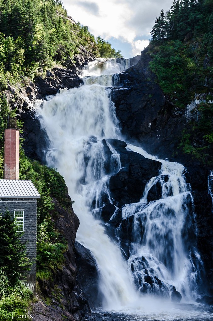
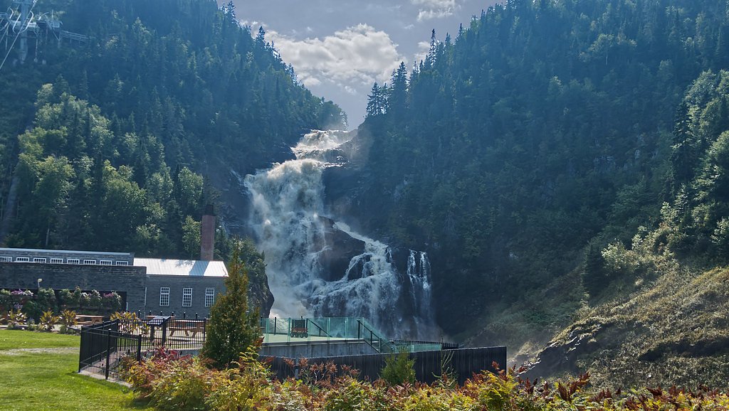
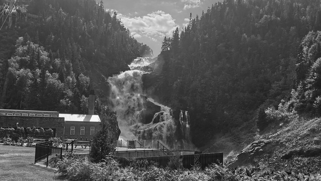
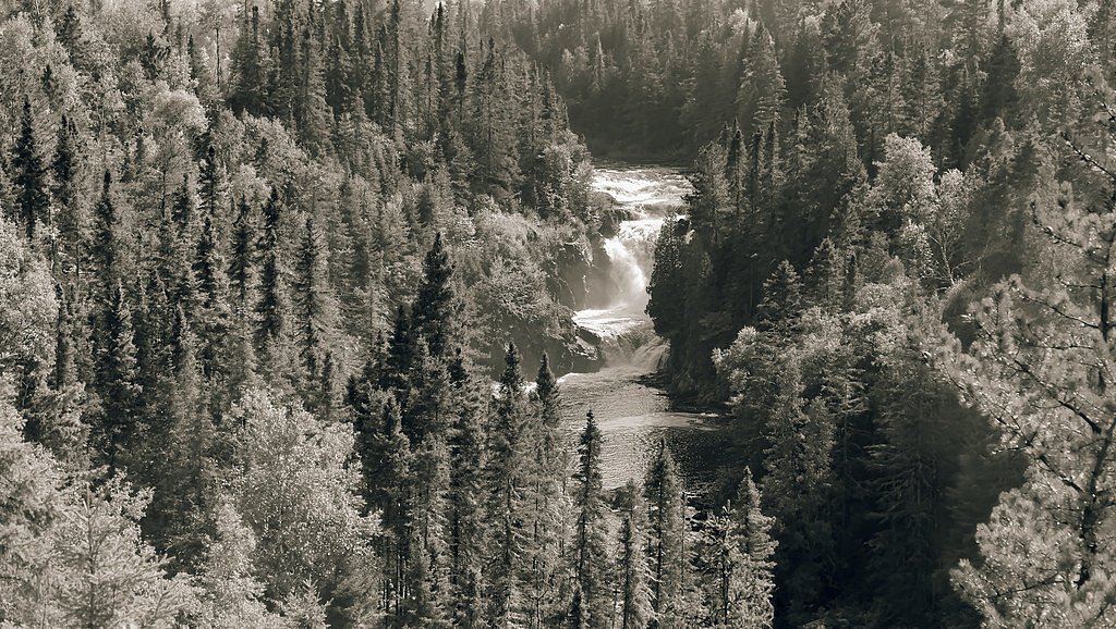
About Chute Jalbert
Chute Jalbert is a coastal waterfall located in the eastern Gulf of St. Lawrence (coordinates 49.1013, -64.6754). The waterfall lies in a remote coastal area of Quebec and is best approached from the Gaspé region or by sea/air access near Port-Menier. Exact published height and formal trail infrastructure are not well documented in widely available sources; expect a natural, undeveloped site with rugged coastal terrain and potentially limited or no signage.
Why This Waterfall Exists
Chute Jalbert flows over layered sedimentary rock laid down about 252-539 million years ago. Over time, the stream has worn through these layers at different rates, creating the step that forms the waterfall.
Trail & Hike Details
The Approach
The easy 1.1-km out-and-back trail gains 54 metres of elevation on the way to the falls.
Trail Description
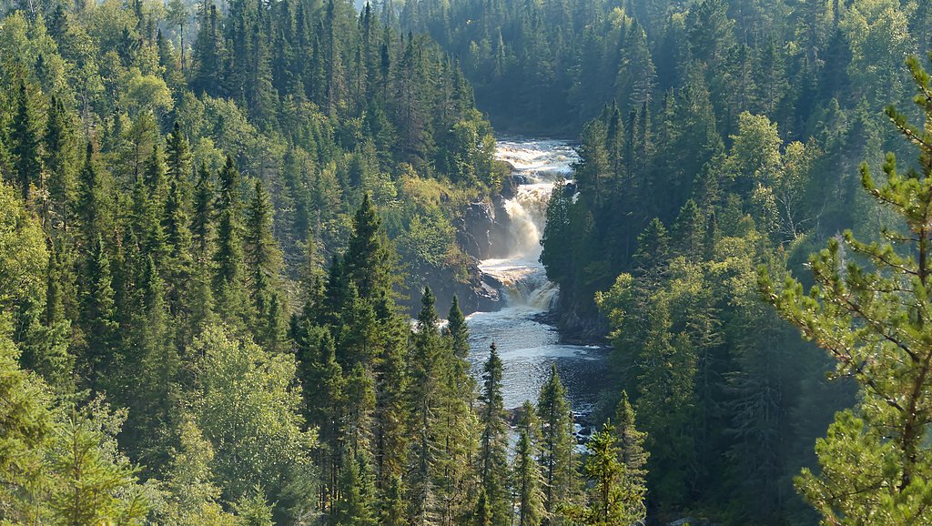
There is no widely published maintained trail to Chute Jalbert in mainstream hiking guides. Approaches reported for similar remote coastal falls typically involve beach/shore walks, scrambling over rocky terrain, and route-finding through unmaintained paths. Visitors should be prepared for uneven ground, slippery rock, and possible tidal crossings depending on approach. If arriving by boat, landing sites may be exposed and subject to swell and wind.
What to Expect
Expect a remote, natural waterfall in a rugged coastal setting. Flow will be seasonal, often highest in spring runoff. Surrounding terrain is likely rocky shoreline, coastal scrub or boreal forest in places, with limited or no facilities (no toilets, trash service, or formal viewpoints). Cell service may be intermittent or absent. Seasonal insects (black flies, mosquitoes) can be heavy in spring/early summer. Weather can change quickly; fog and strong winds are possible near the shore.
Accessibility
The trail is short and relatively flat, but the surface may be uneven. Contact the managing agency for accessibility details.
Frequently Asked Questions
🐶 Are Dogs Allowed at Chute Jalbert?
❌ Dogs are not allowed
Are There Any Fees or Permits Required?
🆖 No fees required
🏊 Is There Swimming at Chute Jalbert?
❌ Swimming is not allowed
When to Visit
Late spring for the fullest flow (snowmelt) and early summer for easier access and milder weather. Fall can offer quieter conditions and good visibility, but weather may be cooler and more changeable. Winter access may be impossible or hazardous due to sea ice, snow, and extreme cold.
Seasonal Access
The best time to visit is Spring, Summer, and Fall. Winter access may be limited. Check with the managing park or local authority for current conditions.
Safety Information
Hazards include slippery and unstable rock, steep/unstable cliff edges, changing tides and sea conditions if approaching by water, rapidly changing weather, limited cell service, and biting insects in warm months. Use conservative judgement, travel with companions, and carry appropriate safety gear. Emergency response may be slow due to remoteness.
7-Day Flow Outlook
Based on the WSC gauge DARTMOUTH (RIVIERE) EN AMONT DU RUISSEAU DU PAS DE DAME (14 km away).
Best time of year: this gauge typically runs highest from mid April to late June, peaking in May.
How we calculate this
This is a transparent outlook, not a precise forecast. We take the waterfall's current flow strength (how it ranks against its historical normal for today, from the nearest WSC stream gauge), carry that ranking forward along the gauge's seasonal curve, and nudge it for forecast rain. Confidence is highest for the next day or two and falls further out. Always check official conditions and your own judgment before visiting — high flows can be dangerous.
Know when to go.
Get a free email alert when waterfalls near Gaspé hit peak flow. We only send when conditions are worth the trip — no weekly newsletters, no spam.
Weather Forecast
Location & Access
Getting There
The waterfall is in a remote coastal location. Typical approaches will be by boat from the Gaspé area or by private/charter flight to landing points in the region (Port-Menier is the nearest named settlement at roughly the distance you provided). There may be no maintained road access, and local tides/sea conditions can affect approach. Expect route-finding and possible use of small craft, ATVs, or hiking along undeveloped shorelines depending on exact landing point.
Get Directions on Google MapsElevation
206 metres above sea level
Coordinates
49.101284° N, -64.675361° W
Visitor Tips & Gear
• Check marine and weather forecasts before attempting any boat approach. • Tell someone your plan and expected return time; travel with a partner when possible. • Wear sturdy, waterproof footwear with good grip for slippery coastal rock. • Bring navigation tools (map, GPS with given coordinates) and a compass; do not rely solely on cell coverage. • Bring insect repellent and layered clothing for wind/cold. • Avoid cliff edges and wet rock near the waterfall; currents and undertows can be dangerous if accessing from the water. • Pack out all trash; there may be no services or waste disposal.
As an Amazon Associate, we earn from qualifying purchases.
For this easy 1.1 km trail, lightweight trail shoes and a water bottle are usually sufficient. Sun exposure on the trail makes good sun protection a must in summer.

Polarized Sunglasses (Knockaround)
Cuts glare off the water so you actually see the falls — and your photos turn out better too.

Columbia Watertight II Rain Jacket
Packs into its own pocket, seam-sealed, and keeps you dry from spray and surprise rain.

Earth Pak Waterproof Dry Bag
Keeps your phone and gear dry when waterfall mist soaks everything else.

Waterproof Phone Pouch (AiRunTech)
Cheap insurance — take photos right next to the falls without killing your phone.

JOBY GorillaPod Starter Kit
Wraps around railings and rocks for long-exposure waterfall shots — no flat surface needed.

Osprey Daylite Daypack
Light, organized, and just the right size for a day hike — fits water, snacks, and layers.
Where to Stay
Browse vacation cabins and private rentals nearby
Unique outdoor stays — tents, yurts, and treehouses
Rent a campervan or RV for your waterfall road trip
Some links are affiliate links. We may earn a commission at no extra cost to you.
Nearby Campground
Camping de la Chute
0.1 km away
Additional Information
Nearby Attractions
The broader region includes the Gaspé Peninsula with attractions such as Forillon National Park and the coastal landscapes of eastern Quebec. If this feature is on or near Anticosti Island, the island is noted for coastal cliffs, seabird colonies, and large white-tailed deer populations (visitor logistics to Anticosti are more complex).
Wildlife
Expect typical Gulf of St. Lawrence coastal and marine wildlife: seabirds, shorebirds, marine mammals offshore (seals, possibly whales in season), and terrestrial species depending on the island/mainland location (Anticosti Island notably has abundant white‑tailed deer). Be cautious around wildlife and do not feed animals.
Cities near Chute Jalbert
Writing about Chute Jalbert? Embed this waterfall on your site for free.