Photo Credits (4)
Difficulty
Easy
Trail Length
1.0 km
Trail Type
Out And Back
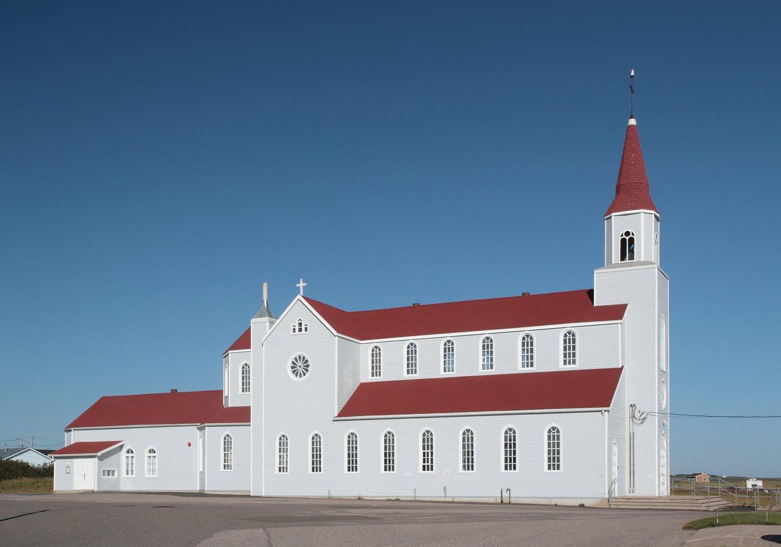
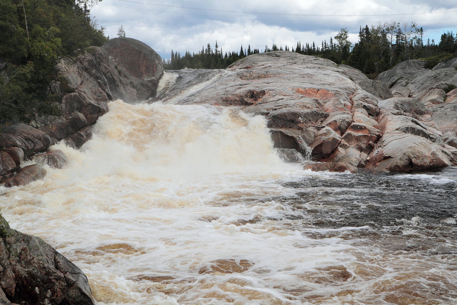
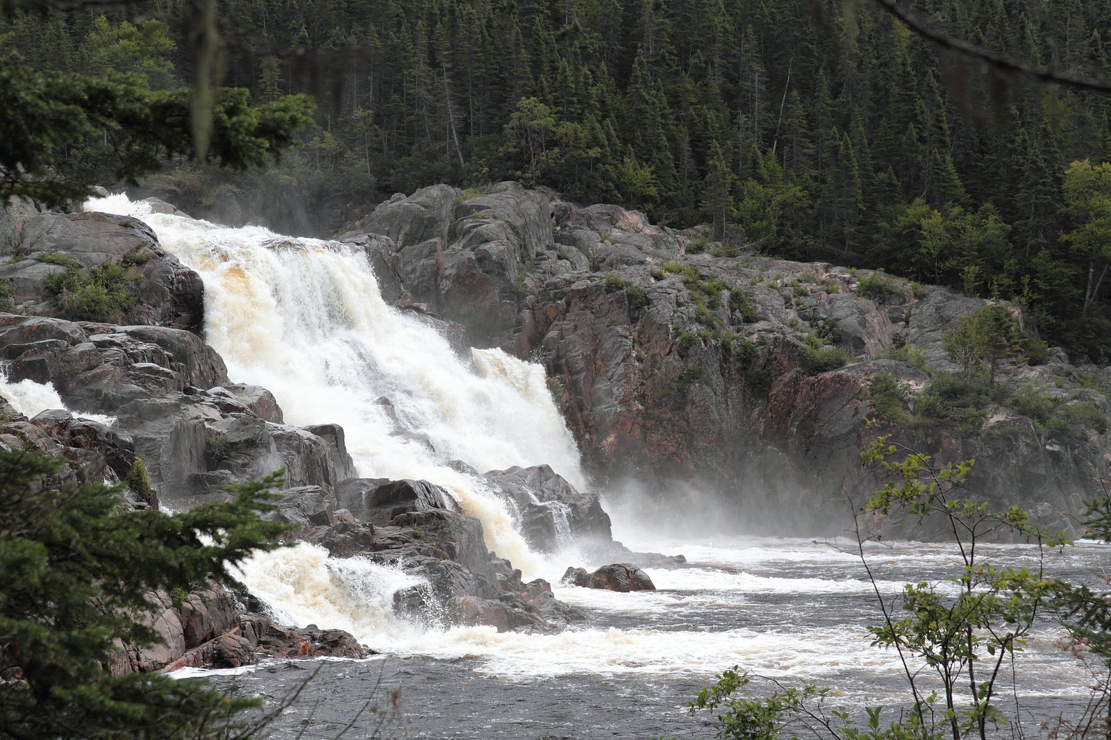
About Chute du Petit-Sault
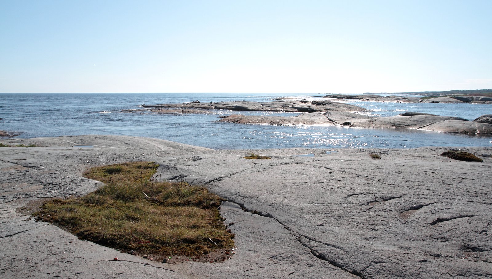
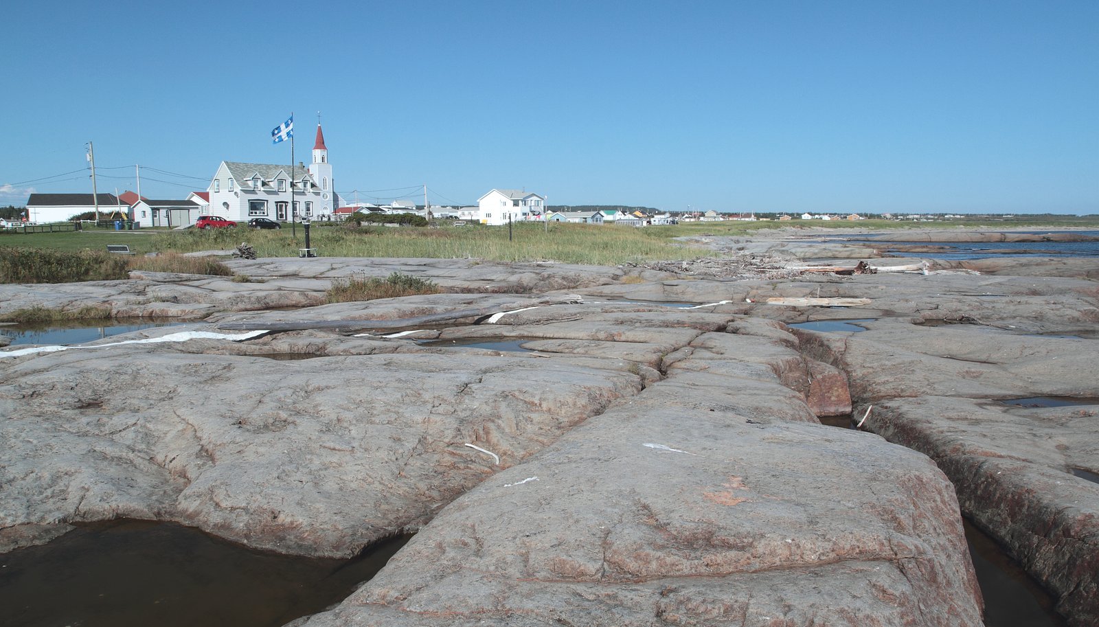
Chute du Petit-Sault is a remote coastal waterfall in eastern Quebec (coordinates: 50.2793, -64.7834). The site appears to be in a sparsely developed area between the communities of Mingan and Port‑Menier and is likely a small to medium cascade or series of drops on a stream reaching the shoreline. Visitor infrastructure does not appear to be developed, so access is typically informal and may require hiking, beach travel, or boat access depending on local terrain and tides. Exact height and formal measurements are not confirmed.
Why This Waterfall Exists
Chute du Petit-Sault flows over hard crystalline rock, primarily charnockite, laid down over 1.0-1.6 billion years ago. These resistant rocks form a durable ledge that water cannot easily wear away, creating the falls where softer material downstream has already eroded.
Trail & Hike Details
Trail Description
There is no widely published, maintained trail description available for Chute du Petit‑Sault. Based on its remote coastal location, any approach may involve unmarked routes, beach walking, forest travel, or rough ATV tracks. Route‑finding skills are likely necessary. Expect uneven, rocky, and potentially muddy terrain near the stream and shoreline.
What to Expect
Remote natural setting with limited or no visitor facilities. The waterfall may be a cascade over bedrock into a coastal inlet or stream channel. Water flow will vary seasonally (higher in spring runoff; lower in late summer/fall). Expect slippery rocks, wet ground near the fall, insects (blackflies/mosquitoes) in warm months, and variable weather. Cell coverage is likely unreliable in some areas.
Accessibility
The trail is short and relatively flat, but the surface may be uneven. Contact the managing agency for accessibility details.
Frequently Asked Questions
🐶 Are Dogs Allowed at Chute du Petit-Sault?
❌ Dogs are not allowed
Are There Any Fees or Permits Required?
🆖 No fees required
🏊 Is There Swimming at Chute du Petit-Sault?
❌ Swimming is not allowed
When to Visit
Spring for higher flows and dramatic water; late spring to early fall for milder weather and easier access. Fall can offer colorful scenery. Winter may present a scenic frozen waterfall but access can be hazardous and is often more difficult.
Seasonal Access
The best time to visit is Spring, Summer, Fall, and Winter. Check with the managing park or local authority for current conditions.
Safety Information
Hazards may include slippery rocks, steep or unstable banks, strong currents near outlets or tidal influence, rapidly changing weather, cold water temperatures, insects, and limited cell coverage. Wildlife encounters are possible. Travel with a partner when possible, tell someone your plans, carry navigation and emergency gear, and check local conditions before visiting. For coastal approaches, be aware of tides and sea conditions.
7-Day Flow Outlook
Based on the WSC gauge MAGPIE (RIVIERE) A LA SORTIE DU LAC MAGPIE (47 km away).
Best time of year: this gauge typically runs highest from early May to late July, peaking in May.
How we calculate this
This is a transparent outlook, not a precise forecast. We take the waterfall's current flow strength (how it ranks against its historical normal for today, from the nearest WSC stream gauge), carry that ranking forward along the gauge's seasonal curve, and nudge it for forecast rain. Confidence is highest for the next day or two and falls further out. Always check official conditions and your own judgment before visiting — high flows can be dangerous.
Know when to go.
Get a free email alert when waterfalls near Mingan hit peak flow. We only send when conditions are worth the trip — no weekly newsletters, no spam.
Weather Forecast
Location & Access
Getting There
The waterfall is in a remote coastal area of eastern Quebec near Mingan (~33.5 miles) and Port‑Menier (~40.9 miles). Access is likely by a combination of driving on local roads, then hiking or using a boat/ATV for the final approach depending on local conditions. Expect limited signage. Confirm routing and access locally before travel.
Get Directions on Google MapsParking
No formal developed parking is known. If you reach the area by vehicle, parking is likely informal or roadside; if coming by boat there are no developed docks. Visitors should plan for limited or no facilities.
Elevation
15 metres above sea level
Coordinates
50.279313° N, -64.783408° W
Visitor Tips & Gear
1) Plan for a self‑supported visit: bring food, water, navigation (map/GPS), and emergency supplies. 2) Wear sturdy waterproof footwear and traction for slippery rocks. 3) Check local authorities or community offices in Mingan or Port‑Menier for up‑to‑date access and safety info before traveling. 4) Be prepared for limited or no signage and bring route‑finding tools. 5) Practice Leave No Trace. 6) Be cautious near cliff edges, fast water, and tidal zones if the fall reaches the shore. 7) Expect insects in spring and summer; bring repellant and long sleeves.
Where to Stay
Browse vacation cabins and private rentals nearby
Unique outdoor stays — tents, yurts, and treehouses
Rent a campervan or RV for your waterfall road trip
Some links are affiliate links. We may earn a commission at no extra cost to you.
Additional Information
Nearby Attractions
The region around the given coordinates is characterized by coastal landscapes and remote natural areas. Nearby communities (Mingan and Port‑Menier) are points to check for local services and possible additional attractions such as coastal scenery, wildlife viewing, and local trails, confirm distances and access locally.
Wildlife
Expect coastal and forest wildlife typical of eastern Quebec: seabirds, shorebirds, marine mammals offshore (seals), and insects such as blackflies and mosquitoes in warm months. Remote areas may also host deer and other larger mammals; always keep a safe distance.
Cities near Chute du Petit-Sault
Nearby Waterfalls
Writing about Chute du Petit-Sault? Embed this waterfall on your site for free.