Photo Credits (5)
About Chute du Calcaire
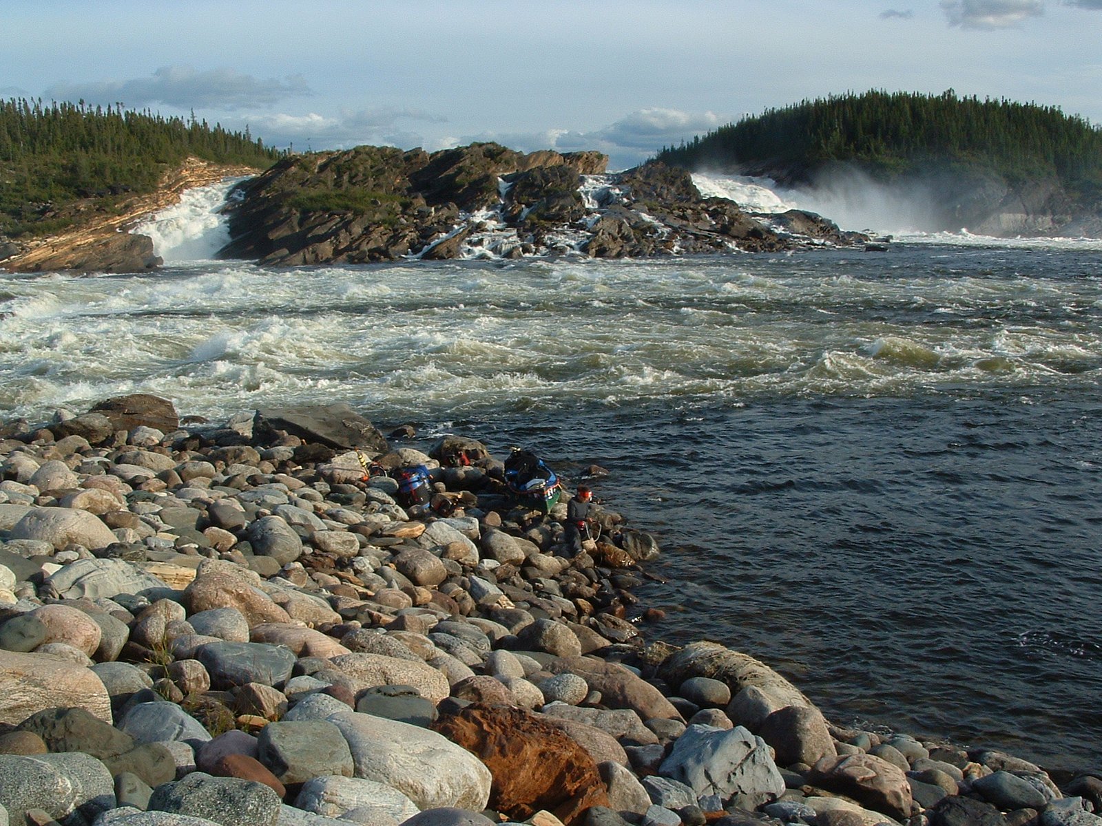
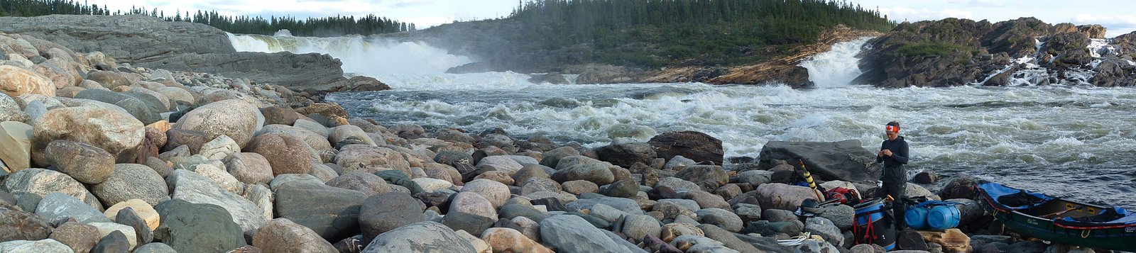
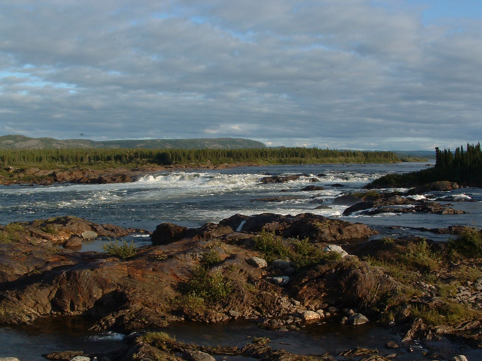
Chute du Calcaire is a remote waterfall in northern Quebec (coordinates 57.4796, -69.3123). It appears to be located in a sparsely developed boreal/tundra transition zone and is likely reached only by travel over rough terrain, watercraft, floatplane, or long backcountry travel. Published, maintained trails and visitor facilities do not appear to be present at the site; details about official viewpoints, infrastructure, or measured height are not readily verifiable. Water flow is likely seasonal, with peak flows during spring melt. Visitors should assume limited or no services and minimal signage.
The Setting
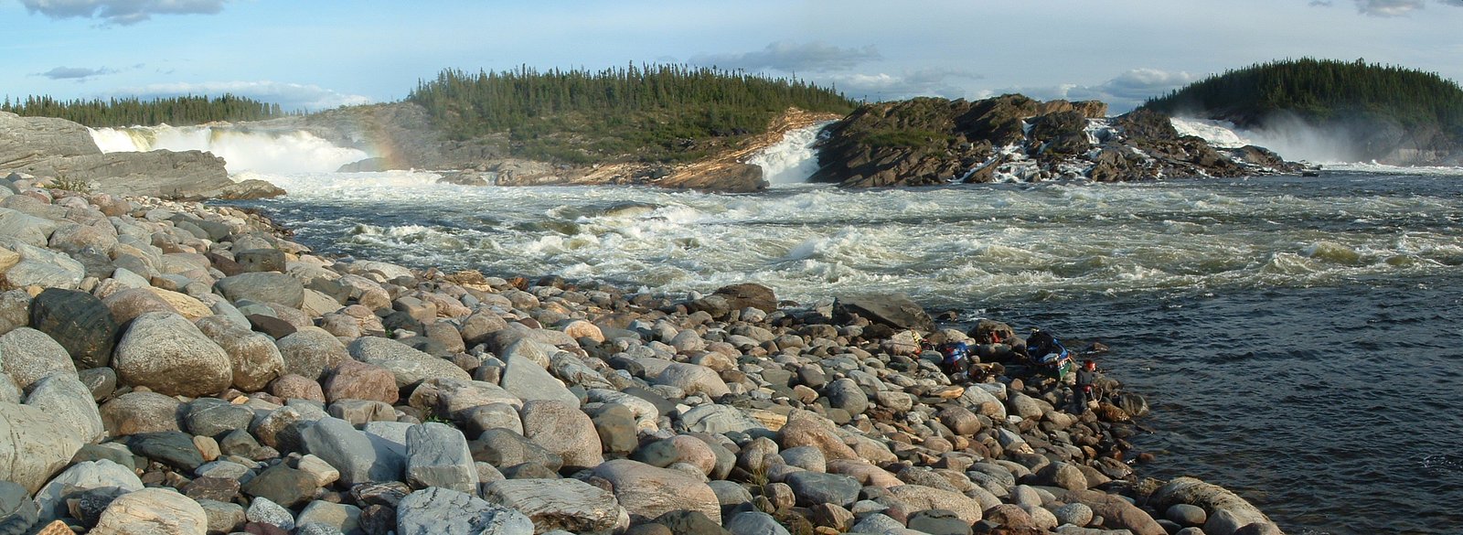
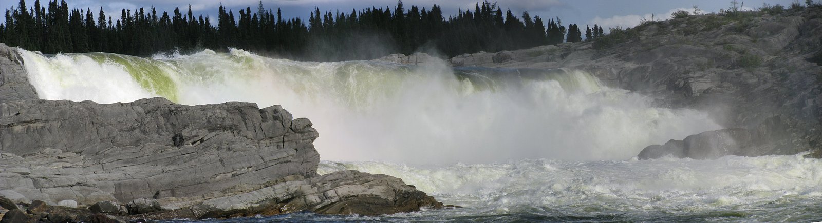
Chute du Calcaire sits at 34 metres in the coastal lowlands of Quebec. The falls drop 22 metres.
Why This Waterfall Exists
Chute du Calcaire flows over Knob Lake Group, a hard metamorphic rock layer deposited over 1.6-2.5 billion years ago. The softer shale erodes faster than the resistant marble and quartzite, creating a 72-foot drop where water plunges over the remaining ledge.
Trail & Hike Details
Trail Description
There is no widely documented maintained trail to Chute du Calcaire. Approaches are likely unmarked and involve cross-country travel, river navigation, or aircraft-assisted access. Expect bushwhacking, riverbanks, and uneven terrain rather than a developed footpath. Trails (if any) are likely used by local outfitters or experienced backcountry travelers rather than casual day-hikers.
What to Expect
The falls drop 22 metres over cemented sandstone.
Accessibility
Not accessible for visitors with limited mobility. No known developed paths, boardwalks, or viewing platforms. Expect uneven, rocky, and potentially steep approaches.
Frequently Asked Questions
🐶 Are Dogs Allowed at Chute du Calcaire?
❌ Dogs are not allowed
Are There Any Fees or Permits Required?
🆖 No fees required
🏊 Is There Swimming at Chute du Calcaire?
❌ Swimming is not allowed
When to Visit
Late spring (during snowmelt) for highest water flow, and mid-to-late summer for more stable weather and easier access. Fall may offer good colors and fewer bugs but colder conditions. Winter access is possible in theory (snowmobile/ski) but is more hazardous and requires advanced experience and equipment.
Seasonal Access
The best time to visit is Spring, Summer, Fall, and Winter. Check with the managing park or local authority for current conditions.
Safety Information
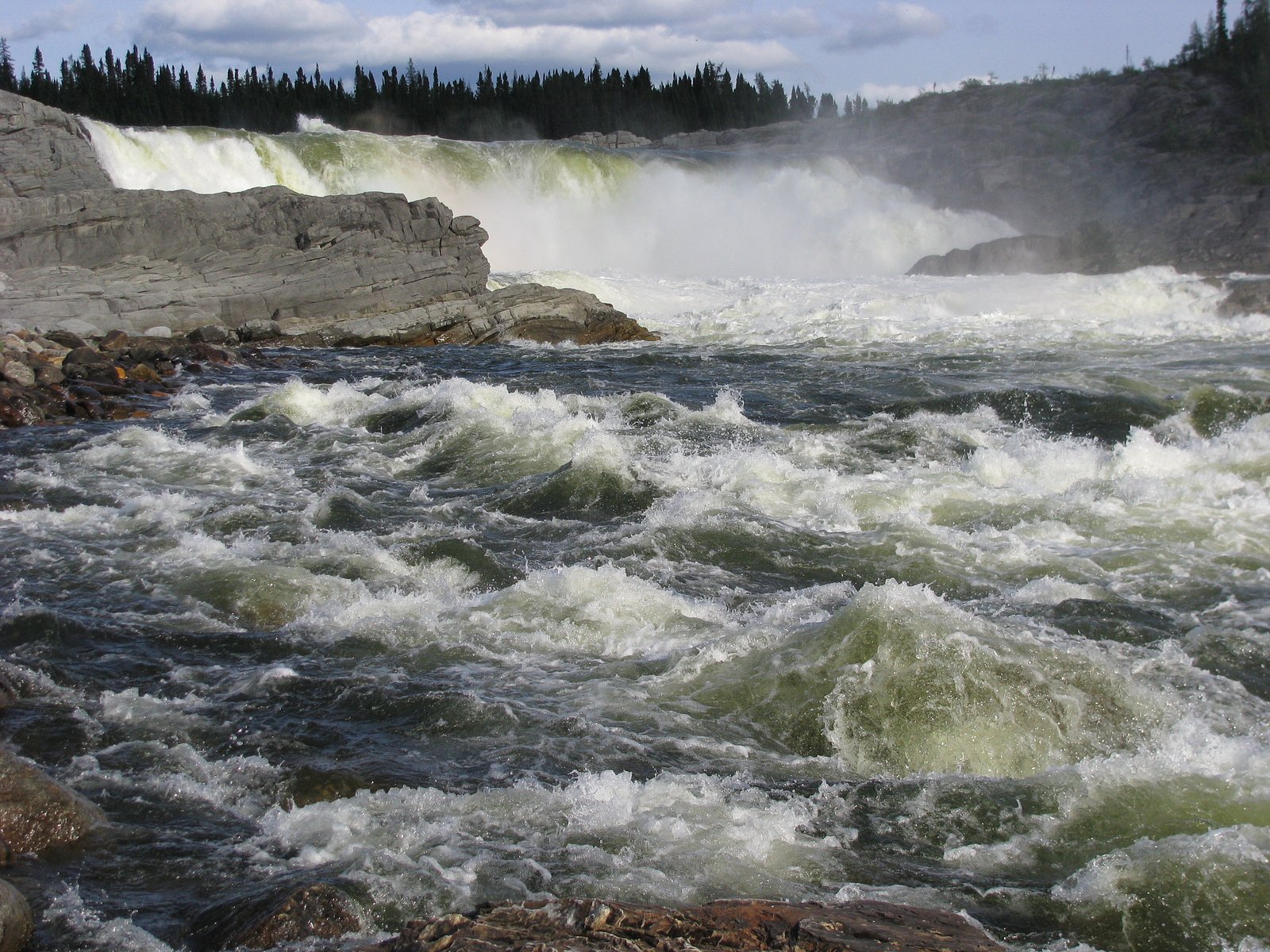
This is a remote wilderness site, prepare accordingly. Hazards include: remote location with limited or no cell coverage, slippery rocks and unstable cliff edges near the falls, strong currents or cold water temperatures, rapidly changing weather, deep mud or boggy terrain, insect harassment, and potential encounters with large wildlife. Carry emergency communications and navigation devices, travel with a partner, and allow extra time for delays. If unsure about access or conditions, consider hiring an experienced local guide or contacting regional authorities before traveling.
7-Day Flow Outlook
Based on the WSC gauge CANIAPISCAU (RIVIERE) A 1,0 KM EN AMONT DE LA CHUTE DE LA PYRITE (8 km away).
Best time of year: this gauge typically runs highest from mid May to early August, peaking in June.
How we calculate this
This is a transparent outlook, not a precise forecast. We take the waterfall's current flow strength (how it ranks against its historical normal for today, from the nearest WSC stream gauge), carry that ranking forward along the gauge's seasonal curve, and nudge it for forecast rain. Confidence is highest for the next day or two and falls further out. Always check official conditions and your own judgment before visiting — high flows can be dangerous.
Weather Forecast
Location & Access
Getting There
The waterfall is in a remote area of northern Quebec. Access will likely require chartered floatplane, helicopter, canoe/kayak along connected rivers, or long backcountry travel. There is unlikely to be regular road access or public transit to the immediate area. Expect little to no cell coverage; plan navigation with GPS and offline maps.
Get Directions on Google MapsParking
No formal parking or developed trailhead is known. Any parking would be remote and informal at the nearest drivable access point many miles away (if road access exists).
Elevation
34 metres above sea level
Coordinates
57.479641° N, -69.312279° W
Visitor Tips & Gear
• Plan for a self-supported backcountry trip: pack navigation tools (GPS, map, compass) and emergency communication (satellite messenger or PLB). • Tell someone your detailed route and expected return. • Prepare for insects in spring/summer and for cold conditions outside mid-summer. • Wear sturdy waterproof footwear and use caution on wet, mossy, or icy rocks near the falls. • Do not rely on online directions or signage in this area; hire local guides or outfitters if unfamiliar with remote northern Quebec travel. • Respect local and Indigenous land use; check for access restrictions before travel.
Where to Stay
Browse vacation cabins and private rentals nearby
Unique outdoor stays — tents, yurts, and treehouses
Rent a campervan or RV for your waterfall road trip
Some links are affiliate links. We may earn a commission at no extra cost to you.
Additional Information
Nearby Attractions
The area is primarily remote wilderness; other natural features such as rivers, smaller cascades, and expansive boreal/tundra landscapes may be nearby. Specific named tourist attractions or developed sites are not documented close to the coordinates provided.
Wildlife
Likely species include moose, black bear, wolves, foxes, and a variety of migratory birds. Insect pressure from mosquitoes and blackflies can be high in warm months.
Nearby Waterfalls
Writing about Chute du Calcaire? Embed this waterfall on your site for free.