Photo Credits (1)
Difficulty
Moderate
Trail Length
8.2 km
Trail Type
Out And Back
Elevation Gain
122 m
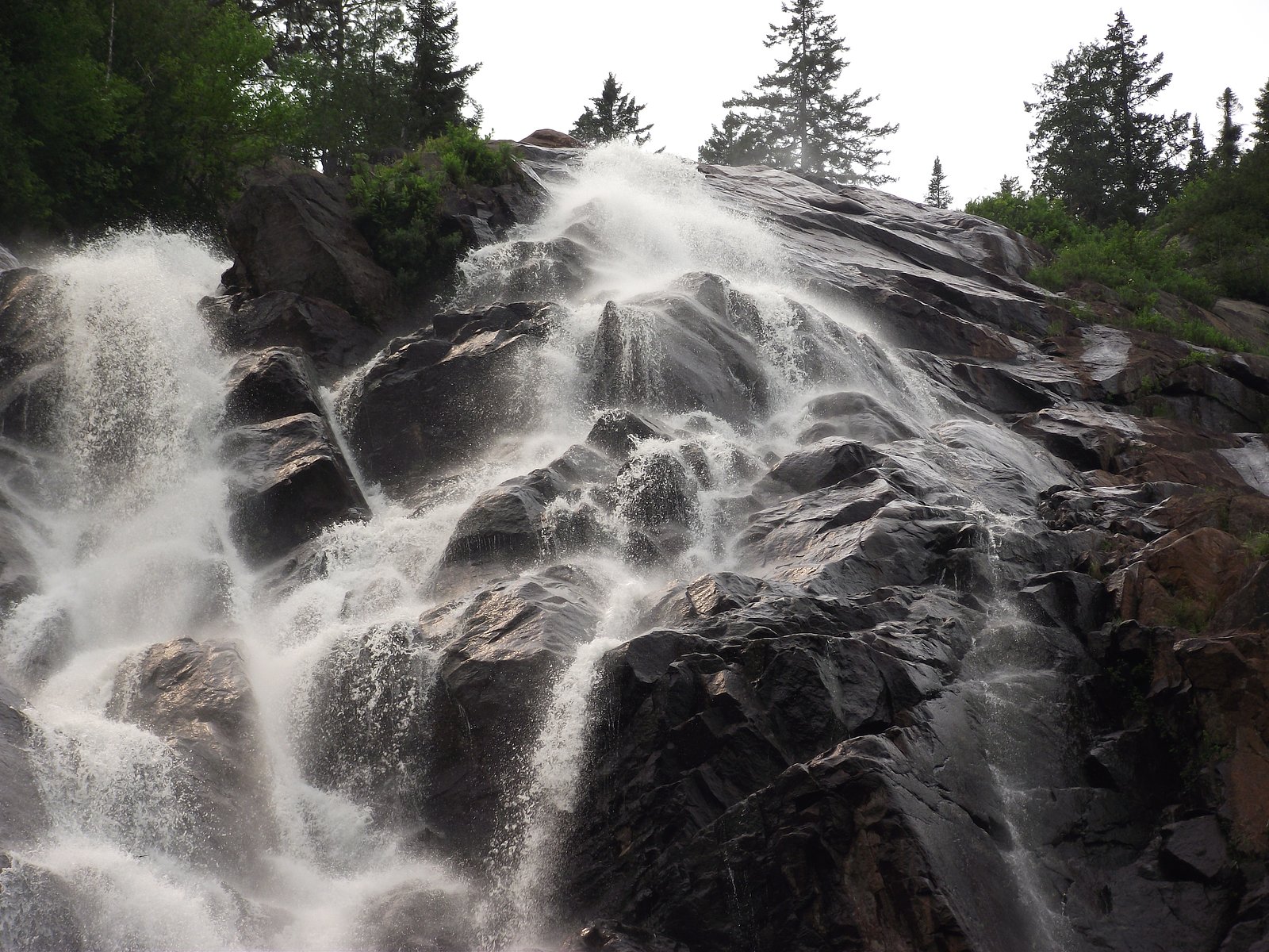
About Chute Delaney
Chute Delaney is a forested, riverine waterfall feature in central Quebec (coordinates 47.0524, -71.8837). It appears as a narrow chute or cascade set in a mixed boreal/temperate forest. Flow volume is likely highest in spring during snowmelt and after heavy rains and lower in late summer. Detailed published information (height, official trailhead name) is limited; the following summarizes typical conditions and access based on regional trail and forestry-road patterns and visitor reports.
Why This Waterfall Exists
Chute Delaney flows over hard crystalline rock, primarily charnockite, laid down over 1.0-1.6 billion years ago. These resistant rocks form a durable ledge that water cannot easily wear away, creating the falls where softer material downstream has already eroded.
Trail & Hike Details
The Approach
The moderate 8.2-km out-and-back trail gains 122 metres of elevation on the way to the falls.
Trail Description
There is limited published trail data for Chute Delaney. Access likely involves a short walk from a roadside parking area or a moderate walk along a forestry track or singletrack through mixed forest. Expect uneven terrain, roots, mud and potentially steep banks near the water. Signage may be minimal or absent; a map, GPS coordinates, and basic route-finding skills are recommended.
What to Expect
A relatively natural, undeveloped waterfall setting with limited visitor infrastructure. Forested approaches, wet/rocky surfaces near the water, and variable water flow depending on season. Likely low visitor numbers compared with major provincial parks, but summer insects (mosquitoes, black flies) and seasonal ticks can be abundant. Cell coverage may be spotty.
Accessibility
The trail is not wheelchair accessible. Uneven terrain and elevation changes require steady footing.
Frequently Asked Questions
🐶 Are Dogs Allowed at Chute Delaney?
❌ Dogs are not allowed
Are There Any Fees or Permits Required?
🆖 No fees required
🏊 Is There Swimming at Chute Delaney?
❌ Swimming is not allowed
When to Visit
Spring (snowmelt and higher flows) for the most impressive water volume; late spring to early fall for easier foot access and milder weather. Fall offers foliage color. Winter access may be possible but can be icy, with gated roads and reduced services, only recommended for well-equipped winter hikers/vehicles.
Seasonal Access
The best time to visit is Spring, Summer, Fall, and Winter. Check with the managing park or local authority for current conditions.
Safety Information
Hazards may include slippery rocks and steep riverbanks, fast or cold water currents, seasonal flooding, unstable banks, limited cell service, biting insects and ticks, and wildlife encounters. Roads may be gated or impassable after heavy rain or during forestry operations. If visiting in winter, expect ice, deep snow, and potential closed roads; travel only with appropriate winter gear and experience. Always tell someone your plans and estimated return time.
7-Day Flow Outlook
Based on the WSC gauge SAINTE-ANNE (RIVIERE) (BRAS DU NORD DE LA) EN AMONT (9 km away).
Best time of year: this gauge typically runs highest from mid April to mid June, peaking in May.
How we calculate this
This is a transparent outlook, not a precise forecast. We take the waterfall's current flow strength (how it ranks against its historical normal for today, from the nearest WSC stream gauge), carry that ranking forward along the gauge's seasonal curve, and nudge it for forecast rain. Confidence is highest for the next day or two and falls further out. Always check official conditions and your own judgment before visiting — high flows can be dangerous.
Know when to go.
Get a free email alert when waterfalls near Québec hit peak flow. We only send when conditions are worth the trip — no weekly newsletters, no spam.
Weather Forecast
Location & Access
Getting There
Chute Delaney is reached from local and secondary roads in the Mauricie/central Quebec forest region. Expect a combination of paved and gravel/forestry roads; some sections may be narrow and seasonally gated. The site is roughly 40–65 miles from major regional centers named by the user. Exact driving directions and the closest official trailhead are not confirmed here, use a recent map/GPS and check local municipal or provincial resources before you go.
Get Directions on Google MapsParking
Parking is likely limited to a small roadside pullout or informal lot near a forestry road or trailhead. Visitors should plan for minimal facilities (no restrooms or formal lot) and park legally off the travel lane. If you find a formal parking area, follow posted signage.
Elevation
345 metres above sea level
Coordinates
47.052393° N, -71.883674° W
Visitor Tips & Gear
• Use the provided coordinates in a reliable GPS or mapping app. • Wear sturdy, waterproof footwear with good traction for slippery rocks. • Expect no facilities, bring water, snacks, and a small trash bag to pack out waste. • Check local forestry road status and seasonal gates before traveling; some roads close for the winter or for logging. • Follow Leave No Trace principles. • Be tick-aware and use repellent; check for ticks after the hike. • If planning to approach cliff edges or the river, exercise caution; wet rocks are slippery.
As an Amazon Associate, we earn from qualifying purchases.
With 8.2 km and 122 m of elevation gain, sturdy boots and trekking poles will help on this moderate trail. Icy conditions are common in winter — traction cleats are a smart addition.

Columbia Watertight II Rain Jacket
Packs into its own pocket, seam-sealed, and keeps you dry from spray and surprise rain.

Polarized Sunglasses (Knockaround)
Cuts glare off the water so you actually see the falls — and your photos turn out better too.

Earth Pak Waterproof Dry Bag
Keeps your phone and gear dry when waterfall mist soaks everything else.

Waterproof Phone Pouch (AiRunTech)
Cheap insurance — take photos right next to the falls without killing your phone.

Timberland Euro Sprint Mid Waterproof
Trusted waterproof boot with premium leather and grippy rubber sole — reliable on rocky, wet trails.

TrailBuddy Trekking Poles
Lightweight aluminum, cork grips, and flip-locks that actually hold — a best-seller for good reason.
Where to Stay
Browse vacation cabins and private rentals nearby
Unique outdoor stays — tents, yurts, and treehouses
Rent a campervan or RV for your waterfall road trip
Some links are affiliate links. We may earn a commission at no extra cost to you.
Nearby Campground
Camping Shannahan
2 km away
Additional Information
Nearby Attractions
Regional forest roads, local rivers and lakes, and provincial attractions in the Mauricie area. Larger, developed destinations such as Mauricie National Park and downtown Trois-Rivières are in the broader region but not adjacent to this specific site. Check local tourism resources for up-to-date nearby attractions.
Wildlife
Typical central-Quebec wildlife: white-tailed deer, moose, black bear, beaver, fox, small mammals, and a variety of forest birds. Practice wildlife safety: store food securely, give animals space, and follow local guidance during bear season.
Cities near Chute Delaney
Nearby Waterfalls
Writing about Chute Delaney? Embed this waterfall on your site for free.