Photo Credits (3)
Difficulty
Easy
Trail Length
1.9 km
Trail Type
Out And Back
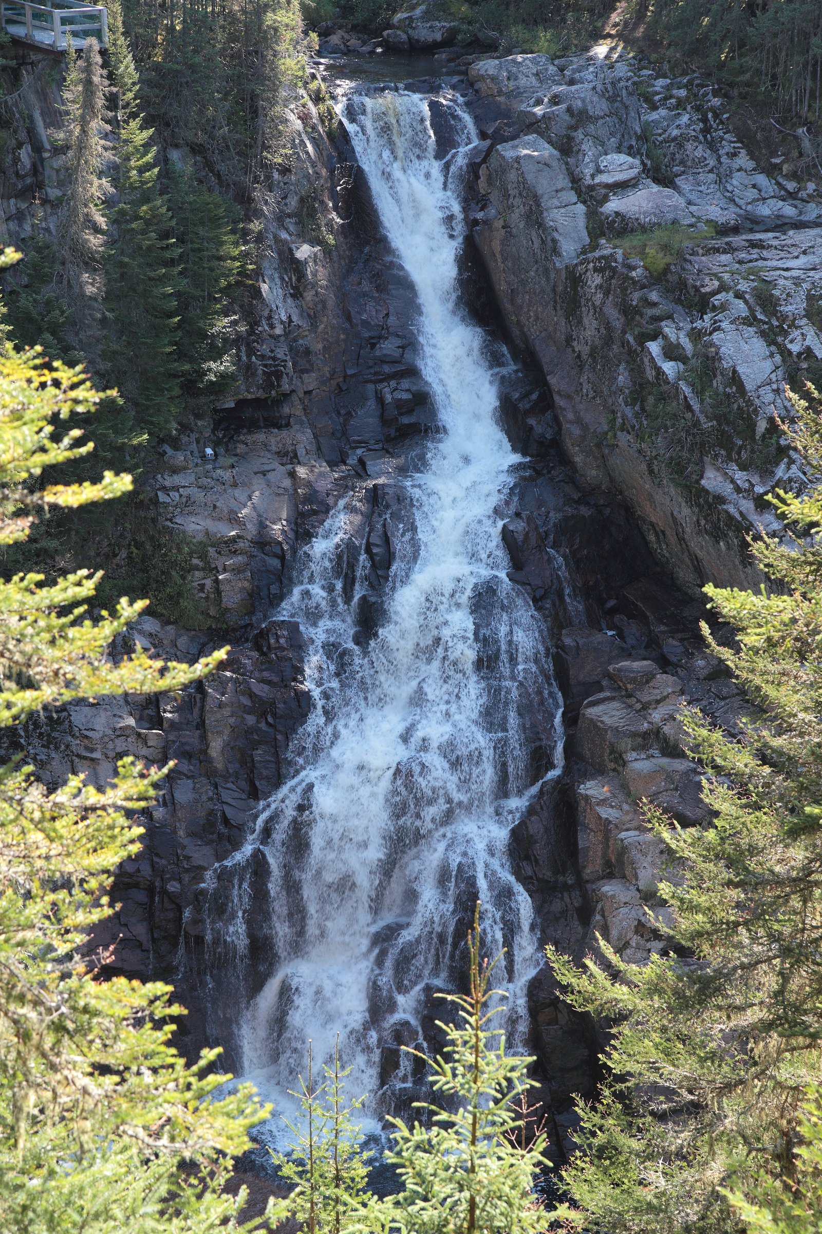
About Chute de la Rivière-Noire
Chute de la Rivière-Noire is a waterfall on the Rivière Noire in the province of Québec, located roughly 32 miles (about 50 km) north of Québec City (coordinates: 47.3267, -71.1019). Reports and regional maps indicate it is a natural cascade in a rural/forest setting. Specifics about the shape and exact drop are inconsistently reported in public sources; visitors typically describe a scenic, wooded site that can have substantially higher flow in spring runoff and lower flow in late summer and winter (when ice forms).
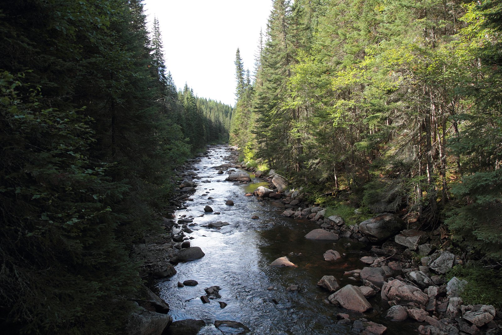
The Setting
Chute de la Rivière-Noire sits at 715 metres within Proposed Forêt-Montmorency Biodiversity Reserve, in the hills of Quebec. The falls drop 28 metres.
Why This Waterfall Exists
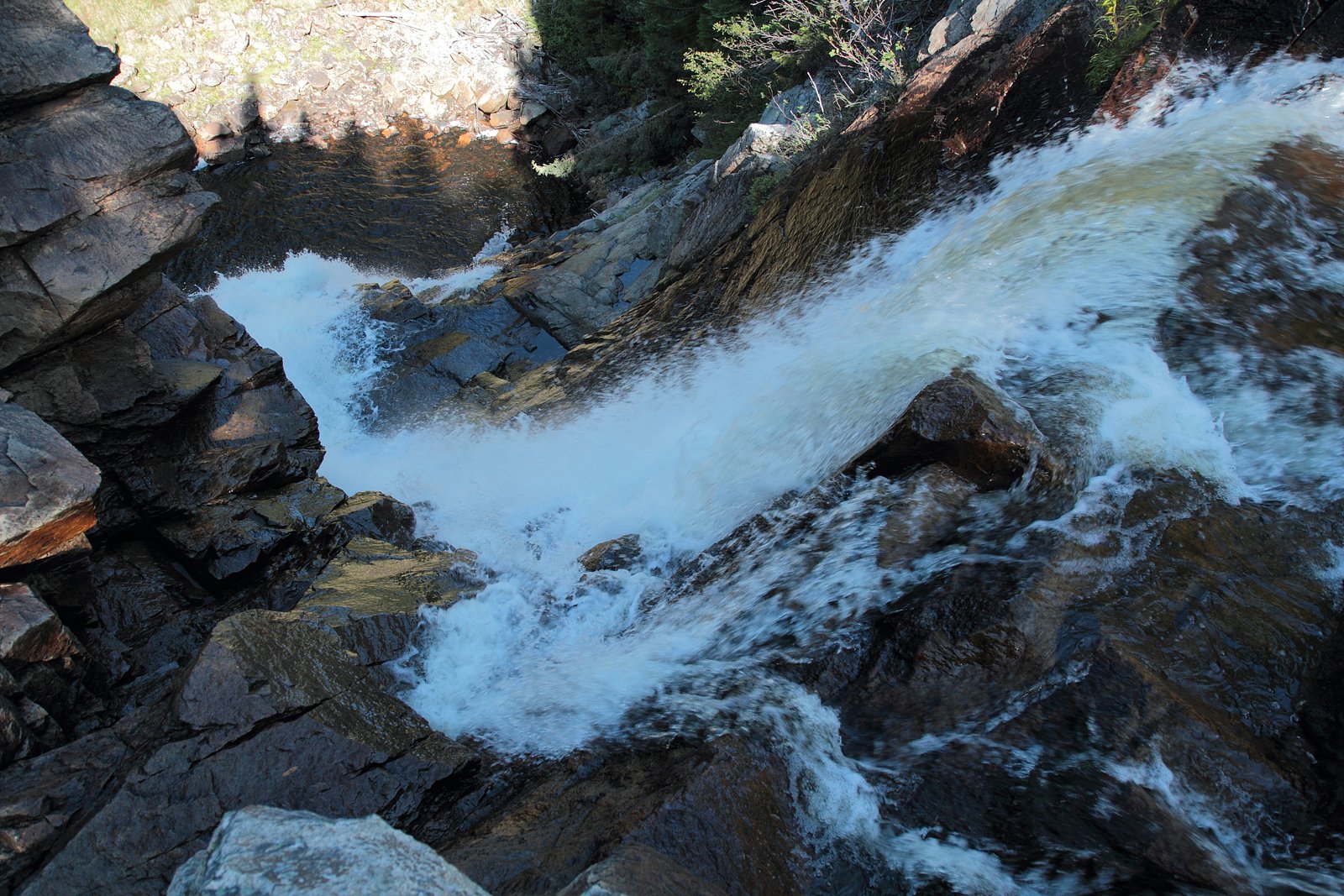
Chute de la Rivière-Noire flows over hard intrusive rock laid down over 1.0-1.2 billion years ago. These resistant rocks form a durable ledge that water cannot easily wear away, creating a 92-foot drop where softer material downstream has already eroded.
Trail & Hike Details
Trail Description
Detailed, authoritative trail descriptions for this specific chute are limited. Access typically involves a short walk from a roadside parking or small trailhead through mixed forest and over uneven, sometimes rocky ground. Trails (if formal) are likely unpaved and may include roots, rocks and modest grades. Expect limited infrastructure (few or no boardwalks, handrails or interpretation signs).
What to Expect
The falls cascade 28 metres over hard intrusive rock.
Accessibility
The trail is not wheelchair accessible. Uneven terrain and elevation changes require steady footing.
Frequently Asked Questions
🐶 Are Dogs Allowed at Chute de la Rivière-Noire?
❌ Dogs are not allowed
Are There Any Fees or Permits Required?
🆖 No fees required
🏊 Is There Swimming at Chute de la Rivière-Noire?
❌ Swimming is not allowed
When to Visit
Spring (late March–May) for the fullest flows and dramatic scenery. Early fall for foliage color and generally pleasant conditions. Summer can be fine but flows are often lower. Winter offers ice and frozen falls for experienced winter hikers and photographers but conditions can be hazardous.
Seasonal Access
The best time to visit is Spring, Summer, Fall, and Winter. Check with the managing park or local authority for current conditions.
Safety Information
Hazards may include slippery wet or ice-covered rocks, unstable river edges, strong currents during high flow, steep or loose slopes, seasonal flooding, and poor footing. Cell coverage may be limited. Wear appropriate footwear, stay a safe distance from the edge, supervise children closely, and avoid attempting technical climbs or river crossings. In winter, ice fall formations can be unstable, avoid standing under overhangs and be cautious of ice breakage. If conditions are uncertain, postpone the visit or consult local authorities.
7-Day Flow Outlook
Based on the WSC gauge AULNAIES OUEST (RUISSEAU DES) EN AMONT DU CHEMIN DU BELVEDERE (6 km away).
Best time of year: this gauge typically runs highest from late April to late June, peaking in May.
How we calculate this
This is a transparent outlook, not a precise forecast. We take the waterfall's current flow strength (how it ranks against its historical normal for today, from the nearest WSC stream gauge), carry that ranking forward along the gauge's seasonal curve, and nudge it for forecast rain. Confidence is highest for the next day or two and falls further out. Always check official conditions and your own judgment before visiting — high flows can be dangerous.
Know when to go.
Get a free email alert when waterfalls near Québec hit peak flow. We only send when conditions are worth the trip — no weekly newsletters, no spam.
Weather Forecast
Location & Access
Getting There
The site is reached by car from Québec City by driving north-northwest toward the general area of the Rivière Noire using local roads. Use the provided coordinates (47.3267, -71.1019) in a GPS device or mapping app to locate access points. Expect narrow rural roads; cell signal may be spotty in places. Follow local signs for municipal parks, roadside pullouts or trailheads if present.
Get Directions on Google MapsParking
Parking is likely limited to a small unpaved pullout or a nearby informal trailhead. There is no indication of a staffed lot or paid parking; use caution when parking on shoulders and avoid blocking farm gates or private driveways.
Elevation
715 metres above sea level
Coordinates
47.326723° N, -71.101896° W
Land Management
Managed by Ministère de l'Environnement, de la Lutte contre les changements climatiques, de la Faune et des Parcs, Direction des aires protégées
Visitor Tips & Gear
1) Use the coordinates and an offline map if you expect weak cell service. 2) Wear sturdy footwear with good traction for rocky, muddy or icy approaches. 3) Bring water and treat or carry out all trash, facilities may be absent. 4) Respect private property and posted signs; do not park where prohibited. 5) Check local municipal or regional park websites or recent visitor reports for up-to-date access conditions before traveling.
Where to Stay
Browse vacation cabins and private rentals nearby
Unique outdoor stays — tents, yurts, and treehouses
Rent a campervan or RV for your waterfall road trip
Some links are affiliate links. We may earn a commission at no extra cost to you.
Nearby Campground
Mare-du-Sault
12 km away
Additional Information
Nearby Attractions
The general region north of Québec City offers provincial and regional parks, hiking opportunities, and riverside scenery. Québec City (approximately 32 miles / ~50 km south) provides services, lodging and visitor information. Check local tourism resources for named regional parks and other waterfalls in the broader area.
Wildlife
Typical wildlife of rural Québec forest and river corridors may be present: white-tailed deer, small mammals (squirrels, hares), a variety of songbirds, and waterfowl. Black bears and moose can occur in some areas of Québec; exercise standard wildlife awareness. Insects (including black flies and mosquitoes) may be abundant in spring and early summer.
Cities near Chute de la Rivière-Noire
Writing about Chute de la Rivière-Noire? Embed this waterfall on your site for free.