
Photo Credits (5)
Difficulty
Moderate
Trail Length
1.2 km
Trail Type
Out And Back
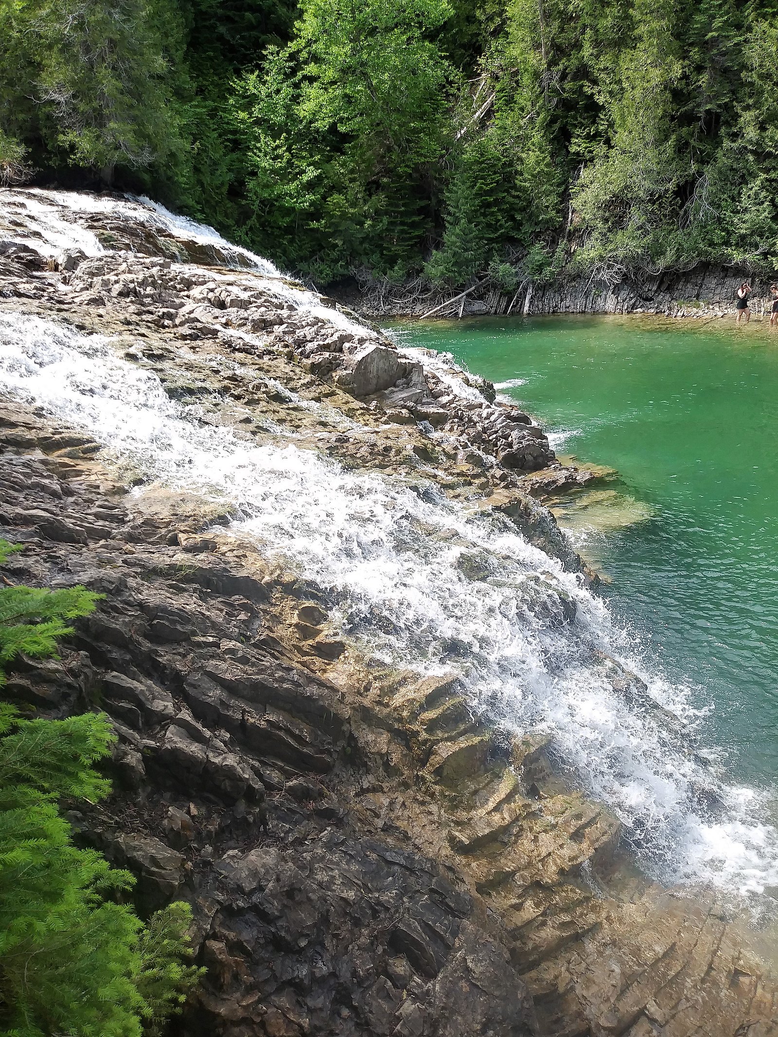
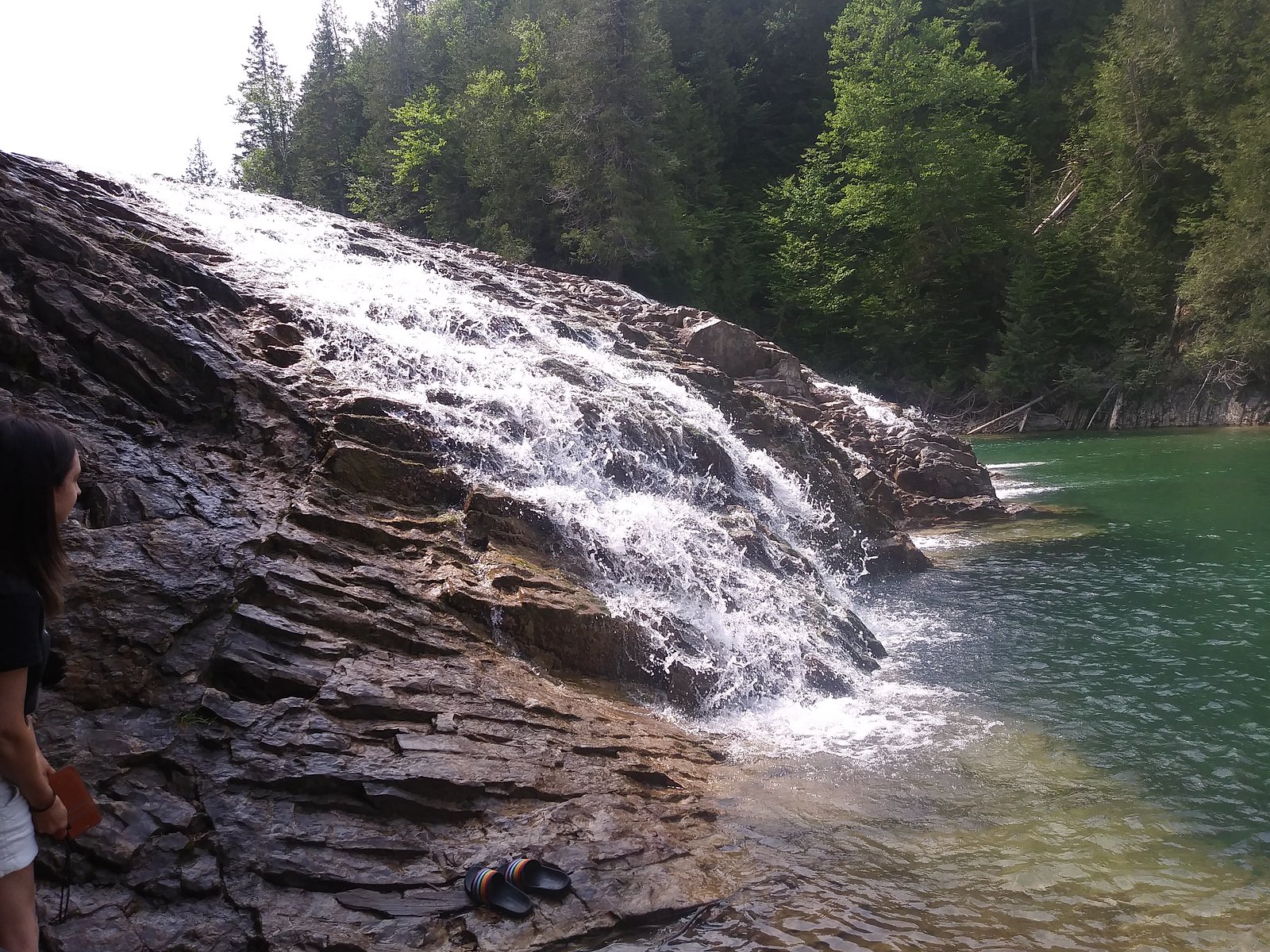
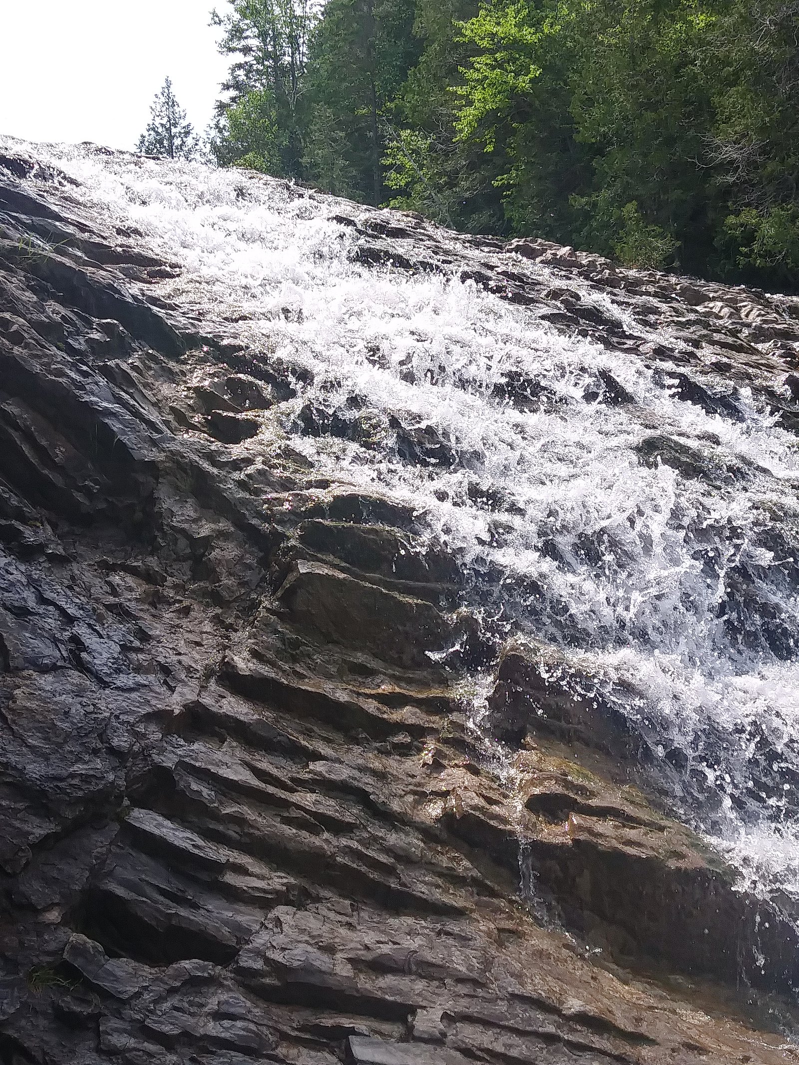
About Chute de la rivière du Portage
Chute de la rivière du Portage is a river cascade on the Rivière du Portage in the Gaspésie region of Quebec, located roughly 18.2 miles (≈29 km) from the town of Gaspé (coordinates: 48.5761, -64.35). The waterfall is set in a forested river valley characteristic of the Gaspé Peninsula and is typically a scenic, natural cascade rather than a large vertical drop. Water levels are highest in spring during snowmelt and can be lower in late summer. Specific formal infrastructure (boardwalks, viewing platforms) may be limited or absent.
Why This Waterfall Exists
Chute de la rivière du Portage flows over layered sedimentary rock laid down about 419-485 million years ago. Over time, the stream has worn through these layers at different rates, creating the step that forms the waterfall.
Trail & Hike Details
Trail Description
Approaches to the falls are likely on informal or lightly maintained footpaths that follow the river. Trails (if present) can be short but uneven, rocky, and potentially muddy; there may be limited signage. Expect a natural, possibly steep scramble to closer viewpoints rather than developed boardwalks. Conditions vary seasonally and after storms.
What to Expect
A forested river setting with a cascade-type waterfall. In spring expect strong flow and possibly swollen rivers; summer offers easier access but lower flow; fall provides attractive foliage. There may be no formal viewing platforms or safety rails. Insects (black flies, mosquitoes) are common in warm months. Cell service may be intermittent.
Accessibility
The trail is not wheelchair accessible. Uneven terrain and elevation changes require steady footing.
Frequently Asked Questions
🐶 Are Dogs Allowed at Chute de la rivière du Portage?
❌ Dogs are not allowed
Are There Any Fees or Permits Required?
🆖 No fees required
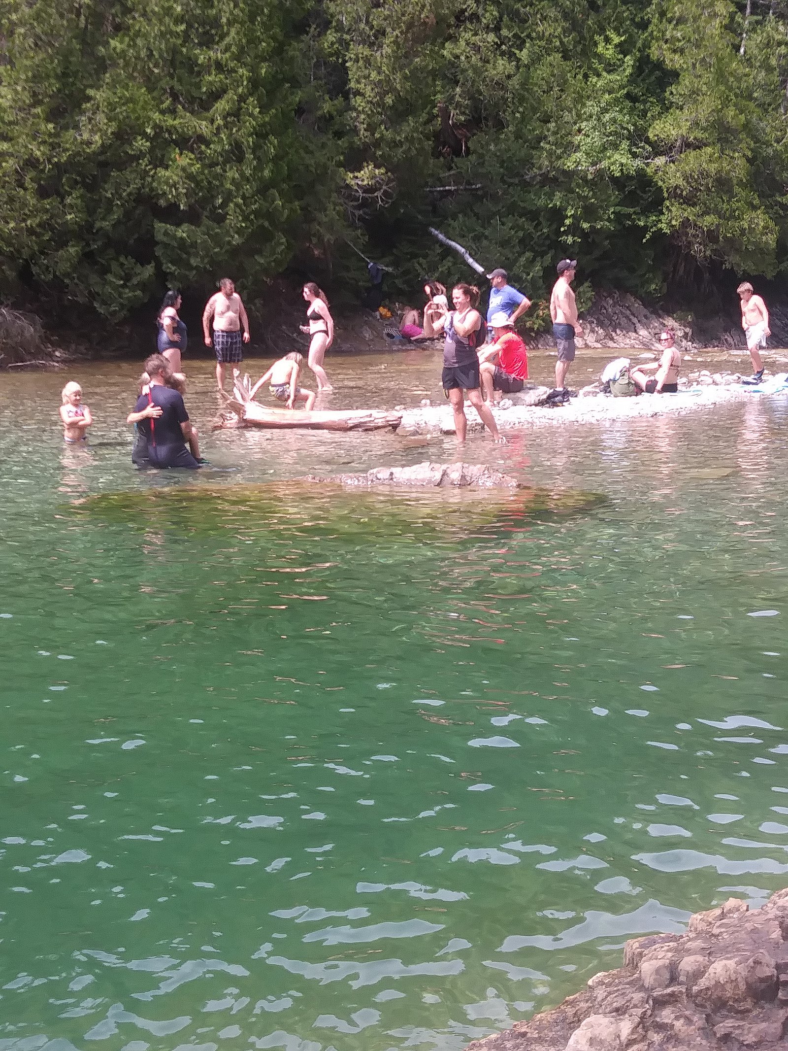
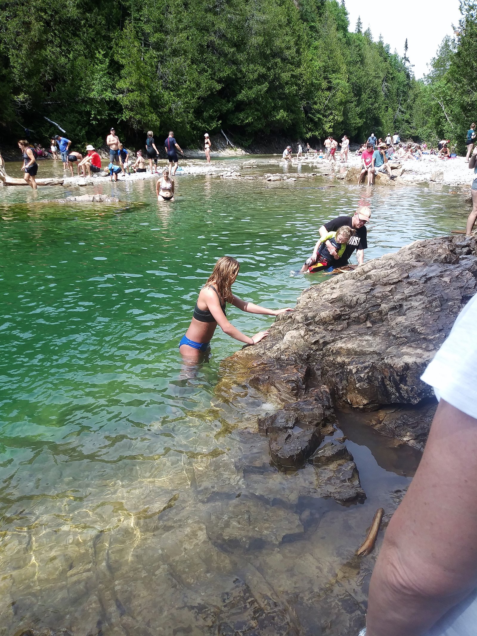
🏊 Is There Swimming at Chute de la rivière du Portage?
❌ Swimming is not allowed
When to Visit
Late spring for high water and dramatic flow; summer for more reliable trail access and warmer weather; early fall for foliage and lower crowds. Winter visits are possible but icy, cold, and potentially dangerous without proper winter gear, not recommended for casual visitors.
Seasonal Access
The best time to visit is Spring, Summer, and Fall. Winter access may be limited. Check with the managing park or local authority for current conditions.
Safety Information
Hazards may include slippery rocks, fast currents, steep or unstable banks, changing river levels (especially during spring freshets), biting insects, and limited cell service. Weather can change rapidly in the region. Use caution near water, avoid climbing on wet or moss-covered rocks, and do not attempt to enter strong currents. If visiting in winter, be prepared for ice, deep snow, and hypothermia risk. Check local conditions and advisories beforehand.
7-Day Flow Outlook
Based on the WSC gauge YORK (RIVIERE) A 1,4 KM EN AVAL DU RUISSEAU DINNER ISLAND (49 km away).
Best time of year: this gauge typically runs highest from mid April to late June, peaking in May.
How we calculate this
This is a transparent outlook, not a precise forecast. We take the waterfall's current flow strength (how it ranks against its historical normal for today, from the nearest WSC stream gauge), carry that ranking forward along the gauge's seasonal curve, and nudge it for forecast rain. Confidence is highest for the next day or two and falls further out. Always check official conditions and your own judgment before visiting — high flows can be dangerous.
Know when to go.
Get a free email alert when waterfalls near Gaspé hit peak flow. We only send when conditions are worth the trip — no weekly newsletters, no spam.
Weather Forecast
Location & Access
Getting There
From Gaspé, follow Route 132 and local roads toward the interior/riverside access points for Rivière du Portage (approximate driving distance ~18.2 miles). Exact access roads or trailheads may not be well signed; some approaches require driving on secondary or forestry roads. Use a detailed map/GPS and check with local municipal or tourism resources for the most current access recommendations before you go.
Get Directions on Google MapsParking
Parking is likely informal (small pullouts or roadside parking). There may not be an official parking lot or signage. Avoid blocking gates or forestry roads and obey local parking rules. Expect limited services and possibly uneven ground at the parking area.
Elevation
61 metres above sea level
Coordinates
48.576139° N, -64.350049° W
Visitor Tips & Gear
• Wear sturdy, waterproof footwear with good traction; rocks are slippery. • Bring insect repellent in spring and summer. • Stay back from the edge of cliffs and fast water; currents can be stronger than they appear. • Respect private property and posted signs; do not trespass. • Tell someone your plans and expected return time; cell coverage can be limited. • Check local tourism or municipal resources for up-to-date access info and any temporary closures.
Where to Stay
Browse vacation cabins and private rentals nearby
Unique outdoor stays — tents, yurts, and treehouses
Rent a campervan or RV for your waterfall road trip
Some links are affiliate links. We may earn a commission at no extra cost to you.
Nearby Campground
Camping Tête d'Indien
14.2 km away
Additional Information
Nearby Attractions
Town of Gaspé (coastal attractions), Forillon National Park (regional park with trails and coastal viewpoints), Cap-des-Rosiers Lighthouse and coastal lookout points. Local scenic drives along Route 132 offer multiple viewpoints and access to regional attractions.
Wildlife
Typical Gaspésie wildlife may include moose, black bear, white-tailed deer, beaver, and a variety of birds. Exercise normal wildlife precautions: store food securely, give animals space, and know how to respond to bear encounters.
Cities near Chute de la rivière du Portage
Nearby Waterfalls
Writing about Chute de la rivière du Portage? Embed this waterfall on your site for free.