Photo Credits (3)
Difficulty
Easy
Trail Length
0.8 km
Trail Type
Out And Back
Elevation Gain
11 m
About Chute de la Grotte-des-Fées
Chute de la Grotte-des-Fées is a natural waterfall site in eastern Quebec (coordinates 48.6809, -67.6799). The name (French for "Fairies' Cave Falls") suggests a scenic setting with rock features and possibly a small cave or grotto nearby. It appears to be in a relatively remote coastal/interior area of the province; the site is roughly 46.1 miles from Baie-Comeau, 47.5 miles from Rimouski, and 61.8 miles from Cap-Chat. Seasonal flow is likely highest in spring (snowmelt) and after rain, and the falls may be reduced in late summer and autumn or partially frozen/ice-covered in winter. Specific measured height is not confirmed.
The Setting
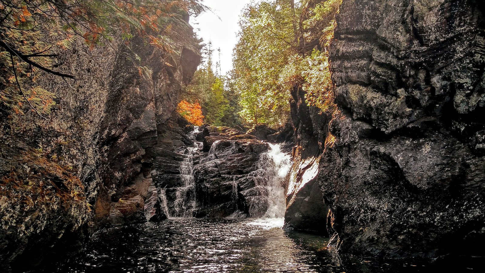
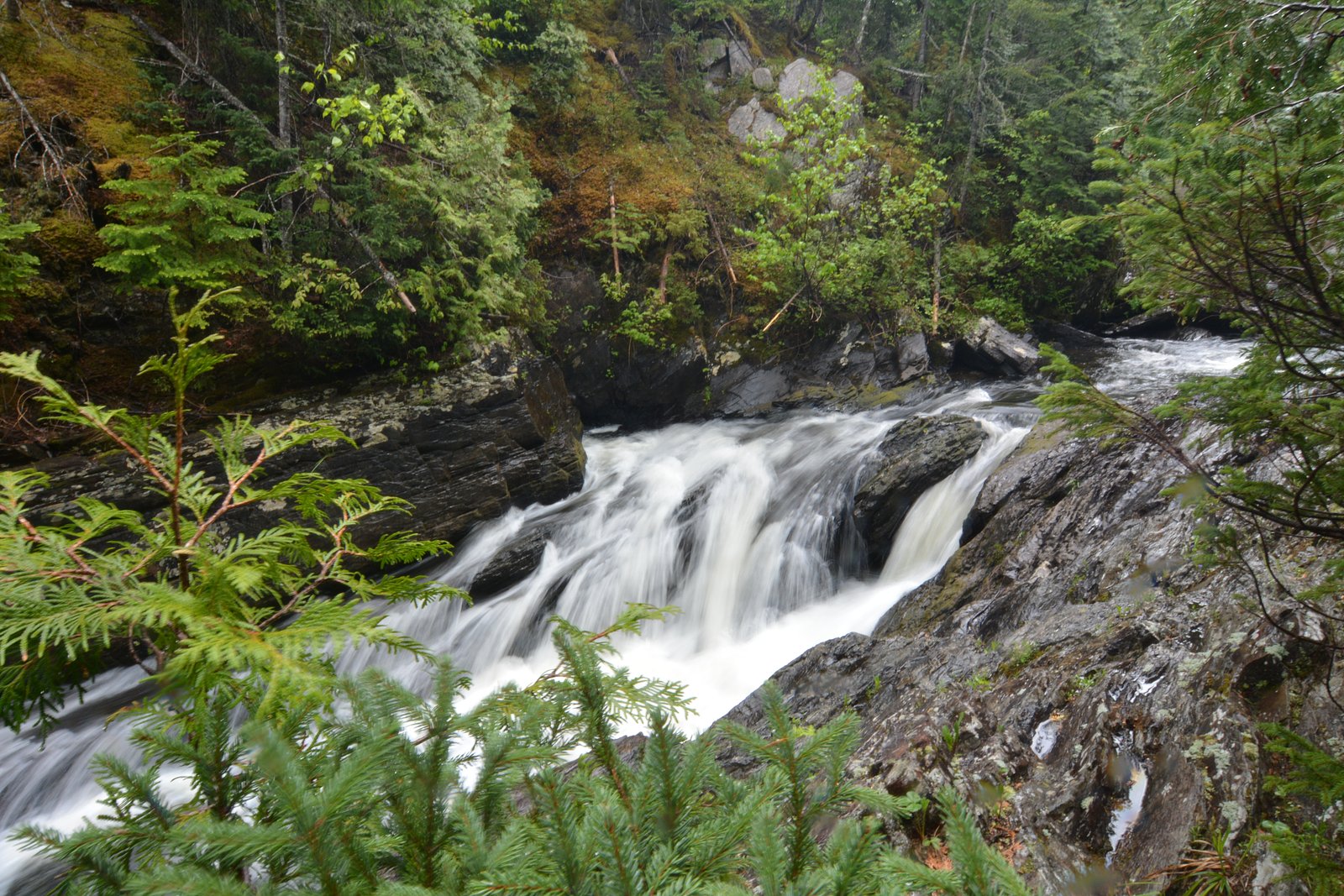
Chute de la Grotte-des-Fées sits at 152 metres in the coastal lowlands of Quebec. The falls drop 7 metres.
Why This Waterfall Exists
Chute de la Grotte-des-Fées flows over layered sedimentary rock laid down about 252-539 million years ago. Over time, the stream has worn through these layers at different rates, creating a 23-foot drop that forms the waterfall.
Trail & Hike Details
The Approach
The easy 0.8-km out-and-back trail gains 11 metres of elevation on the way to the falls.
Trail Description
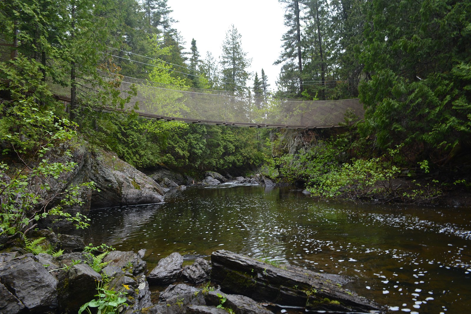
Detailed, authoritative trail descriptions are not available. The approach may involve a short unmarked footpath, rocky terrain and a possible scramble to a viewpoint near the falls. Trails in similar remote Quebec waterfall locations are often single-track, uneven, and may cross wet or muddy ground. Expect limited or no maintained boardwalks, handrails, or signage.
What to Expect
The falls drop a gentle 7 metres over layered sedimentary rock.
Accessibility
The trail is short and relatively flat, but the surface may be uneven. Contact the managing agency for accessibility details.
Frequently Asked Questions
🐶 Are Dogs Allowed at Chute de la Grotte-des-Fées?
❌ Dogs are not allowed
Are There Any Fees or Permits Required?
🆖 No fees required
🏊 Is There Swimming at Chute de la Grotte-des-Fées?
❌ Swimming is not allowed
When to Visit
Spring (late April–June) for highest water flow; early fall for color and typically lower insect activity. Summer offers easiest road access but lower flows at times. Winter can present dramatic ice formations but access may be difficult and hazardous without winter equipment.
Seasonal Access
The best time to visit is Spring, Summer, and Fall. Winter access may be limited. Check with the managing park or local authority for current conditions.
Safety Information
Hazards may include slippery wet rock and mud, unstable or undercut riverbanks, cold and fast-moving water, poor cell reception, rough unpaved roads, and seasonal insect swarms. Do not climb on wet ledges or attempt to swim near the falls; water temperature and currents can be dangerous. In winter, ice can be unstable; only attempt with appropriate experience and equipment. If uncertain about access or conditions, contact local municipal offices or park authorities for up-to-date information before visiting.
7-Day Flow Outlook
Based on the WSC gauge BLANCHE (RIVIERE) A 3,5 KM EN AMONT DU PONT-ROUTE 132 (10 km away).
Best time of year: this gauge typically runs highest from early April to mid June, peaking in May.
How we calculate this
This is a transparent outlook, not a precise forecast. We take the waterfall's current flow strength (how it ranks against its historical normal for today, from the nearest WSC stream gauge), carry that ranking forward along the gauge's seasonal curve, and nudge it for forecast rain. Confidence is highest for the next day or two and falls further out. Always check official conditions and your own judgment before visiting — high flows can be dangerous.
Know when to go.
Get a free email alert when waterfalls near Baie-Comeau hit peak flow. We only send when conditions are worth the trip — no weekly newsletters, no spam.
Weather Forecast
Location & Access
Getting There
The falls are located at latitude 48.6809, longitude -67.6799. Access likely requires travel on regional highways and then on secondary or forest/logging roads; expect unpaved roads and limited signage. Nearest towns listed for context are Baie-Comeau (~46.1 miles), Rimouski (~47.5 miles) and Cap-Chat (~61.8 miles). Visitors should plan for limited cell service and check local route conditions before travel.
Get Directions on Google MapsParking
Parking is likely minimal or informal (roadside/shoulder or a small pullout). There may be no official parking lot, vault toilets, or other facilities. A high-clearance vehicle may be helpful on unpaved approach roads.
Elevation
152 metres above sea level
Coordinates
48.680889° N, -67.679885° W
Visitor Tips & Gear
• Wear sturdy, waterproof footwear with good traction; rocks and trails can be slippery. • Bring insect repellent (black flies and mosquitoes can be abundant from late spring through summer). • Check road conditions and weather before traveling; secondary roads may be rough or seasonally closed. • Tell someone your route and expected return time, cell service may be unreliable. • Respect private property and posted signs; some access routes may cross private land. • Avoid getting too close to the edge or climbing on wet rocks; currents and undercut banks are hazardous.
As an Amazon Associate, we earn from qualifying purchases.
For this easy 0.8 km trail, lightweight trail shoes and a water bottle are usually sufficient. Sun exposure on the trail makes good sun protection a must in summer.

Polarized Sunglasses (Knockaround)
Cuts glare off the water so you actually see the falls — and your photos turn out better too.

Columbia Watertight II Rain Jacket
Packs into its own pocket, seam-sealed, and keeps you dry from spray and surprise rain.

Earth Pak Waterproof Dry Bag
Keeps your phone and gear dry when waterfall mist soaks everything else.

Waterproof Phone Pouch (AiRunTech)
Cheap insurance — take photos right next to the falls without killing your phone.

JOBY GorillaPod Starter Kit
Wraps around railings and rocks for long-exposure waterfall shots — no flat surface needed.

Osprey Daylite Daypack
Light, organized, and just the right size for a day hike — fits water, snacks, and layers.
Where to Stay
Browse vacation cabins and private rentals nearby
Unique outdoor stays — tents, yurts, and treehouses
Rent a campervan or RV for your waterfall road trip
Some links are affiliate links. We may earn a commission at no extra cost to you.
Nearby Campground
Base Plein Air St-Damase
10 km away
Additional Information
Nearby Attractions
Nearest towns: Baie-Comeau (~46.1 miles), Rimouski (~47.5 miles), Cap-Chat (~61.8 miles). Depending on the exact region, coastal viewpoints, provincial parks and regional nature sites may be available within driving distance, plan logistics in advance.
Wildlife
Visitors may encounter forest birds, small mammals, and large mammals typical of eastern Quebec (e.g., moose, white-tailed deer, black bear). Insects such as black flies and mosquitoes can be seasonally abundant. Exercise standard wildlife precautions and secure food.
Cities near Chute de la Grotte-des-Fées
Writing about Chute de la Grotte-des-Fées? Embed this waterfall on your site for free.