
Photo Credits (5)
Difficulty
Easy
Trail Length
3.4 km
Trail Type
Out And Back
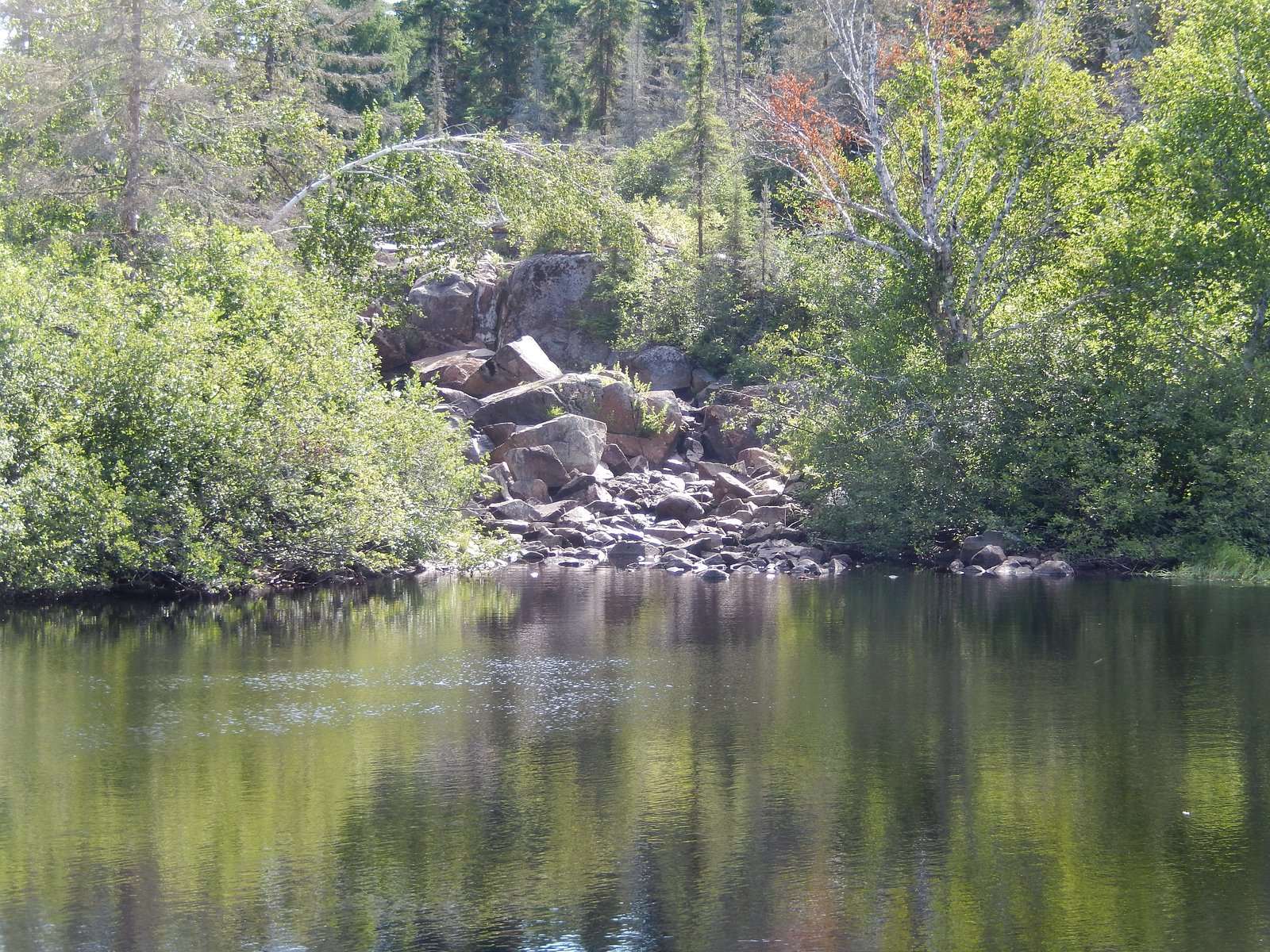
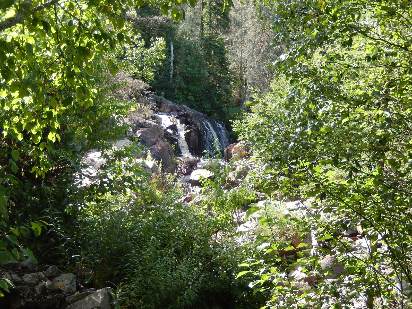
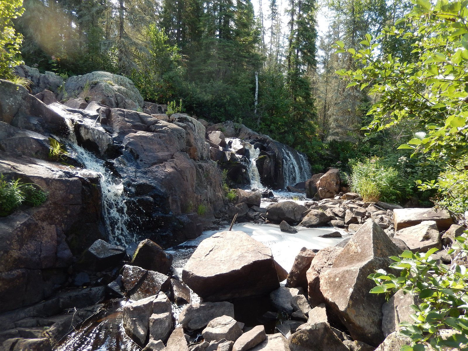
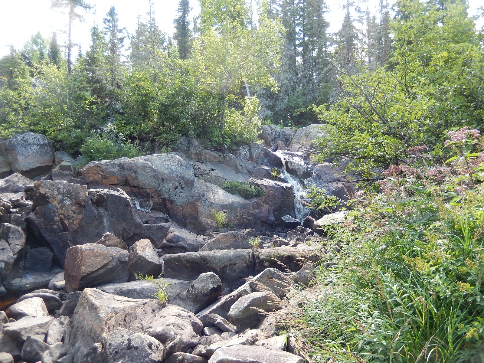
About Chute à Ovide
Chute à Ovide is a forested, rural waterfall located near the Quebec–Ontario border (coordinates 47.3804, -78.9986). It is in a remote, sparsely developed area and appears to be a local natural feature rather than a developed park attraction. Visitor reports and mapping data for this specific chute are limited; flow and appearance are likely seasonal (highest in spring runoff) and conditions may vary significantly year to year.
Why This Waterfall Exists
Chute à Ovide flows over hard volcanic rock laid down over 2.5-2.8 billion years ago. These resistant rocks form a durable ledge that water cannot easily wear away, creating the falls where softer material downstream has already eroded.
Trail & Hike Details
Trail Description
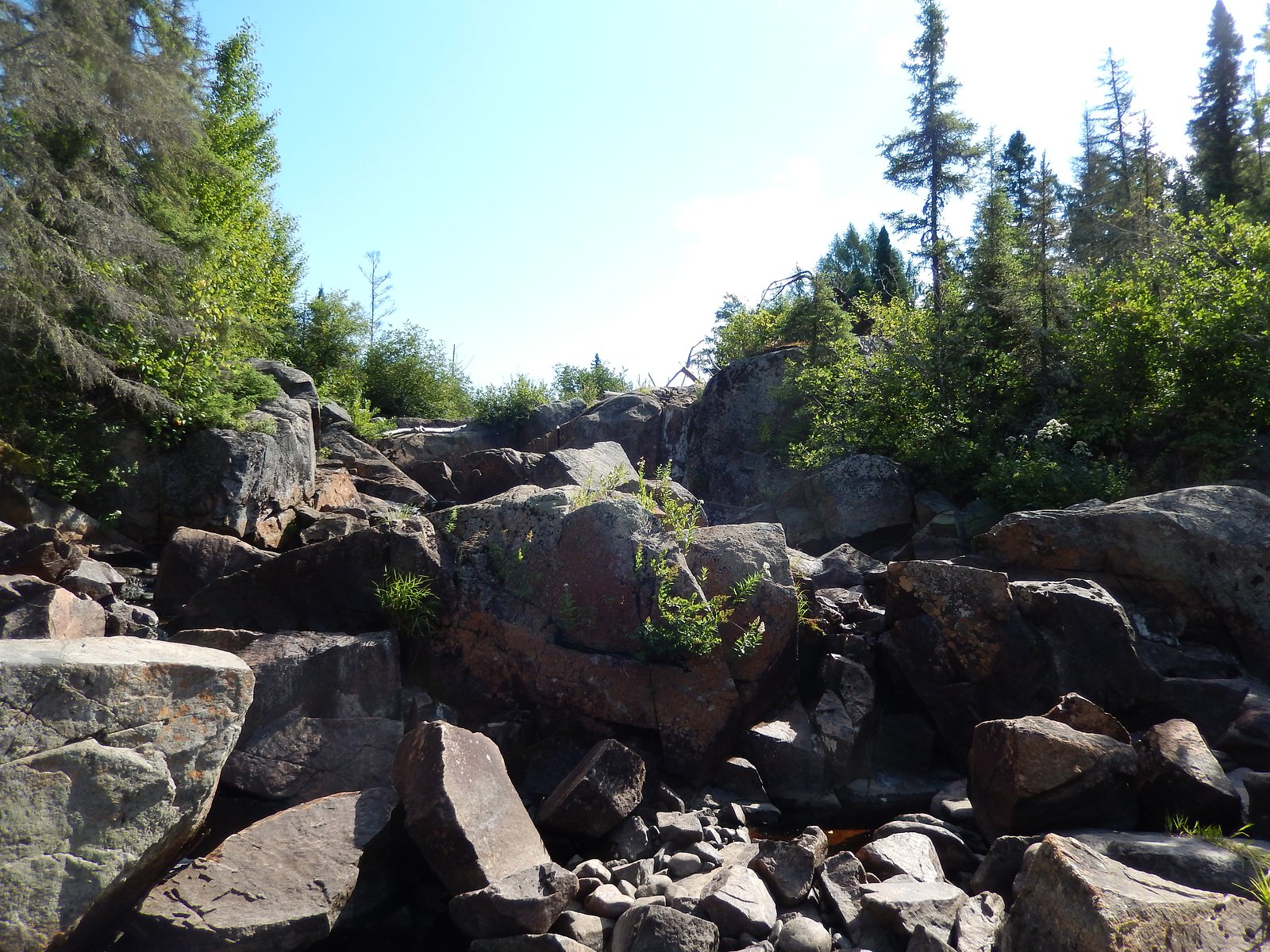
Trail information for Chute à Ovide is not well documented in major trail databases. Expect an unmaintained or lightly used path from a roadside pullout to the falls, possibly involving short bushwhacking, uneven terrain, roots, and rock scrambles near the water. Trails (if present) may be muddy, steep in sections, and poorly signed. If you find a defined path it is likely a short approach rather than a developed boardwalk or viewing platform.
What to Expect
A small-to-medium cascade in a forested setting with rock benches and pools. Flow is typically strongest during spring snowmelt and after heavy rain; late summer flows may be reduced. Surrounding terrain is mixed forest (spruce, fir, birch) with wet, mossy rocks near the water. Expect limited facilities (no restrooms, no trash service) and minimal signage. Wildlife typical of the region (deer, beaver, a variety of birds, and potentially black bear or moose) may be present.
Accessibility
The trail is not wheelchair accessible. Uneven terrain and elevation changes require steady footing.
Frequently Asked Questions
🐶 Are Dogs Allowed at Chute à Ovide?
❌ Dogs are not allowed
Are There Any Fees or Permits Required?
🆖 No fees required
🏊 Is There Swimming at Chute à Ovide?
❌ Swimming is not allowed
When to Visit
Spring (snowmelt) for highest flows and dramatic water volume. Fall for foliage colors and cooler weather. Summer for easier travel and warm weather, but flows may be lower. Winter can offer frozen-fall scenery but access may be difficult and walking on ice is hazardous.
Seasonal Access
The best time to visit is Spring, Summer, Fall, and Winter. Check with the managing park or local authority for current conditions.
Safety Information
Hazards include slippery rocks, steep or unstable banks, strong currents near cascades, cold water temperatures, and limited or no cell coverage. Seasonal hazards: spring runoff (strong flows), ice in winter, and muddy or washed-out roads in wet seasons. Black flies and ticks are common in warmer months. If venturing off main roads, notify someone of your plans and bring emergency supplies.
7-Day Flow Outlook
Based on the WSC gauge KIPAWA (RIVIERE) A 0.2 KM EN AVAL DU BARRAGE LANIEL (43 km away).
Best time of year: this gauge typically runs highest from mid January to late February, peaking in May.
How we calculate this
This is a transparent outlook, not a precise forecast. We take the waterfall's current flow strength (how it ranks against its historical normal for today, from the nearest WSC stream gauge), carry that ranking forward along the gauge's seasonal curve, and nudge it for forecast rain. Confidence is highest for the next day or two and falls further out. Always check official conditions and your own judgment before visiting — high flows can be dangerous.
Know when to go.
Get a free email alert when waterfalls near Cobalt hit peak flow. We only send when conditions are worth the trip — no weekly newsletters, no spam.
Weather Forecast
Location & Access
Getting There
Chute à Ovide (47.3804, -78.9986) lies in a remote area of northwestern Quebec near the Ontario border. Nearest population centers are Cobalt, ON (~29 miles / ~47 km) and New Liskeard / Timiskaming Shores, ON (~34 miles / ~55 km). Access is typically via local secondary or forestry/seasonal roads off main regional highways; a high-clearance vehicle may be advisable. Cell service may be limited; bring a map/GPS and plan for remote access. Check local municipal or provincial forestry/park websites for seasonal road conditions before travel.
Get Directions on Google MapsParking
There is likely no formal parking lot or maintained trailhead. Expect limited roadside pullouts or informal parking on gravel/forestry roads. Park well off the road, avoid blocking gates or driveways, and follow local signage. If unsure, use a town or regional trailhead as a starting point and confirm conditions locally.
Elevation
271 metres above sea level
Coordinates
47.380382° N, -78.998570° W
Visitor Tips & Gear
• Check road and weather conditions before you go; gravel and forestry roads can be rough and may be closed seasonally. • Use a high-clearance vehicle if recommended by local sources. • Wear waterproof hiking boots with good traction, rocks near the falls will be slippery. • Bring insect repellent and long pants in spring/summer (black flies and ticks can be common). • Pack out all trash and avoid disturbing natural features. • Tell someone your route and expected return time; cell service may be unreliable.
Where to Stay
Browse vacation cabins and private rentals nearby
Unique outdoor stays — tents, yurts, and treehouses
Rent a campervan or RV for your waterfall road trip
Some links are affiliate links. We may earn a commission at no extra cost to you.
Nearby Campground
Poirvoirie camping eaux Gillies
8.9 km away
Additional Information
Nearby Attractions
Nearby communities include Cobalt and New Liskeard / Timiskaming Shores, which offer dining, basic services, and regional museums/heritage sites (e.g., Cobalt's mining history). Lake Temiskaming and regional provincial parks are within driving distance and may provide more developed trails and facilities.
Wildlife
Typical northern Quebec / Ontario border-region wildlife: white-tailed deer, moose, black bear, beaver, otter, small mammals, and a variety of forest birds. Take standard precautions for bear country and store food securely.
Cities near Chute à Ovide
Writing about Chute à Ovide? Embed this waterfall on your site for free.