
Before you go
This is an industrial hydroelectric dam site operated by Rio Tinto, not a hiking destination. There is no trail or official viewpoint; stay off dam property.
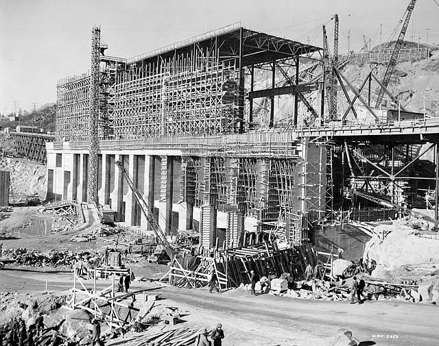
Photo Credits (2)
About Chute-à-Caron
Chute-à-Caron is the site of Rio Tinto's Chute-à-Caron dam on the Saguenay River in the Jonquière borough of Saguenay, Quebec. The concrete gravity dam, in service since 1931, and its spillway control the river here, so any falling water depends on dam releases. There is no developed hiking trail or official viewing area at the falls.
Why This Waterfall Exists
Chute-à-Caron flows over hard intrusive rock, primarily anorthosite, laid down over 1.0-1.6 billion years ago. These resistant rocks form a durable ledge that water cannot easily wear away, creating the falls where softer material downstream has already eroded.
Trail & Hike Details
What to Expect
An industrial hydroelectric site on a large river rather than a forest waterfall. Flow over the spillway is set by the dam operator and can change quickly.
Frequently Asked Questions
🐶 Are Dogs Allowed at Chute-à-Caron?
❌ Dogs are not allowed
Are There Any Fees or Permits Required?
🆖 No fees required
🏊 Is There Swimming at Chute-à-Caron?
❌ Swimming is not allowed
When to Visit
Seasonal Access
The best time to visit is Spring, Summer, Fall, and Winter. Check with the managing park or local authority for current conditions.
Safety Information
Water below the dam and spillway can rise suddenly and without warning during releases. Stay out of the river channel and away from dam structures.
7-Day Flow Outlook
Based on the WSC gauge SABLES (RIVIERE AUX) A SAGUENAY (9 km away).
Best time of year: this gauge typically runs highest from mid April to mid June, peaking in May.
How we calculate this
This is a transparent outlook, not a precise forecast. We take the waterfall's current flow strength (how it ranks against its historical normal for today, from the nearest WSC stream gauge), carry that ranking forward along the gauge's seasonal curve, and nudge it for forecast rain. Confidence is highest for the next day or two and falls further out. Always check official conditions and your own judgment before visiting — high flows can be dangerous.
Know when to go.
Get a free email alert when waterfalls near Chicoutimi hit peak flow. We only send when conditions are worth the trip — no weekly newsletters, no spam.
Weather Forecast
Location & Access
Getting There
The dam is on the Saguenay River in the Jonquière borough of Saguenay, next to Route de la Dam-Deux. There is no marked trail or public viewpoint at the falls.
Get Directions on Google MapsElevation
23 metres above sea level
Coordinates
48.450602° N, -71.250093° W
Visitor Tips & Gear
Stay out of fenced or posted dam property. Water levels below the dam can rise quickly during spillway releases.
Where to Stay
Browse vacation cabins and private rentals nearby
Unique outdoor stays — tents, yurts, and treehouses
Rent a campervan or RV for your waterfall road trip
Some links are affiliate links. We may earn a commission at no extra cost to you.
Nearby Campground
Camping Saguenay
9.4 km away
Additional Information
Nearby Attractions
Chicoutimi (urban amenities, museums, restaurants) and the greater Saguenay region (including the Saguenay Fjord) offer additional sightseeing opportunities. Exact proximity to specific parks or named attractions should be verified locally.
Wildlife
Typical regional wildlife may include black bear, moose, white-tailed deer, foxes, and a variety of songbirds and waterfowl. Take normal wildlife precautions (secure food, make noise on trails).
Cities near Chute-à-Caron
Nearby Waterfalls
Writing about Chute-à-Caron? Embed this waterfall on your site for free.