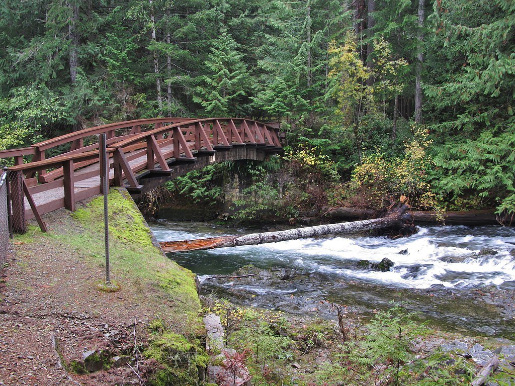
Bridge Creek Falls
By Armen Suny · Last verified Jun 2026
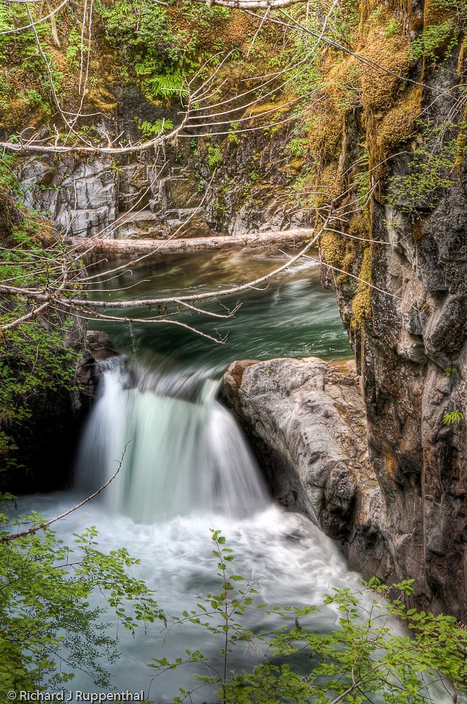
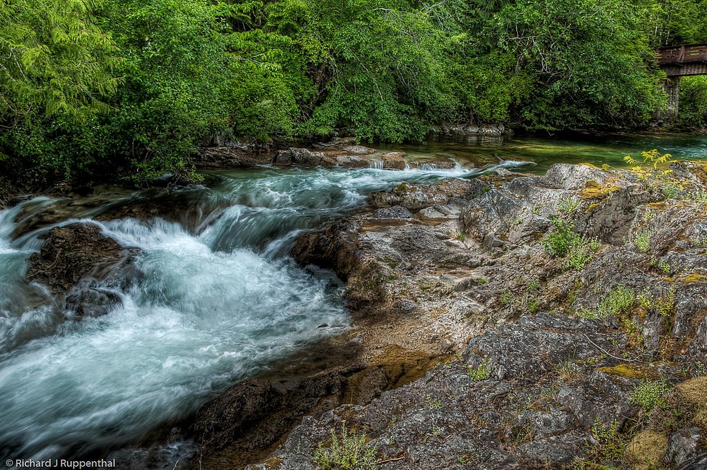
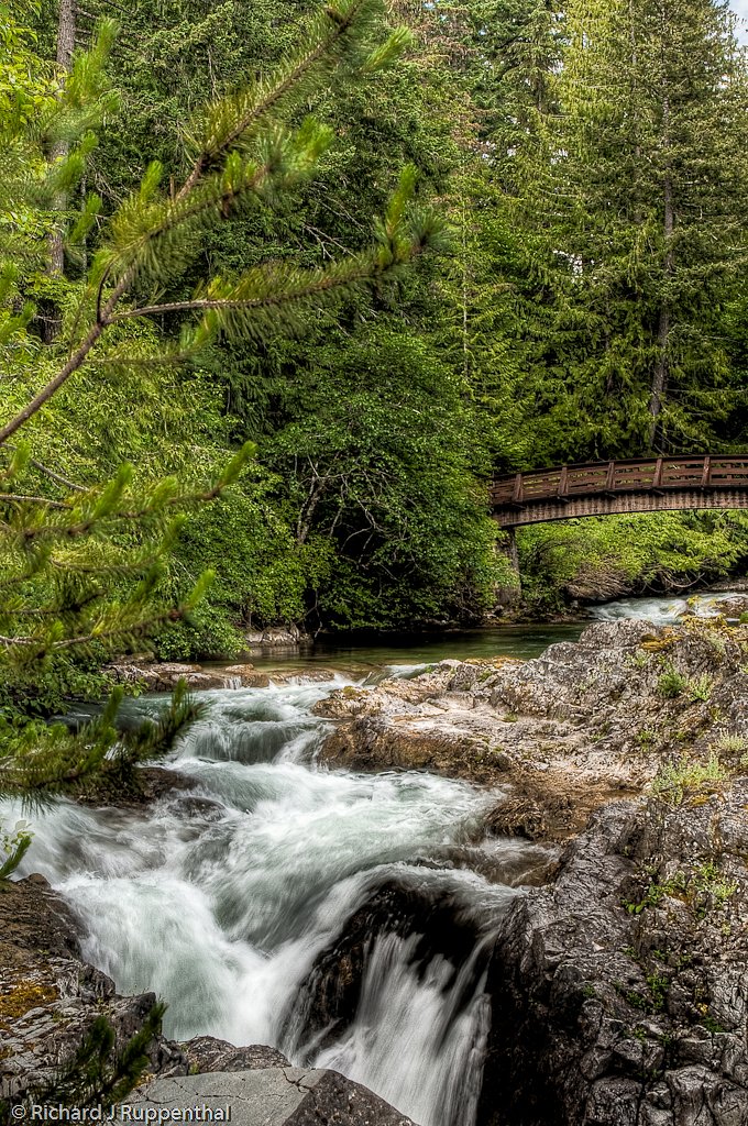
Photo Credits (5)
Difficulty
Easy
Trail Length
0.6 km
Trail Type
Out And Back
Elevation Gain
27 m
About Bridge Creek Falls
Bridge Creek Falls (near Williams Lake, BC) is a forested creek cascade located on Bridge Creek in the Cariboo region. It appears as a modest series of drops and cascades rather than a single tall plunge. Flow is typically highest in spring during snowmelt and after heavy rain; summer flows may be reduced. Exact measured height is not confidently documented.
Why This Waterfall Exists
Bridge Creek Falls flows over Chilcotin Group, a hard volcanic rock layer deposited about 0-23 million years ago. These resistant rocks form a durable ledge that water cannot easily wear away, creating the falls where softer material downstream has already eroded.
Trail & Hike Details
The Approach
The easy 0.6-km out-and-back trail gains 27 metres of elevation on the way to the falls.
Trail Description
There is limited published trail information for Bridge Creek Falls at these coordinates. Visitors typically approach from a nearby forestry road and follow a short, possibly indistinct path or creekside scramble to reach viewing spots. Trails may be unofficial and can include uneven, muddy, or steep sections; routes may require route-finding through forested terrain. No developed boardwalks or formal viewpoints are confirmed.
What to Expect
Expect a modest, wooded creek cascade rather than a large multi-hundred-foot waterfall. Surroundings are typical Cariboo interior forest (pine and mixed conifer) with underbrush and possible fallen logs. Water levels vary seasonally, highest in spring. Conditions may be muddy or icy outside of summer. Cell service may be intermittent or absent in more remote sections.
Accessibility
The trail is short and relatively flat, but the surface may be uneven. Contact the managing agency for accessibility details.
Frequently Asked Questions
🐶 Are Dogs Allowed at Bridge Creek Falls?
❌ Dogs are not allowed
Are There Any Fees or Permits Required?
🆖 No fees required
🏊 Is There Swimming at Bridge Creek Falls?
❌ Swimming is not allowed
When to Visit
Late spring to early summer for the fullest flows (snowmelt). Early fall can offer good access and scenery. Summer can be warmer and drier with reduced flow. Winter access may be limited by snow and icy conditions.
Seasonal Access
The best time to visit is Spring, Summer, and Fall. Winter access may be limited. Check with the managing park or local authority for current conditions.
Safety Information
Potential hazards include slippery and unstable rocks, steep banks, fast water during spring runoff or after heavy rain, remote location with limited cell service, rough forestry roads, and active logging operations. Always check current road and weather conditions, do not approach the edge of cascades or climb wet rocks, and carry basic safety and emergency supplies.
Current Water Conditions
Based on a Water Survey of Canada gauge 26.1 km away
0.4 m³/s
Current discharge — how much water is flowing
Much lower than usual for this time of year
Based on 26 years of record
3.59 m
Water depth at gauge
7-Day Discharge Trend
What does this mean for your visit?
Flow is well below normal for this time of year, so the waterfall may be a trickle.
About This Gauge
This gauge is on a regional waterway. Conditions at the falls may differ, especially after local rain.
7-Day Flow Outlook
Based on the WSC gauge BRIDGE CREEK BELOW DEKA CREEK (26 km away).
Today
Barely Flowing
0.4 m³/s
3/10Tomorrow
Barely Flowing
0.4 m³/s
5/10Tue
Barely Flowing
0.4 m³/s
5/10Wed
Barely Flowing
0.4 m³/s
4/10Thu
Barely Flowing
0.4 m³/s
4/10Fri
Barely Flowing
0.4 m³/s
3/10Sat
Low
0.4 m³/s
4/10Best window: Tomorrow — barely flowing flow, sunny (trip score 5/10).
Best time of year: this gauge typically runs highest from mid April to mid July, peaking in May.
How we calculate this
This is a transparent outlook, not a precise forecast. We take the waterfall's current flow strength (how it ranks against its historical normal for today, from the nearest WSC stream gauge), carry that ranking forward along the gauge's seasonal curve, and nudge it for forecast rain. Confidence is highest for the next day or two and falls further out. Always check official conditions and your own judgment before visiting — high flows can be dangerous.
Know when to go.
Get a free email alert when waterfalls near Williams Lake hit peak flow. We only send when conditions are worth the trip — no weekly newsletters, no spam.
Weather Forecast
Location & Access
Getting There
The falls are located at approximately 51.6395, -121.2898, roughly 60 miles (≈96 km) from Williams Lake. Access is typically via secondary or forestry roads off Highway 97 and may require travel on unpaved logging/Forest Service Roads. Expect narrow, potentially rutted roads; a high-clearance or 4x4 vehicle may be helpful. Exact turn-by-turn directions are not confirmed here, check local maps or forestry road notices before traveling.
Get Directions on Google MapsParking
There is likely informal roadside or pullout parking near a logging road or small turnout. There does not appear to be a formal developed parking lot or facilities. Park clear of gates, private driveways, and avoid blocking the road.
Elevation
942 metres above sea level
Coordinates
51.639523° N, -121.289777° W
Visitor Tips & Gear
• Check recent trip reports or local forestry/park notices for road conditions and access. • Use a vehicle appropriate for logging roads; avoid low-clearance cars if roads are rough. • Wear sturdy, waterproof footwear; expect slippery rocks and uneven ground. • Bring a map, GPS coordinates, and tell someone your route if heading into remote areas. • Respect private property and active logging operations; do not enter gated or signed areas without permission. • Carry bear spray in bear country and know how to use it.
As an Amazon Associate, we earn from qualifying purchases.
For this easy 0.6 km trail, lightweight trail shoes and a water bottle are usually sufficient. Sun exposure on the trail makes good sun protection a must in summer.

Polarized Sunglasses (Knockaround)
Cuts glare off the water so you actually see the falls — and your photos turn out better too.

Columbia Watertight II Rain Jacket
Packs into its own pocket, seam-sealed, and keeps you dry from spray and surprise rain.

Earth Pak Waterproof Dry Bag
Keeps your phone and gear dry when waterfall mist soaks everything else.

Waterproof Phone Pouch (AiRunTech)
Cheap insurance — take photos right next to the falls without killing your phone.

JOBY GorillaPod Starter Kit
Wraps around railings and rocks for long-exposure waterfall shots — no flat surface needed.

Osprey Daylite Daypack
Light, organized, and just the right size for a day hike — fits water, snacks, and layers.
Where to Stay
Browse vacation cabins and private rentals nearby
Unique outdoor stays — tents, yurts, and treehouses
Rent a campervan or RV for your waterfall road trip
Some links are affiliate links. We may earn a commission at no extra cost to you.
Nearby Campground
Bonanza Resort
13.5 km away
Additional Information
Nearby Attractions
Williams Lake (services and supplies), other Cariboo-region outdoor areas and lakes. Historic Barkerville and several provincial recreation sites are in the broader Cariboo region, though not necessarily adjacent to this site.
Wildlife
Black bears, deer, moose, small mammals, and a variety of birds are possible. Insect activity (including mosquitoes) can be high in warmer months. Exercise standard wildlife safety precautions.
Cities near Bridge Creek Falls
Writing about Bridge Creek Falls? Embed this waterfall on your site for free.