
Photo Credits (1)
Difficulty
Hard
Trail Length
24.6 km
Trail Type
Out And Back
Elevation Gain
210 m
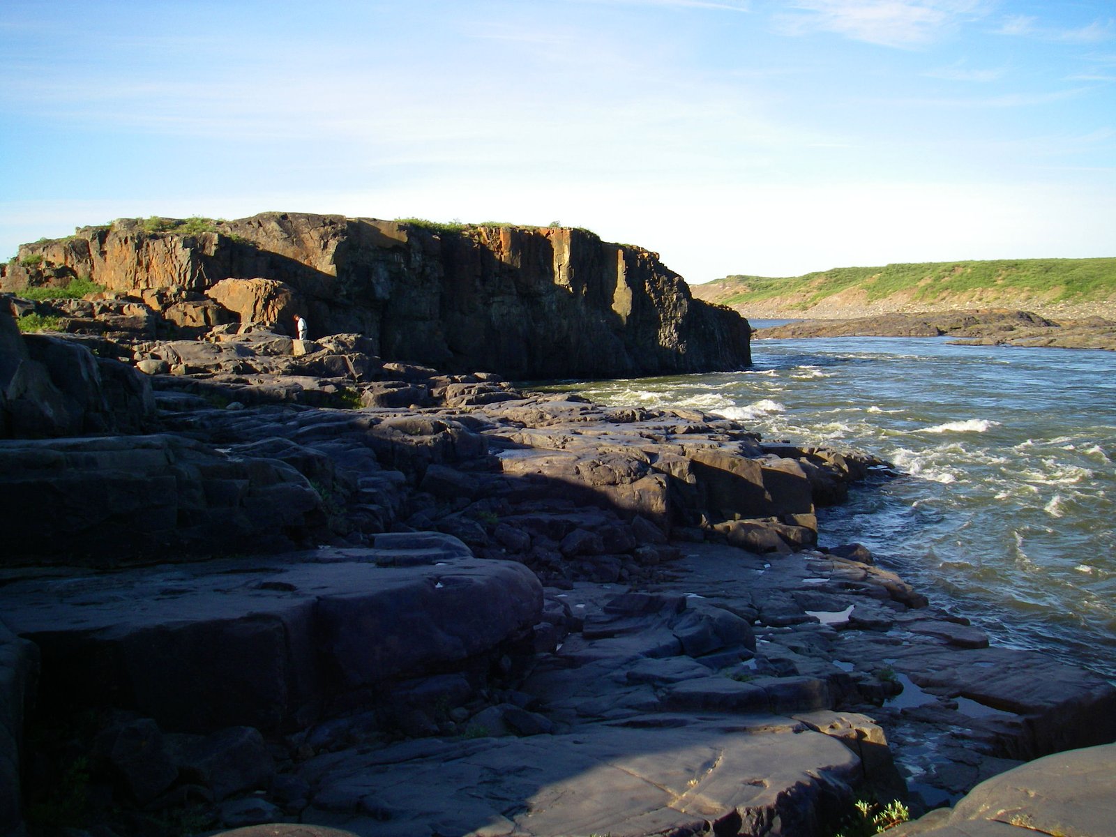
About Bloody Falls
Bloody Falls is a waterfall on the Coppermine River, in the Kugluk/Bloody Falls Territorial Park of Nunavut, Canada. It was the site of the Bloody Falls Massacre in 1771 and the murder of two priests by Uloqsaq and Sinnisiak, two Copper Inuit men in 1913.
Why This Waterfall Exists
Bloody Falls flows over layered sedimentary rock laid down about 720 million to 1.2 billion years ago. Over time, the stream has worn through these layers at different rates, creating the step that forms the waterfall.
Trail & Hike Details
The Approach
The hard 24.6-km out-and-back trail gains 210 metres of elevation on the way to the falls.
Trail Description
A short walk from the parking/turnout leads to rocky shorelines and one or more informal viewpoints over the Coppermine River rapids. The route is typically over tundra, gravel and exposed bedrock; there may be simple footpaths or short boardwalk sections in places. Expect uneven, sometimes steep or slippery rock near the water's edge. The complete outing from parking to viewpoint and back is commonly under 1 mile round-trip.
What to Expect
Tundra and rocky river shoreline, strong river currents and cascades/ledges rather than a single tall waterfall, limited or no facilities, remote Arctic environment. In summer expect biting insects (mosquitoes/black flies), and in spring high flows during snowmelt. Weather can change rapidly and temperatures are cool even in summer.
Accessibility
The trail involves steep, uneven terrain with significant elevation change and is not accessible to mobility devices.
Frequently Asked Questions
🐶 Are Dogs Allowed at Bloody Falls?
❌ Dogs are not allowed
Are There Any Fees or Permits Required?
🆖 No fees required
🏊 Is There Swimming at Bloody Falls?
❌ Swimming is not allowed
When to Visit
Late June through September for the most reliable vehicle access and milder weather. Late spring (breakup) can have very high flows but road and trail conditions may be poor. Winter access is possible by snowmobile but is remote and requires experience and local knowledge.
Seasonal Access
The best time to visit is Spring, Summer, and Fall. Winter access may be limited. Check with the managing park or local authority for current conditions.
Safety Information
This is a remote Arctic river site with slippery rocks, strong currents, and rapidly changing weather. Hazards include: hypothermia from cold water or exposure, falls on wet/uneven rock, fast river currents that can sweep people away, biting insects in summer, and potential encounters with wildlife. Cell phone coverage is unreliable; carry emergency communications and tell someone your plan and expected return. Use caution near edges and do not attempt to climb on unstable rocks near the rapids. If visiting in spring/snowmelt, expect very high flows and increased danger.
Know when to go.
Get a free email alert when waterfalls near Kugluktuk hit peak flow. We only send when conditions are worth the trip — no weekly newsletters, no spam.
Weather Forecast
Location & Access
Getting There
The site is located on the Coppermine River approximately 16.4 miles (user-supplied) from Kugluktuk. Access is typically by vehicle from Kugluktuk on a local access/gravel road for summer months; road conditions vary and may require high-clearance or 4x4. In winter access may be by snowmobile or other winter travel. Check with the Kugluktuk hamlet office or Nunavut authorities for current road status and recommended routes.
Get Directions on Google MapsParking
There is typically a small parking/turnout near the trailhead/viewpoint. Expect limited parking and no services (no potable water, restrooms, or staffed facilities).
Elevation
11 metres above sea level
Coordinates
67.743470° N, -115.367184° W
Visitor Tips & Gear
1) Check local road and weather conditions before you go; contact the Kugluktuk hamlet office or Nunavut Parks for current information. 2) Wear sturdy, waterproof boots and bring layers, wind and cold are common. 3) Keep well back from the river edge; rocks are slippery and currents are strong. 4) Carry insect repellent and sun protection for summer visits. 5) Pack out all trash and respect cultural/historic sites. 6) Carry a personal locator beacon or satellite communicator if travelling from Kugluktuk into more remote areas.
As an Amazon Associate, we earn from qualifying purchases.
This challenging 24.6 km trail gains 210 m in elevation — come prepared with proper hiking boots and trekking poles. Sun exposure on the trail makes good sun protection a must in summer.

Sawyer Squeeze Water Filter
The backcountry standard — filters 99.9% of bacteria and weighs just 3 oz.

Polarized Sunglasses (Knockaround)
Cuts glare off the water so you actually see the falls — and your photos turn out better too.

Columbia Watertight II Rain Jacket
Packs into its own pocket, seam-sealed, and keeps you dry from spray and surprise rain.

Earth Pak Waterproof Dry Bag
Keeps your phone and gear dry when waterfall mist soaks everything else.

Waterproof Phone Pouch (AiRunTech)
Cheap insurance — take photos right next to the falls without killing your phone.

Timberland Euro Sprint Mid Waterproof
Trusted waterproof boot with premium leather and grippy rubber sole — reliable on rocky, wet trails.
Where to Stay
Browse vacation cabins and private rentals nearby
Unique outdoor stays — tents, yurts, and treehouses
Rent a campervan or RV for your waterfall road trip
Some links are affiliate links. We may earn a commission at no extra cost to you.
Additional Information
Nearby Attractions
Kugluktuk hamlet (local cultural sites and services), the mouth of the Coppermine River, opportunities for fishing (char) and birdwatching during migration seasons. Local guided cultural tours may be available through community providers.
Wildlife
Birds (waterfowl and migratory species), Arctic fox, caribou in season, and marine mammals along nearby coastlines. Occasional polar bears have been reported in the western Nunavut region, always check local wildlife advisories and travel with appropriate precautions.
Cities near Bloody Falls
Writing about Bloody Falls? Embed this waterfall on your site for free.