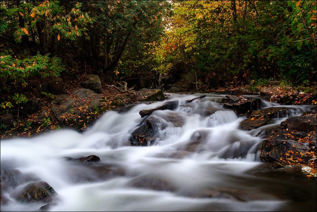
Blakeney Rapids
Ontario • 10 m
By Armen Suny · Last verified Jun 2026
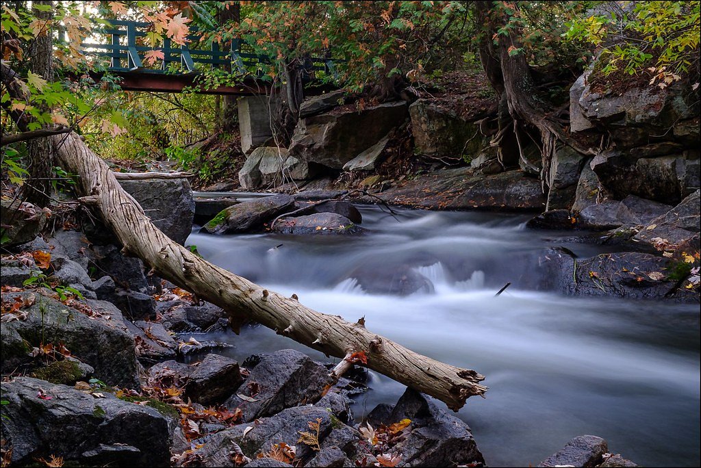
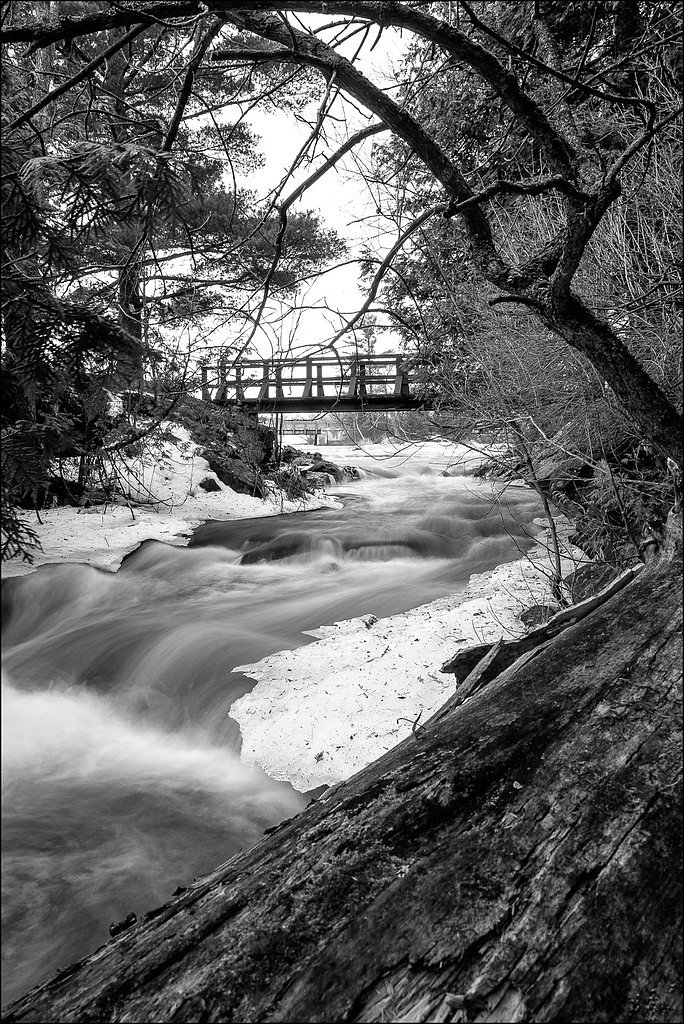
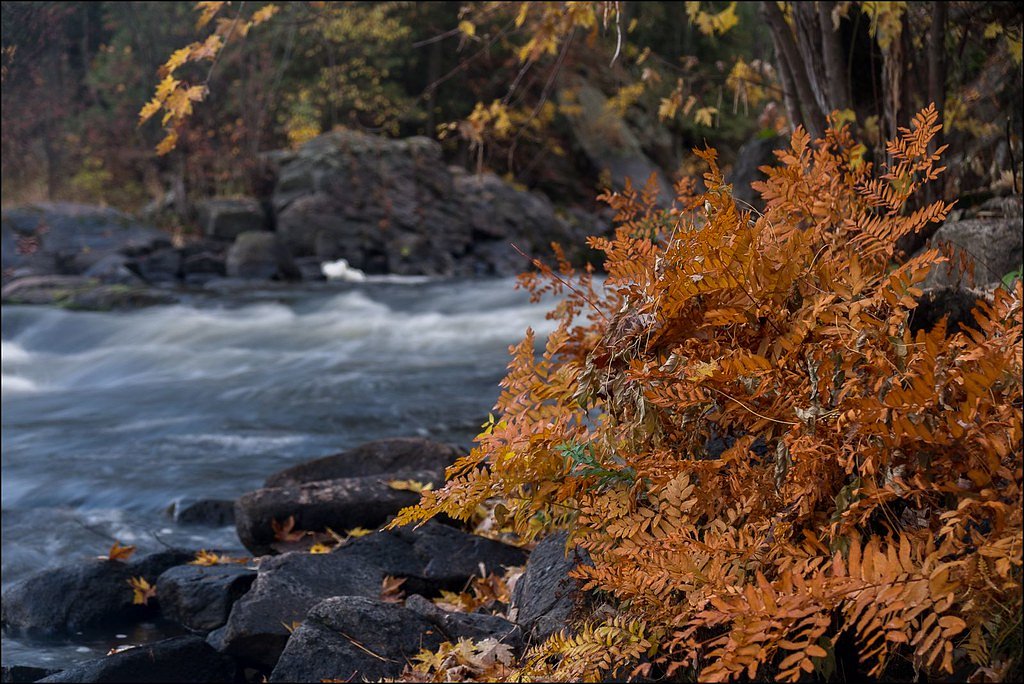
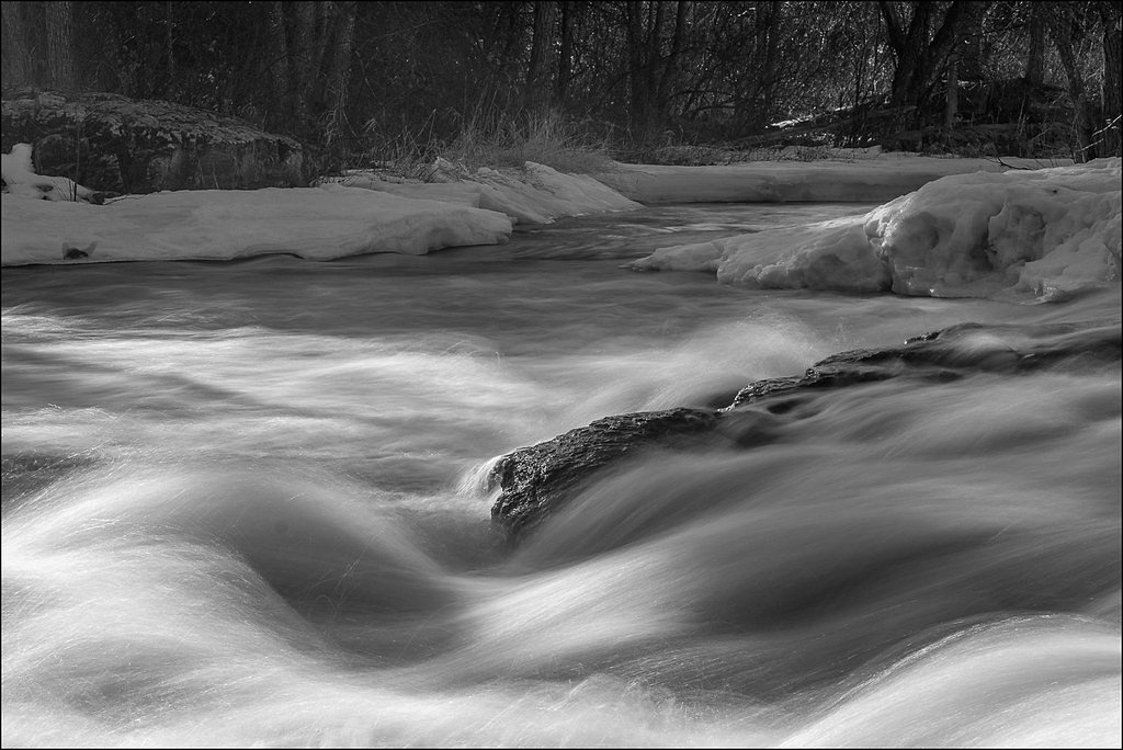
Photo Credits (5)
Difficulty
Easy
Trail Length
0.6 km
Trail Type
Out And Back
Elevation Gain
7 m
About Blakeney Rapids
Blakeney Rapids is a stretch of fast-flowing river rapids rather than a single vertical waterfall. It is a scenic waterside spot known for rocky riverbanks and turbulent water, with best flows typically during spring runoff and after heavy rain. Exact developed infrastructure (formal viewpoints, boardwalks) appears limited or informal, so visitors should expect a natural, undeveloped riverside setting.
The Setting
Blakeney Rapids sits at 100 metres in the coastal lowlands of Ontario. The falls drop 10 metres.
Why This Waterfall Exists
Blakeney Rapids flows over hard intrusive rock, primarily granodiorite and tonalite, laid down about 539 million to 1.6 billion years ago. These resistant rocks form a durable ledge that water cannot easily wear away, creating a 33-foot drop where softer material downstream has already eroded.
Trail & Hike Details
The Approach
The easy 0.6-km out-and-back trail gains 7 metres of elevation on the way to the falls.
Trail Description
There does not appear to be a long maintained trail system specifically for Blakeney Rapids. Access usually involves a short walk over mixed terrain (grassy or rocky banks and possibly informal footpaths) from a roadside parking area to river viewpoints. Trails may be uneven and can be muddy or icy depending on season.
What to Expect
The falls drop 10 metres over hard intrusive rock.
Accessibility
The trail is short and relatively flat, but the surface may be uneven. Contact the managing agency for accessibility details.
Frequently Asked Questions
🐶 Are Dogs Allowed at Blakeney Rapids?
❌ Dogs are not allowed
Are There Any Fees or Permits Required?
🆖 No fees required
🏊 Is There Swimming at Blakeney Rapids?
❌ Swimming is not allowed
When to Visit
Spring (high water) for dramatic flow; summer for easier access, warmer weather and surrounding greenery; fall for foliage color. Winter offers ice features but is more hazardous and requires winter footwear and experience.
Seasonal Access
The best time to visit is Spring, Summer, Fall, and Winter. Check with the managing park or local authority for current conditions.
Safety Information
Hazards include slippery and unstable rocks, strong currents and undertows near rapids, sudden water-level changes during spring thaw or after heavy rain, cold water shock, and limited or no emergency services on site. Winter ice can be unstable, do not assume river ice is safe. Watch for ticks and poisonous plants (e.g., poison ivy). Bring a charged phone, tell someone your plans, and avoid risky behavior close to the water.
Current Water Conditions
0.4 m³/s
Current discharge — how much water is flowing
About average for this time of year
Based on 50 years of record
8.55 m
Water depth at gauge
7-Day Discharge Trend
What does this mean for your visit?
Flow is about average for this time of year.
About This Gauge
7-Day Flow Outlook
Based on the WSC gauge INDIAN RIVER NEAR BLAKENEY (3 km away).
Today
Moderate
0.4 m³/s
6/10Tomorrow
Moderate
0.4 m³/s
6/10Tue
Moderate
0.4 m³/s
6/10Wed
Moderate
0.4 m³/s
6/10Thu
Moderate
0.4 m³/s
6/10Fri
Moderate
0.4 m³/s
5/10Sat
Moderate
0.5 m³/s
6/10Best window: Today — moderate flow, cloudy (trip score 6/10).
Best time of year: this gauge typically runs highest from early March to late May, peaking in April.
How we calculate this
This is a transparent outlook, not a precise forecast. We take the waterfall's current flow strength (how it ranks against its historical normal for today, from the nearest WSC stream gauge), carry that ranking forward along the gauge's seasonal curve, and nudge it for forecast rain. Confidence is highest for the next day or two and falls further out. Always check official conditions and your own judgment before visiting — high flows can be dangerous.
Know when to go.
Get a free email alert when waterfalls near Ottawa hit peak flow. We only send when conditions are worth the trip — no weekly newsletters, no spam.
Weather Forecast
Location & Access
Getting There
Coordinates: 45.2676, -76.2493. The rapids lie in eastern Ontario roughly 30.5 miles from Ottawa, and within driving distance of Brockville and Ogdensburg. Access is by local roads; there is no widely advertised shuttle or visitor center. Expect to navigate local secondary roads and follow a short walk from a roadside pullout or small parking area.
Get Directions on Google MapsParking
Parking is likely informal (small pullouts or roadside parking). Expect limited spaces and no staffed lot or restrooms. Park clear of driveways and private property.
Elevation
100 metres above sea level
Coordinates
45.267584° N, -76.249287° W
Visitor Tips & Gear
• Wear sturdy, grippy footwear; rocks are slippery. • Stay back from the water edge, currents and undercut rocks can be dangerous. • No guaranteed facilities: bring water, snacks, and a small trash bag to pack out waste. • Cell reception may be spotty; tell someone your plans if visiting alone. • Check river conditions after heavy rain or spring thaw, water levels and currents can change quickly. • Respect private property and posted signs; park only in legal pullouts.
As an Amazon Associate, we earn from qualifying purchases.
For this easy 0.6 km trail, lightweight trail shoes and a water bottle are usually sufficient. Icy conditions are common in winter — traction cleats are a smart addition.

Columbia Watertight II Rain Jacket
Packs into its own pocket, seam-sealed, and keeps you dry from spray and surprise rain.

Polarized Sunglasses (Knockaround)
Cuts glare off the water so you actually see the falls — and your photos turn out better too.

Earth Pak Waterproof Dry Bag
Keeps your phone and gear dry when waterfall mist soaks everything else.

Waterproof Phone Pouch (AiRunTech)
Cheap insurance — take photos right next to the falls without killing your phone.

Kahtoola MICROspikes
Cult-favorite traction cleats that grip ice and wet rock — essential for winter waterfall hikes.

JOBY GorillaPod Starter Kit
Wraps around railings and rocks for long-exposure waterfall shots — no flat surface needed.
Where to Stay
Browse vacation cabins and private rentals nearby
Unique outdoor stays — tents, yurts, and treehouses
Rent a campervan or RV for your waterfall road trip
Some links are affiliate links. We may earn a commission at no extra cost to you.
Nearby Campground
Breezy Hill Camping & RV Park
9.1 km away
Additional Information
Nearby Attractions
General region: Ottawa is the nearest major city (approximately 30–35 miles away). Other regional attractions and services are found in nearby towns, confirm precise distances and services before planning. Specific formal attractions immediately adjacent to the rapids are not well-documented.
Wildlife
Typical eastern Ontario riverside wildlife: waterfowl (ducks, geese), songbirds, beavers, muskrats, white-tailed deer, and small mammals. Ticks and mosquitoes can be present in warmer months.
Cities near Blakeney Rapids
Writing about Blakeney Rapids? Embed this waterfall on your site for free.