Photo Credits (2)
About Arrow River Falls
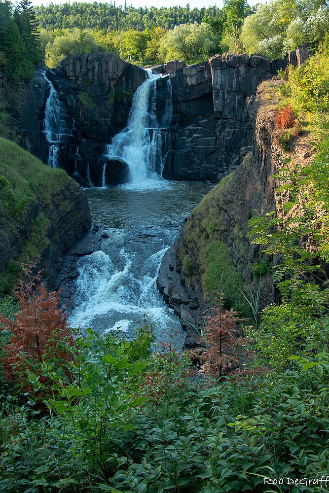
Arrow River Falls is a remote cascade on the Arrow River on the north shore region of Lake Superior in northwestern Ontario (coordinates: 48.0379, -89.7198). The falls sit in a forested, rocky landscape and typically shows its highest flows in spring runoff. Exact published height and official facility details are not widely documented; the feature is best described as a small to moderate cascade rather than a large vertical drop.
Why This Waterfall Exists
Arrow River Falls flows over layered sedimentary rock laid down over 1.6-2.5 billion years ago. Over time, the stream has worn through these layers at different rates, creating the step that forms the waterfall.
Nearby Falls Worth Visiting
Pigeon Falls, the tallest waterfall in Minnesota at 37 metres, lies 9.8 kilometres to the east.
Trail & Hike Details
Trail Description
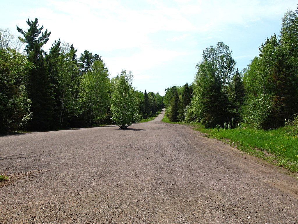
Approach to the falls is through mixed boreal forest and over rocky terrain. Visitor reports for similar north-shore cascades describe short, informal approaches that can include wet or muddy sections, exposed roots, and a final rocky scramble to viewing points. Trails may be unmarked and unmaintained; follow established footprints where present and avoid creating new paths. Expect variable footing and limited handrails or safety infrastructure.
What to Expect
A natural, relatively undeveloped waterfall in a forested setting. Expect variable stream flow (highest in spring), rocky banks, and potentially limited viewpoints. There may be no interpretive signage, toilets, or potable water. Cell reception can be patchy; nearby roads can be gravel or forest service roads. Wildlife such as deer, small mammals, and birds are common; larger mammals (moose, black bear) may be present in the region.
Accessibility
The site is likely not wheelchair accessible. Terrain near the falls is rocky and uneven with potential scrambles; expect limited or no formal accessibility infrastructure.
Frequently Asked Questions
🐶 Are Dogs Allowed at Arrow River Falls?
❌ Dogs are not allowed
Are There Any Fees or Permits Required?
🆖 No fees required
🏊 Is There Swimming at Arrow River Falls?
❌ Swimming is not allowed
When to Visit
Spring (late melt) for highest flows; summer for easier access, milder weather, and fewer muddy sections; fall for color and lower visitor numbers. Winter offers ice formations but is more hazardous and may require winter travel experience and traction devices.
Seasonal Access
The best time to visit is Spring, Summer, Fall, and Winter. Check with the managing park or local authority for current conditions.
Safety Information
Hazards include slippery and unstable rocks, steep or exposed edges, seasonal high flows (especially in spring), cold water temperatures, limited cell service, and variable weather. There may be no safety rails or signage. Do not approach the edge when wet or icy. Inform someone of your plans if traveling to remote areas and carry emergency supplies.
Current Water Conditions
Based on a Water Survey of Canada gauge 29 km away
0.4 m³/s
Current discharge — how much water is flowing
About average for this time of year
Based on 46 years of record
0.51 m
Water depth at gauge
7-Day Discharge Trend
What does this mean for your visit?
Flow is about average for this time of year.
About This Gauge
This gauge is on a regional waterway. Conditions at the falls may differ, especially after local rain.
7-Day Flow Outlook
Based on the WSC gauge WHITEFISH RIVER AT NOLALU (29 km away).
Today
Moderate
0.4 m³/s
6/10Tomorrow
Moderate
0.5 m³/s
5/10Tue
Moderate
0.5 m³/s
6/10Wed
Moderate
0.4 m³/s
6/10Thu
Moderate
0.4 m³/s
6/10Fri
Moderate
0.4 m³/s
6/10Sat
Moderate
0.4 m³/s
6/10Best window: Today — moderate flow, cloudy (trip score 6/10).
Best time of year: this gauge typically runs highest from early April to late June, peaking in April.
How we calculate this
This is a transparent outlook, not a precise forecast. We take the waterfall's current flow strength (how it ranks against its historical normal for today, from the nearest WSC stream gauge), carry that ranking forward along the gauge's seasonal curve, and nudge it for forecast rain. Confidence is highest for the next day or two and falls further out. Always check official conditions and your own judgment before visiting — high flows can be dangerous.
Know when to go.
Get a free email alert when waterfalls near Thunder Bay hit peak flow. We only send when conditions are worth the trip — no weekly newsletters, no spam.
Weather Forecast
Location & Access
Getting There
The falls are located at approximately 48.0379, -89.7198 on the north shore region of Lake Superior, roughly 38 miles from Thunder Bay, 40 miles from Grand Marais (MN), and about 59 miles from Lutsen (MN). Use those coordinates with a mapping app or GPS to navigate. Access typically requires driving forest/secondary roads off the Trans-Canada/Highway 17 corridor and a short walk; exact public access routes may vary and local logging roads or seasonal gates can affect approach.
Get Directions on Google MapsParking
There may be limited or informal roadside parking/pullouts near the trailhead. Expect no formal paved parking lot, signs, or facilities; parking space may be tight and seasonal (mud/snow) conditions can limit access.
Elevation
312 metres above sea level
Coordinates
48.037929° N, -89.719804° W
Visitor Tips & Gear
1) Use the provided coordinates and a reliable map/GPS. 2) Wear sturdy, waterproof footwear, rocks around the falls are often slippery. 3) Keep dogs on leash and under control; leash laws and policies vary, check local authorities. 4) Bring insect repellent in summer. 5) Practice Leave No Trace: pack out all trash. 6) Check local road conditions and weather before travel; some forest roads may be closed seasonally or for logging.
Where to Stay
Browse vacation cabins and private rentals nearby
Unique outdoor stays — tents, yurts, and treehouses
Rent a campervan or RV for your waterfall road trip
Some links are affiliate links. We may earn a commission at no extra cost to you.
Additional Information
Nearby Attractions
Lake Superior shoreline and scenic drives along the north shore; the city of Thunder Bay (services, accommodations, and larger parks) is the nearest major center. Local provincial parks and roadside viewpoints are found throughout the region; check local tourism resources for specific nearby parks or trails.
Wildlife
Typical north-shore wildlife includes white-tailed deer, black bears, moose, foxes, small mammals, and a variety of birds. Take standard wildlife precautions (store food securely, give animals space).
Cities near Arrow River Falls
Nearby Waterfalls
Writing about Arrow River Falls? Embed this waterfall on your site for free.