Aguasabon Falls
Ontario • 30 m
By Armen Suny · Last verified Jun 2026
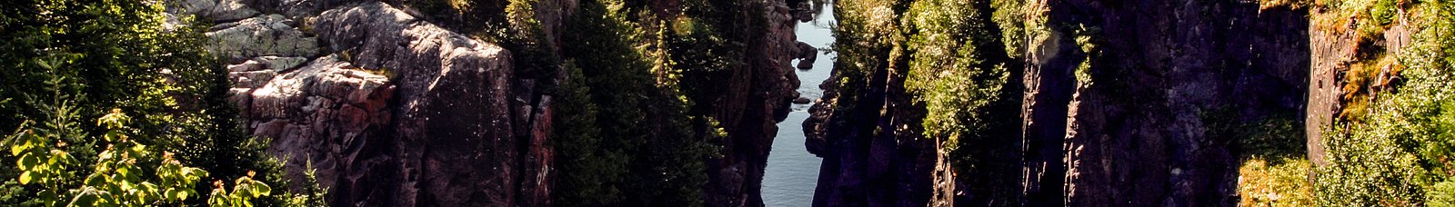
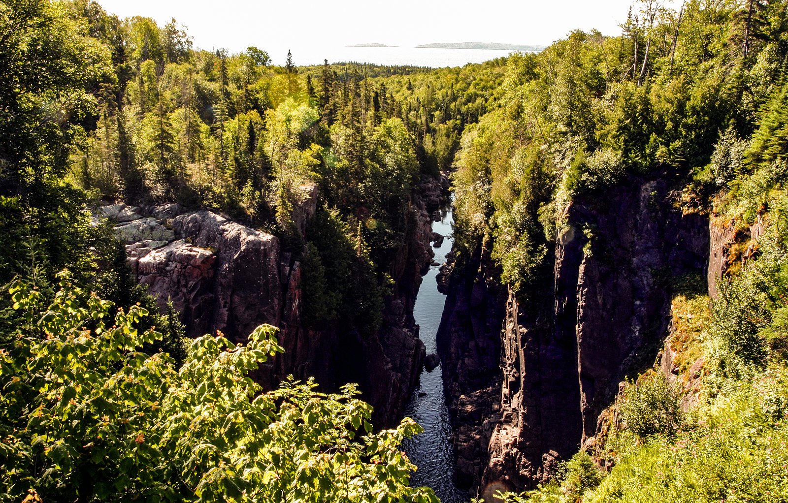
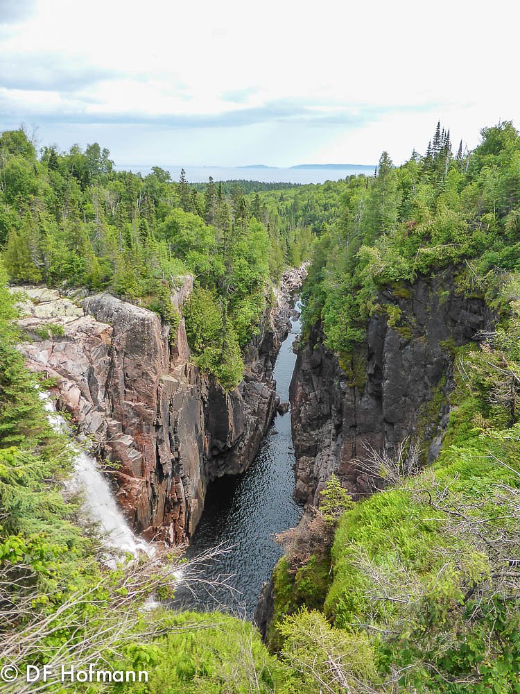
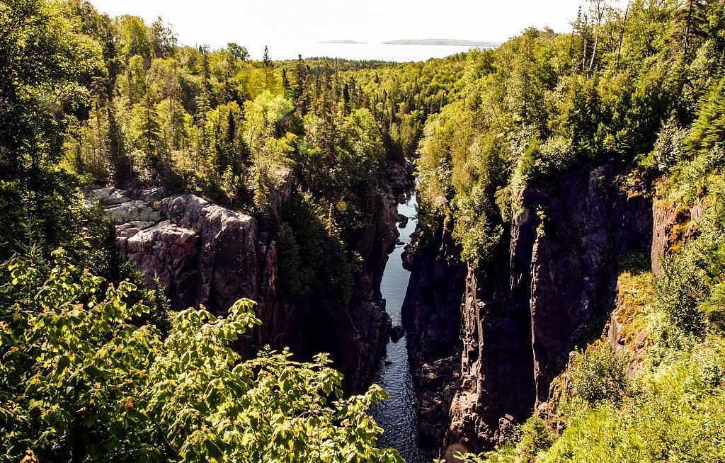
Photo Credits (5)
Difficulty
Easy
Trail Length
0.3 km
Trail Type
Out And Back
Elevation Gain
15 m
About Aguasabon Falls
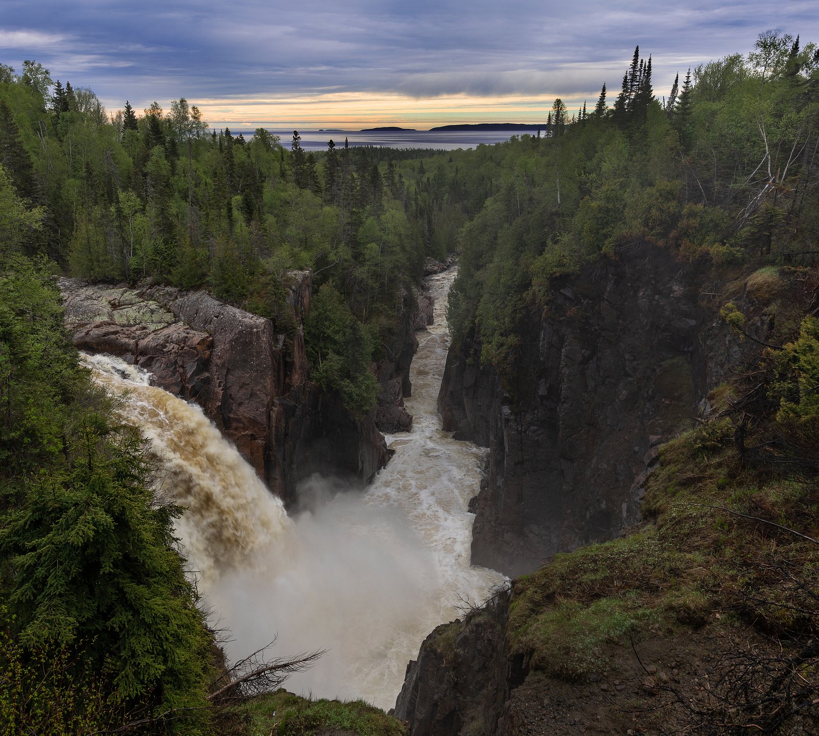
Aguasabon Falls is a dramatic drop on the Aguasabon River near Terrace Bay in northwestern Ontario. The falls and surrounding gorge are a popular roadside attraction with an upper parking/picnic area, viewing platforms and stairs that lead to lower viewpoints. The river flows past a hydroelectric facility in the area, and the gorge offers scenic views year‑round, especially during spring melt and after heavy rains.
The Setting
Aguasabon Falls sits at 248 metres in the foothills of Ontario. At 30 metres, it is among the taller waterfalls in Ontario.
Why This Waterfall Exists
Aguasabon Falls flows over hard volcanic rock laid down over 2.5-2.8 billion years ago. These resistant rocks form a durable ledge that water cannot easily wear away, creating a 100-foot drop where softer material downstream has already eroded.
Trail & Hike Details
The Approach
The easy 0.3-km out-and-back trail gains 15 metres of elevation on the way to the falls.
Trail Description
The main access from the parking area leads to an upper viewing platform and picnic area a short walk from the lot. A set of stairs and short maintained trails descend to lower viewpoints and to the top of the gorge. Trails are short, well‑maintained and suitable for most visitors, but there are stairs and some uneven rock at lower viewpoints.
What to Expect
The falls cascade 30 metres over hard volcanic rock.
Accessibility
The trail is short and relatively flat, but the surface may be uneven. Contact the managing agency for accessibility details.
Frequently Asked Questions
🐶 Are Dogs Allowed at Aguasabon Falls?
❌ Dogs are not allowed
Are There Any Fees or Permits Required?
🆖 No fees required
🏊 Is There Swimming at Aguasabon Falls?
❌ Swimming is not allowed
When to Visit
Spring, higher flows make the falls most dramatic. Summer, easiest access and full services; fall, fall foliage adds color. Winter offers striking ice formations but surfaces are icy and viewing areas may be hazardous or partially closed.
Seasonal Access
The best time to visit is Spring, Summer, Fall, and Winter. Check with the managing park or local authority for current conditions.
Safety Information
Stay behind railings and on marked trails. The gorge has steep, slippery rock and strong water flows. Do not attempt to climb down to the river or swim near the falls. Be cautious in winter, ice build‑up can make stairs and platforms hazardous. There may be operational releases from hydro facilities; respect all warning signs and barriers. Supervise children closely.
Current Water Conditions
5.2 m³/s
Current discharge — how much water is flowing
Lower than usual for this time of year
Based on 22 years of record
7.01 m
Water depth at gauge
7-Day Discharge Trend
What does this mean for your visit?
Flow is lower than usual for this time of year.
About This Gauge
This gauge is on a nearby waterway and may not reflect exact conditions at the falls.
7-Day Flow Outlook
Based on the WSC gauge STEEL RIVER BELOW SANTOY LAKE (20 km away).
Today
Low
5.2 m³/s
5/10Tomorrow
Moderate
5.5 m³/s
5/10Tue
Moderate
5.5 m³/s
5/10Wed
Low
5.0 m³/s
5/10Thu
Moderate
5.1 m³/s
5/10Fri
Low
4.6 m³/s
5/10Sat
Low
4.2 m³/s
5/10Best window: Today — low flow, fog (trip score 5/10).
Best time of year: this gauge typically runs highest from mid April to early July, peaking in May.
How we calculate this
This is a transparent outlook, not a precise forecast. We take the waterfall's current flow strength (how it ranks against its historical normal for today, from the nearest WSC stream gauge), carry that ranking forward along the gauge's seasonal curve, and nudge it for forecast rain. Confidence is highest for the next day or two and falls further out. Always check official conditions and your own judgment before visiting — high flows can be dangerous.
Know when to go.
Get a free email alert when waterfalls near Marathon hit peak flow. We only send when conditions are worth the trip — no weekly newsletters, no spam.
Weather Forecast
Location & Access
Getting There
The falls are located off Ontario Highway 17 (Trans-Canada Highway) near Terrace Bay. From Marathon the drive is approximately 33.5 miles (route and travel time vary by conditions). Use GPS coordinates 48.7808, -87.123 to locate the parking area. Follow posted signs for Aguasabon Falls / provincial day‑use area.
Get Directions on Google MapsParking
Paved parking lot adjacent to the main viewpoints and picnic area. Parking is typically day‑use; spaces close to the upper lookout are a short walk from the lot. Winter parking may be reduced due to snow.
Elevation
248 metres above sea level
Coordinates
48.780802° N, -87.123017° W
Visitor Tips & Gear
Wear sturdy, non‑slip shoes, stairs and rock surfaces can be slippery, especially when wet or icy. Stay on designated trails and behind railings; do not attempt to climb into the gorge. Bring bug spray in summer and warm layers in shoulder seasons. Check local conditions for closure notices or maintenance. Respect signage related to hydroelectric operations.
As an Amazon Associate, we earn from qualifying purchases.
For this easy 0.3 km trail, lightweight trail shoes and a water bottle are usually sufficient. Icy conditions are common in winter — traction cleats are a smart addition.

Columbia Watertight II Rain Jacket
Packs into its own pocket, seam-sealed, and keeps you dry from spray and surprise rain.

Polarized Sunglasses (Knockaround)
Cuts glare off the water so you actually see the falls — and your photos turn out better too.

Earth Pak Waterproof Dry Bag
Keeps your phone and gear dry when waterfall mist soaks everything else.

Waterproof Phone Pouch (AiRunTech)
Cheap insurance — take photos right next to the falls without killing your phone.

Kahtoola MICROspikes
Cult-favorite traction cleats that grip ice and wet rock — essential for winter waterfall hikes.

JOBY GorillaPod Starter Kit
Wraps around railings and rocks for long-exposure waterfall shots — no flat surface needed.
Where to Stay
Browse vacation cabins and private rentals nearby
Unique outdoor stays — tents, yurts, and treehouses
Rent a campervan or RV for your waterfall road trip
Some links are affiliate links. We may earn a commission at no extra cost to you.
Nearby Campground
Lambton Cove Campsite
12.9 km away
Additional Information
Nearby Attractions
Terrace Bay amenities and shoreline, Aguasabon River Provincial Park (nearby), Neys Provincial Park and Lake Superior shoreline areas further along Highway 17. Marathon is approximately 33.5 miles east by road.
Wildlife
Typical boreal species may be present: black bear, moose, white‑tailed deer, beaver, otter, and a variety of songbirds and waterfowl. Take standard wildlife precautions (store food, keep distance).
Cities near Aguasabon Falls
Writing about Aguasabon Falls? Embed this waterfall on your site for free.